Auction Information

737.48 acres in Cavalier County, North Dakota
LAND AUCTION
737.48 +/- Acres - Cavalier County, ND
Thursday, March 30, 2023 10:00 a.m.
Auction Location: Langdon Activity Center: 516 10th Ave. - Langdon, ND
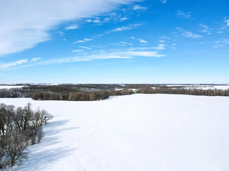
Auction Note: Cavalier County land features 624 +/- acres of highly productive cropland, with excellent Soil Productivity Indexes (SPI) with much of it having a 70 to 85 SPI! Parcel 2 includes a farmstead which includes quonset, pole shed and grain bins. Excellent hunting habitat acres feature wooded terrain and the South Pembina River running throughout all the wooded area making prime hunting for whitetail deer, turkey, partridge, and other small game. Northwest portion of parcel 4 of the forest/hunting borders North Dakota Game & Fish land. Conveniently located north of Hwy. #5 near Olga, ND, this land to be sold in four parcels and available for 2023 crop year! This will be a live auction with internet bidding available.
Contact: Bob Pifer at 701.371.8538 for more information or for a complete catalog.
Parcel 1
Acres: 240 +/-
Legal: EW 9-161-57 and NWNE & NENW 16-161-57 (South Olga Township)
Crop Acres: 235.14 +/-
Taxes (2022): $2,417.76
This parcel features 235.14 +/- acres of exceptional cropland with a portion being tiled. Excellent SPI of 75.2 and most of it is between 79-85. See tile map for details for the portion of section 9 tiling.
Parcel 2
Acres: 200 +/-
Legal: SESE 30-162-57 and EE 31-162-57 (North Olga Township)
Crop Acres: 190.29 +/-
Taxes (2022): $1,865.48
Outbuilding and Grain Bins:
Metal Quonset - 40' x 76' - 18'W x 12'H Door - Power - Concrete Floor
Pole Shed - 32' x 48' - 17'W x 8.5'H Door - Concrete Floor
Pole Shed(aka Fuel Shed) - 23' x 25' - 10'W x 7.5 H Door - Power - Concrete Floor
Grain Bins
4 - 3,200 bu. Storage
1 5,550 bu. Storage
2 8,086 bu. Storage
Hopper Bottom is NOT part of the sale
This parcel features 190.29 +/- acres of exceptional cropland. Excellent SPI of 70.6 and most of it is between 79-85. Parcel also includes a farmstead with grain bins, out buildings and power. Hopper Bottom is owned by the tenant and is NOT included in the sale.
Parcel 3
Acres: 148.74 +/-
Legal: WNW 31-162-57 and SNE 36-162-58 (North Olga & Loam Townships)
Crop Acres: 105 +/-
Taxes (2022): $986.43 - - The 2022 tax bill reflect part of the wooded area in the Forest Stewartship Tax Law which expired in 2021 and at that time the tax on the woods was assessed at .50 cents per acre. Cavalier tax accessor to determine the new tax amount.
This parcel features 105 +/- acres of exceptional cropland. Excellent SPI of 71.1 and much of it is between 76-85. Remaining acres feature woods and the South Pembina River running through the property making prime hunting for whitetail deer, turkey, partridge, and other small game. The property borders North Dakota Game & Fish land on the northwest side.
Parcel 4
Acres: 148.74 +/-
Legal: WSW 31-162-57 and ESE 36-162-58 (North Olga & Loam Townships)
Crop Acres: 93.04 +/-
Taxes (2022): $986.43 - The 2022 tax bill reflect part of the wooded area in the Forest Stewartship Tax Law which expired in 2021 and at that time the tax on the woods was assessed at .50 cents per acre. Cavalier tax accessor to determine the new tax amount.
This parcel features 93.04 +/- acres of exceptional cropland. Excellent SPI of 74.2 and much of it is between 76-85. Remaining acres feature woods and the South Pembina River running through the property making prime hunting for whitetail deer, turkey, partridge, and other small game.
OWNER: Eddie V Benoit Irrevocable Trust
From elevation to risk assessment
Search for detailed parcel information including; Elevation & Vegetation Maps, Ownership Information, Detailed Parcel Information, Crop History Map, Soil Survey Productivity Data, and more.
Research Parcel InformationDirections
Driving Directions:
Parcel 1: Go one mile south of Olga, ND on County Rd. #45 to 94th St. NE and go .25 miles east to the west side of the property.
Parcel 2: From Olga, ND go north one mile to 97th St. NE then go west one mile to 120th Ave. NE this will bring you to the northeast portion of the parcel.
Parcels 3 & 4: From Parcel 2, Continue 0.75 miles west and this will bring you to the northeast corner of parcel 3. Go back to 97th St. NE & 120th Ave. NE and go one mile south to 96th St. NE and then 0.75 miles west. This will bring you to the southeast corner of parcel 4.
Resources
Land for Sale by Kevin Pifer
Cavalier County Properties By Type
- Farms for Sale in Cavalier County, North Dakota
- Hunting Land for Sale in Cavalier County, North Dakota
- Residential Property for Sale in Cavalier County, North Dakota
- Commercial Property for Sale in Cavalier County, North Dakota
- Undeveloped Land for Sale in Cavalier County, North Dakota
- Recreational Property for Sale in Cavalier County, North Dakota
- Ranches for Sale in Cavalier County, North Dakota
- Timberland for Sale in Cavalier County, North Dakota
- Horse Property for Sale in Cavalier County, North Dakota
- Lakefront Property for Sale in Cavalier County, North Dakota
- Beachfront Property for Sale in Cavalier County, North Dakota
- Riverfront Property for Sale in Cavalier County, North Dakota
Properties for Sale Nearby Counties
Cavalier County Properties By City
- Alsen, North Dakota Land for Sale
- Calvin, North Dakota Land for Sale
- Hannah, North Dakota Land for Sale
- Langdon, North Dakota Land for Sale
- Maida, North Dakota Land for Sale
- Milton, North Dakota Land for Sale
- Munich, North Dakota Land for Sale
- Nekoma, North Dakota Land for Sale
- Osnabrock, North Dakota Land for Sale
- Sarles, North Dakota Land for Sale
- Wales, North Dakota Land for Sale
- Calio, North Dakota Land for Sale
- More
- Clyde, North Dakota Land for Sale
- Dresden, North Dakota Land for Sale
- Loma, North Dakota Land for Sale
- Mount Carmel, North Dakota Land for Sale
- Union, North Dakota Land for Sale
- Easby, North Dakota Land for Sale
- Olga, North Dakota Land for Sale
- Vang, North Dakota Land for Sale
- Weaver, North Dakota Land for Sale