Auction Information

769.56 acres in McLean County, North Dakota
LAND AUCTION
769.56 +/- Acres - McLean County, ND
Tuesday, September 27, 2022 2:00 p.m. (CT)
Auction Location: Garrison City Auditorium: 32 Main St. S - Garrison, ND
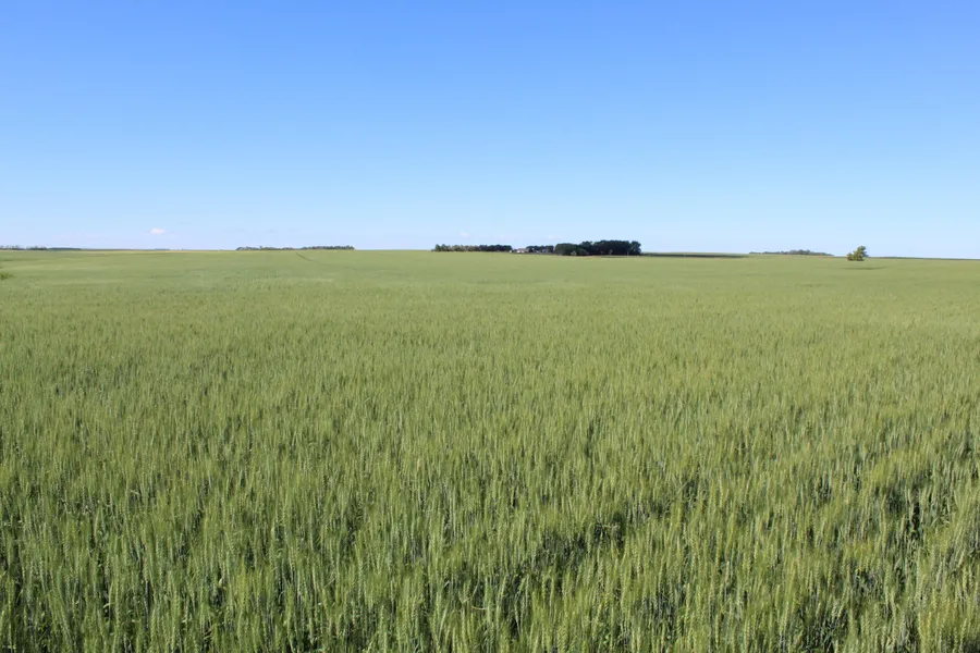
Auction Note: This property features 718.11 +/- acres of quality cropland northeast of Lake Audubon. The cropland highlights Soil Productivity Indexes (SPI) in the high 70s and low 80s! This land features gently rolling terrain with one small water pond and several wetlands.
Contact: Alan Butts, 701.400.8858 for more information or Pifers Auction & Realty at 877.700.4099 for a complete catalog.
Parcel 1:
Acres: 160 +/-
Legal: NW1/4 23-148-82
Crop Acres: 130 +/- (Estimate, 718.11 +/- total all parcels. FSA will split cropland between parcels)
Taxes (2021): $1,181.59
This parcel features 130 +/- acres of strong cropland with a SPI of 83.6. Nearly all level terrain, Parcel 1 is a desirable quarter for a farmer or investor/hunter!
Parcel 2:
Acres: 289.56 +/-
Legal: E1/2 22-148-82 LESS PLAT OF OUTLOT A 30.44 acres
Crop Acres: 275 +/- (Estimate, 718.11 +/- total all parcels. FSA will split cropland between parcels)
Taxes (2021): $2,404 (Estimate)
Parcel 2 features 275 +/- acres of strong cropland with a SPI of 83.4. The land is nearly flat, with only a 45-foot variance in elevation in the entire field. The farmstead, Outlot A, 30.44 acres has been surveyed out of Parcel 2.
Parcel 3:
Acres: 320 +/-
Legal: W1/2 22-148-82
FSA Cropland: 310 +/- (Estimate, 718.11 +/- total all parcels. FSA will split cropland between parcels)
Taxes (2021): $2,310.94
Parcel 3 features an estimated 310 +/- acres of strong cropland with a SPI of 77.1. The land is nearly flat, with only a 45-foot variance in elevation in the entire field.
OWNERS: Alan Okerson, Arlan Okerson, & Coleen Clooten
From elevation to risk assessment
Search for detailed parcel information including; Elevation & Vegetation Maps, Ownership Information, Detailed Parcel Information, Crop History Map, Soil Survey Productivity Data, and more.
Research Parcel InformationDirections
Driving Directions: From the intersection of Hwy. #83 and County Hwy. #8, travel 10.3 miles east to 26th Ave. NW, then one mile south to the northwest corner or Parcel 1, and the northeast corner of Parcel 2. Travel mile west to the northeast corner of Parcel 3.
Resources
Land for Sale by Kevin Pifer
McLean County Properties By Type
- Commercial Property for Sale in McLean County, North Dakota
- Lakefront Property for Sale in McLean County, North Dakota
- Farms for Sale in McLean County, North Dakota
- Undeveloped Land for Sale in McLean County, North Dakota
- Hunting Land for Sale in McLean County, North Dakota
- Recreational Property for Sale in McLean County, North Dakota
- Residential Property for Sale in McLean County, North Dakota
- Ranches for Sale in McLean County, North Dakota
- Horse Property for Sale in McLean County, North Dakota
- Beachfront Property for Sale in McLean County, North Dakota
- Riverfront Property for Sale in McLean County, North Dakota
- Timberland for Sale in McLean County, North Dakota
Properties for Sale Nearby Counties
- Burleigh County, North Dakota Land for Sale
- Dunn County, North Dakota Land for Sale
- McHenry County, North Dakota Land for Sale
- Mercer County, North Dakota Land for Sale
- Mountrail County, North Dakota Land for Sale
- Oliver County, North Dakota Land for Sale
- Sheridan County, North Dakota Land for Sale
- Ward County, North Dakota Land for Sale
McLean County Properties By City
- Benedict, North Dakota Land for Sale
- Butte, North Dakota Land for Sale
- Coleharbor, North Dakota Land for Sale
- Garrison, North Dakota Land for Sale
- Max, North Dakota Land for Sale
- Mercer, North Dakota Land for Sale
- Riverdale, North Dakota Land for Sale
- Roseglen, North Dakota Land for Sale
- Ruso, North Dakota Land for Sale
- Turtle Lake, North Dakota Land for Sale
- Underwood, North Dakota Land for Sale
- Washburn, North Dakota Land for Sale
- More