West Burns Parcel
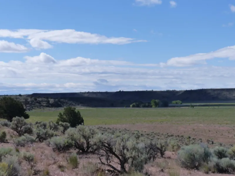
This property has a lot of potential. There are water rights that can be developed into a nice farm that would be conveniently located just a few miles from Burns. The south end of the property borders Hwy 20 and the north end is rolling south sloping hillside with great views of Sage Hen Valley. This property also borders thousands of acres of BLM ground to recreate on and qualifies for 2 LOP tags.
Location: Approximately 7 1/2 miles west of Burns Oregon
Acreage: 790.13 +/- deeded acres consisting of the following:
- 235 acres flat bottom ground (brush beaten)
- 555.13 acres south sloping hillside
Water Rights: 389.94 acres of permitted water rights under #G-16737. Priority date of permit is October 10, 2006 with an extension to complete to March 4, 2018
Wells: None - 1 spring for stock water
From elevation to risk assessment
Search for detailed parcel information including; Elevation & Vegetation Maps, Ownership Information, Detailed Parcel Information, Crop History Map, Soil Survey Productivity Data, and more.
Research Parcel InformationResources
Land for Sale by Curt Blackburn
Harney County Properties By Type
- Ranches for Sale in Harney County, Oregon
- Undeveloped Land for Sale in Harney County, Oregon
- Farms for Sale in Harney County, Oregon
- Residential Property for Sale in Harney County, Oregon
- Hunting Land for Sale in Harney County, Oregon
- Lakefront Property for Sale in Harney County, Oregon
- Riverfront Property for Sale in Harney County, Oregon
- Commercial Property for Sale in Harney County, Oregon
- Recreational Property for Sale in Harney County, Oregon
- Timberland for Sale in Harney County, Oregon
- Horse Property for Sale in Harney County, Oregon
- Beachfront Property for Sale in Harney County, Oregon
Properties for Sale Nearby Counties
Harney County Properties By City
- Burns, Oregon Land for Sale
- Crane, Oregon Land for Sale
- Diamond, Oregon Land for Sale
- Drewsey, Oregon Land for Sale
- Fields, Oregon Land for Sale
- Frenchglen, Oregon Land for Sale
- Hines, Oregon Land for Sale
- Princeton, Oregon Land for Sale
- Riley, Oregon Land for Sale
- Lawen, Oregon Land for Sale
- Andrews, Oregon Land for Sale
- Buchanan, Oregon Land for Sale
- More
- Dunnean, Oregon Land for Sale
- Frost Mill, Oregon Land for Sale
- Harney, Oregon Land for Sale
- Indian Village, Oregon Land for Sale
- Narrows, Oregon Land for Sale
- New Princeton, Oregon Land for Sale
- Suntex, Oregon Land for Sale
- Trout Creek, Oregon Land for Sale
- Van, Oregon Land for Sale
- Venator, Oregon Land for Sale
- Voltage, Oregon Land for Sale
- Wagontire, Oregon Land for Sale