Auction Information

791 acres in McLean County, North Dakota
LAND AUCTION
791 +/- Acres - McLean County, ND
Tuesday, November 17, 2020 10:00 a.m. (CT)
Auction Location: Sleep Inn & Suites (Sunrise Room) - Minot, ND
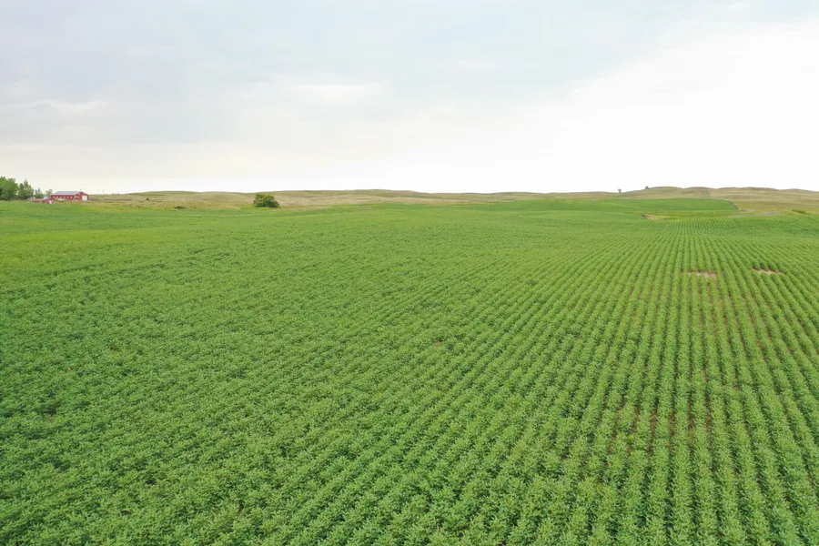
Auction Note: This auction features excellent crop, pasture and hunting land, and a farmstead in McLean County, North Dakota. Offered in six parcels, this property consists of 493.25 +/- acres of cropland with an average Soil Productivity Index (SPI) of 65 and a strong cropping history. The cropland was planted to both soybeans and wheat in 2020 and is subject to current leases. The remaining pasture acreage consists of lush native grasses and adequate water sources ideal for both cattle and promoting a healthy whitetail deer habitat. The farmstead includes a five-bedroom, two-bath ranch-style home and several outbuildings. Do not miss out on this fantastic land offering in McLean County!
Contact: Darin Peterson at 701.220.5396 or Alan Butts 701.400.8858.
Parcel 1
Acres: 160 +/-
Legal: NE1/4 24-150-81
Cropland Acres: 78.27 +/-
Parcel 2
Acres: 160 +/-
Legal: SW1/4 24-150-81
Cropland Acres: 153.67 +/-
Parcel 3
Acres: 155.59 +/-
Legal: NE1/4 14-150-81
Cropland Acres: 115.34 +/-
Parcel 4
Acres: 155.59 +/-
Legal: SE1/4 11-150-81
Cropland Acres: 82.58 +/-
Parcel 5
Acres: 80 +/-
Legal: W1/2SW1/4 11-149-82
Pasture Acres: 80 +/-
Parcel 6
Acres: 80 +/-
Legal: W1/2NW1/4 10-149-82
Cropland Acres: 63.39 +/-
OWNER: Robert Johnson Estate
From elevation to risk assessment
Search for detailed parcel information including; Elevation & Vegetation Maps, Ownership Information, Detailed Parcel Information, Crop History Map, Soil Survey Productivity Data, and more.
Research Parcel InformationDirections
Parcel 1: From the US Hwy. #83 and Hwy. #53 Interchange (Max, ND), go east 15.5 miles, turn south on 18th Ave. NW for 1 mile. Here you will be at the northeast corner of Parcel 1.
Parcel 2: From the US Hwy. #83 and Hwy. #53 Interchange (Max, ND), go east 15.5 miles, turn south on 18th Ave. NW for 2 miles, turn west on section line road for .5 miles. Here you will be at the southeast corner of Parcel 2.
Parcels 3 & 4: From the US Hwy. #83 and Hwy. #53 Interchange (Max, ND), go east 14 miles. Here you will be at the northwest corner of Parcel 3 and the southwest corner of Parcel 4.
Parcel 5: From the US Hwy. #83 and 21st St. NW Interchange, go east 6 miles, turn north on 27th Ave. NW for 1 mile. Follow the curve east on 22nd St. NW for 1 mile. Here you will be at the southwest corner of Parcel 5.
Parcel 6: From the US Hwy. #83 and 21st St. NW Interchange, go east 6 miles, turn north on 27th Ave. NW for 1.5 miles. Here you will be at the southwest corner of Parcel 6.
Resources
Land for Sale by Kevin Pifer
McLean County Properties By Type
- Farms for Sale in McLean County, North Dakota
- Commercial Property for Sale in McLean County, North Dakota
- Lakefront Property for Sale in McLean County, North Dakota
- Undeveloped Land for Sale in McLean County, North Dakota
- Residential Property for Sale in McLean County, North Dakota
- Recreational Property for Sale in McLean County, North Dakota
- Hunting Land for Sale in McLean County, North Dakota
- Ranches for Sale in McLean County, North Dakota
- Horse Property for Sale in McLean County, North Dakota
- Timberland for Sale in McLean County, North Dakota
- Beachfront Property for Sale in McLean County, North Dakota
- Riverfront Property for Sale in McLean County, North Dakota
Properties for Sale Nearby Counties
- Burleigh County, North Dakota Land for Sale
- Dunn County, North Dakota Land for Sale
- McHenry County, North Dakota Land for Sale
- Mercer County, North Dakota Land for Sale
- Mountrail County, North Dakota Land for Sale
- Oliver County, North Dakota Land for Sale
- Sheridan County, North Dakota Land for Sale
- Ward County, North Dakota Land for Sale
McLean County Properties By City
- Benedict, North Dakota Land for Sale
- Butte, North Dakota Land for Sale
- Coleharbor, North Dakota Land for Sale
- Garrison, North Dakota Land for Sale
- Max, North Dakota Land for Sale
- Mercer, North Dakota Land for Sale
- Riverdale, North Dakota Land for Sale
- Roseglen, North Dakota Land for Sale
- Ruso, North Dakota Land for Sale
- Turtle Lake, North Dakota Land for Sale
- Underwood, North Dakota Land for Sale
- Washburn, North Dakota Land for Sale
- More