Auction Information
Jackson Co., MN – 344.00 Ac., m/l (190-0077)
1750 Cottonwood Lake Dr. , Windom, MN
Start Date: 03/18/2022, 10:00 AM
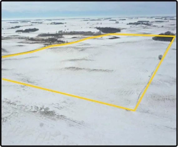
Jackson Co., MN 80.00 Ac., m/l (190-0077-02)
80.00 acres, m/l, located 2 miles south of Windom, Minnesota on the north side of 920th St. at 480th Ave.
This level to rolling farm has 72.62 FSA/Eff. crop acres with a CPI of 87.50.
This is a high-quality Jackson County farm with a high CPI rating.
From elevation to risk assessment
Search for detailed parcel information including; Elevation & Vegetation Maps, Ownership Information, Detailed Parcel Information, Crop History Map, Soil Survey Productivity Data, and more.
Research Parcel InformationDirections
From Windom: go west on State Hwy.
60 for 1.2 miles, then go south on 470th
Ave./Co. Rd. 15 for 1.6 miles. Turn east
on 920th St. for 1.2 miles. Parcel 2 is on
the north side of 920th St.
Resources
Contact Seller
Listing provided by
Hertz Real Estate Services
Hertz Real Estate Services(309) 326-7672
Listing last updated: May 25, 2022 at 8:49 AM
Report this listing
Land for Sale by Hertz Real Estate Services
Jackson County Properties By Type
- Lakefront Property for Sale in Jackson County, Minnesota
- Farms for Sale in Jackson County, Minnesota
- Hunting Land for Sale in Jackson County, Minnesota
- Commercial Property for Sale in Jackson County, Minnesota
- Residential Property for Sale in Jackson County, Minnesota
- Ranches for Sale in Jackson County, Minnesota
- Undeveloped Land for Sale in Jackson County, Minnesota
- Recreational Property for Sale in Jackson County, Minnesota
- Timberland for Sale in Jackson County, Minnesota
- Horse Property for Sale in Jackson County, Minnesota
- Beachfront Property for Sale in Jackson County, Minnesota
- Riverfront Property for Sale in Jackson County, Minnesota
Properties for Sale Nearby Counties
Jackson County Properties By City
- Alpha, Minnesota Land for Sale
- Heron Lake, Minnesota Land for Sale
- Jackson, Minnesota Land for Sale
- Lakefield, Minnesota Land for Sale
- Okabena, Minnesota Land for Sale
- Bergen, Minnesota Land for Sale
- Miloma, Minnesota Land for Sale
- Petersburg, Minnesota Land for Sale
- Rost, Minnesota Land for Sale
- Sioux Valley, Minnesota Land for Sale
- Spafford, Minnesota Land for Sale