Auction Information
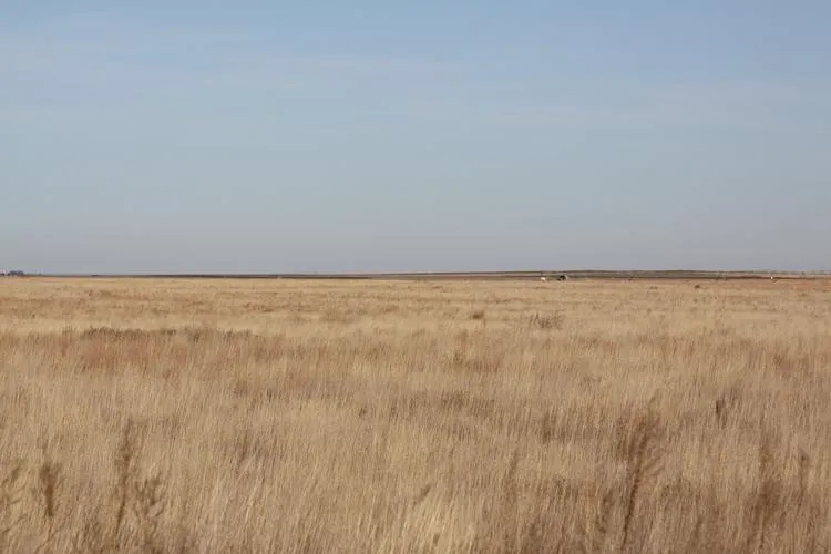
800 acres in Prowers County, Colorado
Description
LEGAL DESCRIPTIONS:
TRACT 1: Section 18-27-41,
Prowers Co, Colo
TRACT 2: Lots 1, 2, & NW/4 of 17-26-43, Hamilton Co, KS
LAND LOCATION: SIGNS WILL BE POSTED
TRACT 1: From the intersection of US Hwy 50 & Hwy 89 in Holly, CO, go 25 miles South to County Road D, then 2 miles East to the SW corner of the property.
TRACT 2: From the intersection of US Hwy 50 & Hwy 89 in Holly, CO, go 17 miles South to County Road M, 3 miles East to the State line (County Road 39), then ½ mile South to the NW corner of the property OR from the intersection of US Hwy 50 & Hwy 27 in Syracuse, KS, go 10½ miles South to County Road 31, 15½ miles West to the State line (County Road 39), then 2 miles South to the NW corner of the property.
MANNER OF SALE: This real estate will be offered in 2 individual tracts only. Auction procedure and increments of bidding are at the discretion of the auction company.
TERMS: 10% down day of sale, with the balance to be paid on or before February 26, 2010, or upon such terms as may be acceptable to the Seller. Personal and corporate checks are acceptable for the down payment with the final payment to be made in certified funds. All funds will be held by an identified title/escrow company. Bidding is not contingent upon financing. Financing, if necessary, needs to be arranged and approved prior to the auction. Announcements made day of sale take precedence over printed material and previously made oral statements.
MINERAL RIGHTS: All of the Seller’s interest will transfer to the Buyer(s) at closing.
CRP INFORMATION: Buyer(s) will receive 100% of the 2010 CRP payments which will accrue from October 1, 2009, through September 30, 2010, under the current CRP contract.
POSSESSION: Date of closing.
CLOSING: Date of closing will be on or before February 26, 2010.
REAL ESTATE TAXES: Sellers will pay taxes for 2009 and prior years. Taxes for 2010 will be the responsibility the Buyer(s).
ACCEPTANCE OF BIDS: Each successful bidder will be required to enter into a real estate purchase contract immediately following the auction. Copies of the contracts will be available from the auction company prior to the sale.
EVIDENCE OF TITLE: Sellers will provide title insurance to the Buyer(s) in the amount of the purchase price with the premium to be paid one-half by the Buyer(s) and one-half by the Sellers. Title evidence will be provided on sale day.
ACREAGES: Acreage figures are considered to be approximate and are from reliable sources, based on (USDA) FSA figures. All FSA information is subject to change. FSA acres may not be the same as deeded acres.
INSPECTIONS: Each potential bidder is responsible for conducting their own independent inspections and due diligence concerning pertinent facts about the property. Neither Seller, nor Farm & Ranch Realty, Inc., its agents or representatives, are making any warranties about the property, either expressed or implied.
EASEMENTS: This sale is subject to all rights-of-way and easements, whether recorded or not, and to any oil and gas leases of record.
AGENCY: Farm & Ranch Realty, Inc., its agents and representatives, are the Exclusive Agents of the Sellers.
AUCTIONEER’S NOTE: Driving south of Holly into this great basin of wonderful, flat cropland reminds you of the great wheat land in the states of Kansas and Colorado being offered here at ABSOLUTE PUBLIC AUCTION. If you are looking for a great investment in wheat land come and see these two farms. There are mineral rights available and CRP extensions are not ruled out. This is a great safe haven for that “nest egg” that’s being neglected in the bank! There are great farmers available, just look at the grain piled up at the Buckeye elevator near Tract 1!
From elevation to risk assessment
Search for detailed parcel information including; Elevation & Vegetation Maps, Ownership Information, Detailed Parcel Information, Crop History Map, Soil Survey Productivity Data, and more.
Research Parcel InformationResources
Prowers County Properties By Type
- Ranches for Sale in Prowers County, Colorado
- Farms for Sale in Prowers County, Colorado
- Undeveloped Land for Sale in Prowers County, Colorado
- Hunting Land for Sale in Prowers County, Colorado
- Residential Property for Sale in Prowers County, Colorado
- Recreational Property for Sale in Prowers County, Colorado
- Riverfront Property for Sale in Prowers County, Colorado
- Commercial Property for Sale in Prowers County, Colorado
- Horse Property for Sale in Prowers County, Colorado
- Lakefront Property for Sale in Prowers County, Colorado
- Beachfront Property for Sale in Prowers County, Colorado
- Timberland for Sale in Prowers County, Colorado
Properties for Sale Nearby Counties
Prowers County Properties By City
- Granada, Colorado Land for Sale
- Hartman, Colorado Land for Sale
- Holly, Colorado Land for Sale
- Lamar, Colorado Land for Sale
- Wiley, Colorado Land for Sale
- Bristol, Colorado Land for Sale
- Carlton, Colorado Land for Sale
- Koen, Colorado Land for Sale
- Kornman, Colorado Land for Sale
- May Valley, Colorado Land for Sale
- Prowers, Colorado Land for Sale
- West Farm, Colorado Land for Sale
- More