Is this your property? Sell it faster with premium placement and targeted ads.
GOV'T LOTS 6 & 7 AND THE SW4 SW4 LYING WITHIN SEC 14 CONT 83.2 AC RES 210-5
Description
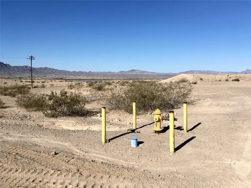
Incredible 83.20-acre parcel located directly along Historic Route 66 in Topock, AZ, overlooking the Havasu National Wildlife Refuge and Colorado River corridor. This unique property is positioned within a federally designated Qualified Opportunity Zone, making it a prime investment for mixed-use development including single-family or workforce housing, RV park or campground, commercial storage, retail, or a combination of uses. Zoned A-R (Agricultural Residential) under the Mohave County General Plan with Urban Development and Light Industrial designations, the site features nearly ½ mile of frontage along Route 66 with paved access on two sides. Utilities are to and through the property, including power, high-speed internet, natural gas, and water service Golden Shores Water Company has issued a will serve letter, and ADWR previously approved a 100-year Colorado River water supply for the former Topock Village Estates plat. Entirely located in FEMA Zone X (outside the floodplain), the land sits at approximately 600 elevation and offers unobstructed panoramic views of Topock Bay and surrounding mountains. The property is ideally situated near the communities of Golden Shores and Topock, just minutes from Topock66 Marina & Restaurant, and centrally located between Lake Havasu City, Bullhead City, Laughlin, and Needles. With strong regional growth, recreational amenities, and over 145,000 residents within a 35-mile radius, this parcel presents a rare large-scale development opportunity in Mohave County. Enjoy quick access to I-40, nearby schools, fire department, post office, and local businesses. Endless outdoor recreation surrounds you with boating, fishing, off-roading, and wildlife exploration all within minutes. Whether you envision a residential community, destination RV resort, or mixed-use investment blending homes, storage, and retail, this property provides the land, location, and infrastructure to bring your vision to life. More land available to the south of this parcel held by the same owner, for a total of 169 acres if desired.
Copyright 2025 Western Arizona REALTOR® Data Exchange, Inc.. All rights reserved.
From elevation to risk assessment
Search for detailed parcel information including; Elevation & Vegetation Maps, Ownership Information, Detailed Parcel Information, Crop History Map, Soil Survey Productivity Data, and more.
Research Parcel InformationEnvironmental Factors
Is this your property? Sell it faster with premium placement and targeted ads.
Mohave County Properties By Type
- Undeveloped Land for Sale in Mohave County, Arizona
- Farms for Sale in Mohave County, Arizona
- Residential Property for Sale in Mohave County, Arizona
- Ranches for Sale in Mohave County, Arizona
- Recreational Property for Sale in Mohave County, Arizona
- Commercial Property for Sale in Mohave County, Arizona
- Lakefront Property for Sale in Mohave County, Arizona
- Horse Property for Sale in Mohave County, Arizona
- Riverfront Property for Sale in Mohave County, Arizona
- Beachfront Property for Sale in Mohave County, Arizona
- Timberland for Sale in Mohave County, Arizona
- Hunting Land for Sale in Mohave County, Arizona
Properties for Sale Nearby Counties
- Clark County, Arizona Land for Sale
- Coconino County, Arizona Land for Sale
- Kane County, Arizona Land for Sale
- La Paz County, Arizona Land for Sale
- Lincoln County, Arizona Land for Sale
- San Bernardino County, Arizona Land for Sale
- Washington County, Arizona Land for Sale
- Yavapai County, Arizona Land for Sale
Mohave County Properties By City
- Bullhead City, Arizona Land for Sale
- Chloride, Arizona Land for Sale
- Colorado City, Arizona Land for Sale
- Dolan Springs, Arizona Land for Sale
- Golden Valley, Arizona Land for Sale
- Hackberry, Arizona Land for Sale
- Kingman, Arizona Land for Sale
- Lake Havasu City, Arizona Land for Sale
- Littlefield, Arizona Land for Sale
- Meadview, Arizona Land for Sale
- Mohave Valley, Arizona Land for Sale
- Oatman, Arizona Land for Sale
- More
- Peach Springs, Arizona Land for Sale
- Topock, Arizona Land for Sale
- Valentine, Arizona Land for Sale
- Wikieup, Arizona Land for Sale
- Yucca, Arizona Land for Sale
- Black Meadow Landing, Arizona Land for Sale
- Cane Beds, Arizona Land for Sale
- Grasshopper Junction, Arizona Land for Sale
- Moccasin, Arizona Land for Sale
- Truxton, Arizona Land for Sale
- White Hills, Arizona Land for Sale
- Antares, Arizona Land for Sale
- Arizona Village, Arizona Land for Sale
- Athos, Arizona Land for Sale
- Berry, Arizona Land for Sale
- Bonelli Landing, Arizona Land for Sale
- Booze Crossing, Arizona Land for Sale
- Butler, Arizona Land for Sale
- Catfish Paradise, Arizona Land for Sale
- Cedar, Arizona Land for Sale
- Cerbat, Arizona Land for Sale
- Crozier, Arizona Land for Sale
- Cyclopic, Arizona Land for Sale
- Davis Dam, Arizona Land for Sale
- Fivemile Landing, Arizona Land for Sale
- Franconia, Arizona Land for Sale
- Getz, Arizona Land for Sale
- Greenwood, Arizona Land for Sale
- Griffith, Arizona Land for Sale
- Harris, Arizona Land for Sale
- Haviland, Arizona Land for Sale
- Indian Moccasin, Arizona Land for Sale
- Jops Landing, Arizona Land for Sale
- Katherine, Arizona Land for Sale
- Larneds Landing, Arizona Land for Sale
- McConnico, Arizona Land for Sale
- Mesquite Creek, Arizona Land for Sale
- Mohave Crossing, Arizona Land for Sale
- Mount Trumbull, Arizona Land for Sale
- New Kingman, Arizona Land for Sale
- Oak Grove, Arizona Land for Sale
- Powell, Arizona Land for Sale
- Ray Place, Arizona Land for Sale
- Rock Crossing, Arizona Land for Sale
- Santa Claus, Arizona Land for Sale
- Signal, Arizona Land for Sale
- Six Mile Crossing, Arizona Land for Sale
- Sixmile Village, Arizona Land for Sale
- South Cove, Arizona Land for Sale
- Stockton, Arizona Land for Sale
- Tuweep, Arizona Land for Sale
- Walapai, Arizona Land for Sale
- Willow Valley, Arizona Land for Sale
- Willow Beach, Arizona Land for Sale
- Temple Bar Marina, Arizona Land for Sale
- Fort Mohave, Arizona Land for Sale
- Valle Vista, Arizona Land for Sale
- Valle Vista, Arizona Land for Sale