Baird Ranch
LEGAL DESCRIPTION: All of Section 41 and 202.61 +/- acres in Section 40, both in Block B-3, BS&F Survey, Briscoe County, Texas, and containing 842.61 acres +/-.
ACREAGE: 842.61 +/-
CRP Grasslands: 819.51
DRY FARMLAND:
GRASSLAND: All
TOPOGRAPHY: Flat to slightly sloping open grassland with several playa areas.
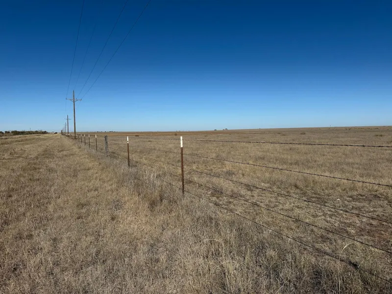
IMPROVEMENTS: There is barn/cowshed near the old homesite. Perimeter fencing ranges from very good to good t-post fence to useable older fencing, with a portion of the of the east and north sides using hot-wire fence. There is some internal fencing as well.
WATER: There is an electric submersible pump on a timer with a tank and overflow pond near the middle of the property, and a windmill with tank and overflow pond in the northern part. Presently there is some surface water in the playas.
UTILITIES:
ELECTRICITY: Yes
NATURAL GAS: No
PROPANE: No
PERSONAL PROPERTY: None.
TAXES: $1,284.36 base tax for 2025 w /ag exemption
SCHOOL DISTRICT: Silverton ISD
MINERALS: Subject to previous reservations of record, seller will reserve none.
POSSESSION: Property is leased for grazing through 5/31/26. Possession will be subject to the grazing lease.
PRICE: $1,850.00/acre ($1,558,828.00)
OTHER DATA: This ranch has excellent grass turf, fronts pavement, and is an ideal cattle place. The CRP Grasslands program pays $18.00/acre or $14,751.00/year.
***The information contained herein was obtained from reliable sources; however, it is not guaranteed and is subject to prior sale or withdrawal. Buyer's broker/agent must be identified on first contact with listing broker and accompany buyer for all site visits to be consideredfor brokerage fee sharing.***
From elevation to risk assessment
Search for detailed parcel information including; Elevation & Vegetation Maps, Ownership Information, Detailed Parcel Information, Crop History Map, Soil Survey Productivity Data, and more.
Research Parcel InformationDirections
LOCATION: Property is located roughly 2 miles north of Lake Mackenzie. The intersection of State Highway 207 and CR AAA is the southwest corner of the ranch. The property has about 1.25 miles of frontage on the east side of SH 207, with county road frontage along the other three sides.
Resources
Land for Sale by Lee Whitaker
Briscoe County Properties By Type
- Ranches for Sale in Briscoe County, Texas
- Farms for Sale in Briscoe County, Texas
- Hunting Land for Sale in Briscoe County, Texas
- Recreational Property for Sale in Briscoe County, Texas
- Undeveloped Land for Sale in Briscoe County, Texas
- Residential Property for Sale in Briscoe County, Texas
- Horse Property for Sale in Briscoe County, Texas
- Lakefront Property for Sale in Briscoe County, Texas
- Beachfront Property for Sale in Briscoe County, Texas
- Riverfront Property for Sale in Briscoe County, Texas
- Timberland for Sale in Briscoe County, Texas
- Commercial Property for Sale in Briscoe County, Texas
