Quirk Land & Cattle Co.
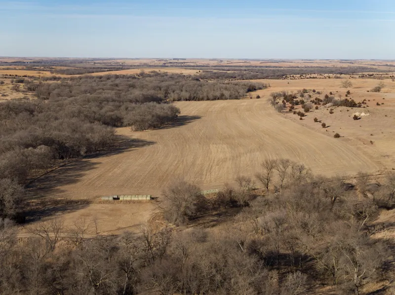
844 acres of prime, Webster County hardland range with productive pockets of cropland being offered in multiple parcels. A great addition to any ranching operation with several excellent hunting/recreational tracts within the Republican River Valley!
Legal Description:
See brochure for detailed legal descriptions.
Acres:
844
Property Price:
Parcel 1: $461,250.00
Parcel 2: $288,000.00
Parcel 3: $323,300.00
Parcel 4: $321,600.00
Parcel 5: $244,000.00
Parcel 6: $466,000.00
Comments | Parcel 1:
This is excellent hardland range bisected by the Lost Creek. A great balance of mature trees and secluded location within a mile of the Republican River make this an excellent hunting/recreational parcel!
Comments | Parcel 2:
This L-shaped tract, also bisected by the Lost Creek, provides excellent hardland range and great access off of a well-improved county road. Natural water features and rural water service create limitless possibilities with this parcel.
Comments | Parcel 3:
Bisected by both the Oak and Lost Creeks and with tremendous tree cover, interspersed with the perfect balance of cropland and range, make this a coveted hunting location.
Comments | Parcel 4:
This is a great piece of hardland range with both a stock dam and rural water.
Comments | Parcel 5:
A perfectly-sized recreational tract bisected by the Oak and Lost Creeks. Cropland surrounded by hardland range with a solar well provides for a well-equipped hunting tract.
Comments | Parcel 6:
A nice-sized parcel of hardland range with dug-out water features. Good access off well-improved county roads make this an excellent choice for the cattleman.
Taxes (2021):
Parcel 1: $3,731.18
Parcel 2: $2,216.16 (estimated)
Parcel 3: $2,206.00 (estimated)
Parcel 4: $2,206.00 (estimated)
Parcel 5: $1,604.40
Parcel 6: $3,699.68
Natural Resource District:
Lower Republican Natural Resource District
FSA Information:
Parcel 1: Total Farmland: 203.61 Acres
Parcel 2: Total Farmland: 118.09 Acres
Parcel 3: Total Farmland: 104 Acres (estimated)
Est. Government Base Acres: Corn34.8 PLC Yields: Corn102
Parcel 4: Total Farmland: 132 Acres (estimated)
Parcel 5: Total Farmland: 78.13 Acres
Government Base Acres: Corn20.4 (estimated) PLC Yields: Corn102
Parcel 6: Total Farmland: 197.38 Acres
Soils:
Parcel 1:
Primarily Geary and Hobbs soils, Holdrege silty clay loam, Hobbs silt loam, and Colby-Hobbs silt loams. The balance is Holdrege & Hord silt loams.
Parcel 2:
Primarily Geary and Hobbs soils, Holdrege, Deroin, Hobbs silt loam, and Holdrege silt loam. The balance is Hord silt loam and Holdrege silty clay loam.
Parcel 3:
Primarily Hord silt loam, Hobbs silt loam, Wakeen silt loam, Geary and Hobbs and Deroin soils. The balance is Holdrege soils.
Parcel 4:
Primarily Hord silt loam, Hobbs silt loam, Wakeen silt loam, Geary and Hobbs and Deroin soils. The balance is Holdrege soils.
Parcel 5:
Primarily Kipson silt loam, Hobbs silt loam and Hord silt loam. The balance is Wakeen silt loam and Deroin soils.
Parcel 6:
Primarily Kipson silt loam, Geary and Hobbs and Deroin soils. The balance is Holdrege, Geary silt loam and Holdrege silty clay loam.
From elevation to risk assessment
Search for detailed parcel information including; Elevation & Vegetation Maps, Ownership Information, Detailed Parcel Information, Crop History Map, Soil Survey Productivity Data, and more.
Research Parcel InformationDirections
Parcel 1:
Southeast of Red Cloud, Nebraska, south of the Republican River. From the River Road and Road 1700, 1 mile south to Road D, then 3/8 of a mile east.
Parcel 2:
Southeast of Red Cloud, Nebraska, south of the Republican River. From the River Road and Road 1700, 1 mile south to Road D (the NW border of parcel).
Parcel 3:
Southeast of Red Cloud, Nebraska, south of the Republican River. From the River Road and Road 1700, 2 miles south to Road C, then 1/4 of a mile east.
Parcel 4:
Southeast of Red Cloud, Nebraska, south of the Republican River. From the River Road and Road 1700, 2 miles south to Road C, then 5/8 of a mile east.
Parcel 5:
Southeast of Red Cloud, Nebraska, south of the Republican River. From the River Road and Road 1700, 2 miles south to Road C, then 1/4 of a mile east.
Parcel 6:
Southeast of Red Cloud, Nebraska, south of the Republican River. From the River Road and Road 1700, 2 miles south to Road C, then 1 mile east.
Resources
Land for Sale by Agri Affiliates | Hastings
Webster County Properties By Type
- Ranches for Sale in Webster County, Nebraska
- Farms for Sale in Webster County, Nebraska
- Hunting Land for Sale in Webster County, Nebraska
- Recreational Property for Sale in Webster County, Nebraska
- Riverfront Property for Sale in Webster County, Nebraska
- Commercial Property for Sale in Webster County, Nebraska
- Residential Property for Sale in Webster County, Nebraska
- Undeveloped Land for Sale in Webster County, Nebraska
- Horse Property for Sale in Webster County, Nebraska
- Lakefront Property for Sale in Webster County, Nebraska
- Beachfront Property for Sale in Webster County, Nebraska
- Timberland for Sale in Webster County, Nebraska
Properties for Sale Nearby Counties
Webster County Properties By City
- Bladen, Nebraska Land for Sale
- Blue Hill, Nebraska Land for Sale
- Guide Rock, Nebraska Land for Sale
- Inavale, Nebraska Land for Sale
- Red Cloud, Nebraska Land for Sale
- Cowles, Nebraska Land for Sale
- Rosemont, Nebraska Land for Sale
- Amboy, Nebraska Land for Sale
- Lester Junction, Nebraska Land for Sale
- Pawnee Village, Nebraska Land for Sale