Twin Rivers Plantation
Description
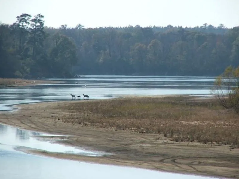
Twin Rivers Plantation on the rivers is an incredibly unique river property. Tattnall County Land for sale on two rivers! Twin Rivers has approximately 2.4 miles on the Altamaha River and 2. 6 miles on the Ohoopee River. Both rivers have considerable high bluff. Year around access to the Altamaha River is provided by a concrete boat landing with an additional concrete boat landing on the Ohoopee River. Road system is very good with access throughout the property.
Property is loaded with deer, turkey and hogs providing hunting opportunity all year long. Fishing is excellent and there is significant water fowl population. Twin Rivers is a multi-use hugely diverse property with many opportunities to venture into. There is timber value on the property but some areas have been harvested which are in a conservation easement with harvest restrictions. There have been two blocks of longleaf pines planted and other areas of large natural timber that do allow for timber harvesting.
Owner has installed power nearly a mile into the back of the property. A park area is at the end of the power line that has a pole barn like structure with a concrete floor and septic tank already installed. Access into property is through to points that are both graded and partially rocked though the rock was not necessary. A section of the two access points are deeded 40 foot easements. Property Taxes were $6,148 in 2019. Property is in a conservation easement that does allow for some harvesting on upland areas, has two building sites for single family homes and support buildings. Copy of easement is available upon request. This property is one of the better year around recreational properties you will find. Give us a call!
Property Details
Price/Acre: USD $ 1,250
Total Acres: 846.31 (+/-)
Total Price: USD $ 1,059,000
County: Tattnall
Latitude: 31.91876
Longitude: -82.12336
Current Zoning: AG
Potential Uses: Cattle Ranch, Conservation Easement, Development, Fishing, Home Site, Horse Farm, Hunting, Investment, Recreational, Recreation
The information contained herein was obtained from sources deemed reliable, but no liability is assumed for errors or omissions. Purchasers are encouraged to independently evaluate all characteristics of the herein-described property. Notice to Brokers is posted on our website. Brokers, please review our brokerage policy on our website.
From elevation to risk assessment
Search for detailed parcel information including; Elevation & Vegetation Maps, Ownership Information, Detailed Parcel Information, Crop History Map, Soil Survey Productivity Data, and more.
Research Parcel InformationResources
Tattnall County Properties By Type
- Farms for Sale in Tattnall County, Georgia
- Undeveloped Land for Sale in Tattnall County, Georgia
- Hunting Land for Sale in Tattnall County, Georgia
- Ranches for Sale in Tattnall County, Georgia
- Commercial Property for Sale in Tattnall County, Georgia
- Riverfront Property for Sale in Tattnall County, Georgia
- Lakefront Property for Sale in Tattnall County, Georgia
- Residential Property for Sale in Tattnall County, Georgia
- Timberland for Sale in Tattnall County, Georgia
- Horse Property for Sale in Tattnall County, Georgia
- Recreational Property for Sale in Tattnall County, Georgia
- Beachfront Property for Sale in Tattnall County, Georgia
Properties for Sale Nearby Counties
Tattnall County Properties By City
- Cobbtown, Georgia Land for Sale
- Collins, Georgia Land for Sale
- Glennville, Georgia Land for Sale
- Manassas, Georgia Land for Sale
- Reidsville, Georgia Land for Sale
- Mendes, Georgia Land for Sale
- Altamaha, Georgia Land for Sale
- Hughland, Georgia Land for Sale
- Jennie, Georgia Land for Sale
- Lynn, Georgia Land for Sale
- Tison, Georgia Land for Sale