9.75 acres in Ozark County, Missouri
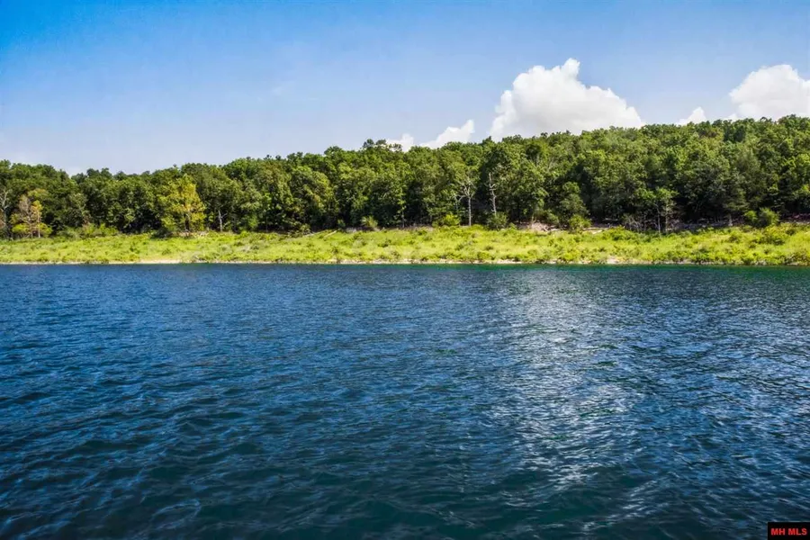
With more than mi of frontage on the government take line, and about the same frontage on a county gravel road, this all wooded acreage enjoys a secluded setting on a cove on Bull Shoals Lake. There's an easy walk to the water, and an excellent building site facing southeast. The adjoining government acreage is as pretty a woods as you're likely to see anywhere, accessible on foot and teeming with wildlife. The surrounding land includes a big Missouri Century farm, a lot of lake, and very few people.
From elevation to risk assessment
Search for detailed parcel information including; Elevation & Vegetation Maps, Ownership Information, Detailed Parcel Information, Crop History Map, Soil Survey Productivity Data, and more.
Research Parcel InformationContact Seller
Listing provided by
Donald Smiley
CENTURY 21 LeMac Realty(417) 543-3685
Source: Century 21, MLS# 116079
Listing last updated: February 5, 2022 at 6:42 PM
Listing last checked: December 1, 2025 at 9:30 AM
Report this listing
More Land for Sale in Ozark County
Ozark County Properties By Type
- Farms for Sale in Ozark County, Missouri
- Hunting Land for Sale in Ozark County, Missouri
- Undeveloped Land for Sale in Ozark County, Missouri
- Ranches for Sale in Ozark County, Missouri
- Residential Property for Sale in Ozark County, Missouri
- Riverfront Property for Sale in Ozark County, Missouri
- Lakefront Property for Sale in Ozark County, Missouri
- Recreational Property for Sale in Ozark County, Missouri
- Timberland for Sale in Ozark County, Missouri
- Commercial Property for Sale in Ozark County, Missouri
- Horse Property for Sale in Ozark County, Missouri
- Beachfront Property for Sale in Ozark County, Missouri
Properties for Sale Nearby Counties
Ozark County Properties By City
- Bakersfield, Missouri Land for Sale
- Brixey, Missouri Land for Sale
- Caulfield, Missouri Land for Sale
- Dora, Missouri Land for Sale
- Gainesville, Missouri Land for Sale
- Hardenville, Missouri Land for Sale
- Isabella, Missouri Land for Sale
- Noble, Missouri Land for Sale
- Pontiac, Missouri Land for Sale
- Rockbridge, Missouri Land for Sale
- Tecumseh, Missouri Land for Sale
- Theodosia, Missouri Land for Sale
- More
- Thornfield, Missouri Land for Sale
- Udall, Missouri Land for Sale
- Wasola, Missouri Land for Sale
- Zanoni, Missouri Land for Sale
- Dugginsville, Missouri Land for Sale
- Longrun, Missouri Land for Sale
- Nottinghill, Missouri Land for Sale
- Ocie, Missouri Land for Sale
- Souder, Missouri Land for Sale
- Sycamore, Missouri Land for Sale
- Almartha, Missouri Land for Sale
- Althea, Missouri Land for Sale
- Bird Springs, Missouri Land for Sale
- Dawt, Missouri Land for Sale
- Dawt Mill, Missouri Land for Sale
- Dillia, Missouri Land for Sale
- Dormis, Missouri Land for Sale
- Elijah, Missouri Land for Sale
- Fay, Missouri Land for Sale
- Foil, Missouri Land for Sale
- Hammond, Missouri Land for Sale
- High Place Lookout Tower, Missouri Land for Sale
- Howards Ridge, Missouri Land for Sale
- Locust, Missouri Land for Sale
- Luna, Missouri Land for Sale
- Lutie, Missouri Land for Sale
- Mammoth, Missouri Land for Sale
- Oak Mound, Missouri Land for Sale
- Pondfork, Missouri Land for Sale
- Prestonia, Missouri Land for Sale
- Romance, Missouri Land for Sale
- Sharp, Missouri Land for Sale
- Summit City, Missouri Land for Sale
- Sundown, Missouri Land for Sale
- Thuroy, Missouri Land for Sale
- Toccoa, Missouri Land for Sale
- Toledo, Missouri Land for Sale
- Trail, Missouri Land for Sale
- Udall Landing, Missouri Land for Sale
- Willhoit, Missouri Land for Sale