5 Acres Near Browns Canyon!
Description
Just $1500 Down! See pricing details below!
Summer is a great time to connect with nature and explore the beautiful outdoors, and what better way to do so than through camping? If youre looking for the perfect place to pitch your tent or RV, look no further than this stunning 5-acre land in Colorado. Roast marshmallows over a bonfire with family and friends or hike through scenic trails to clear your mind. With its serene surroundings, breathtaking views, and peaceful atmosphere, its the ideal spot for anyone seeking some much-needed R&R.
But if youre dreaming of something more permanent than a summer campsite, this land also offers an incredible opportunity to build your dream home. Imagine waking up every morning surrounded by picturesque views while enjoying all the comforts of modern living. Whether you want a cozy log cabin or a sprawling mansion with all the bells and whistles, theres plenty of room on this expansive property to make your vision a reality.
Property Address: 916 Chicha Rd., Hartsel, Colorado
Parcel ID: 9909
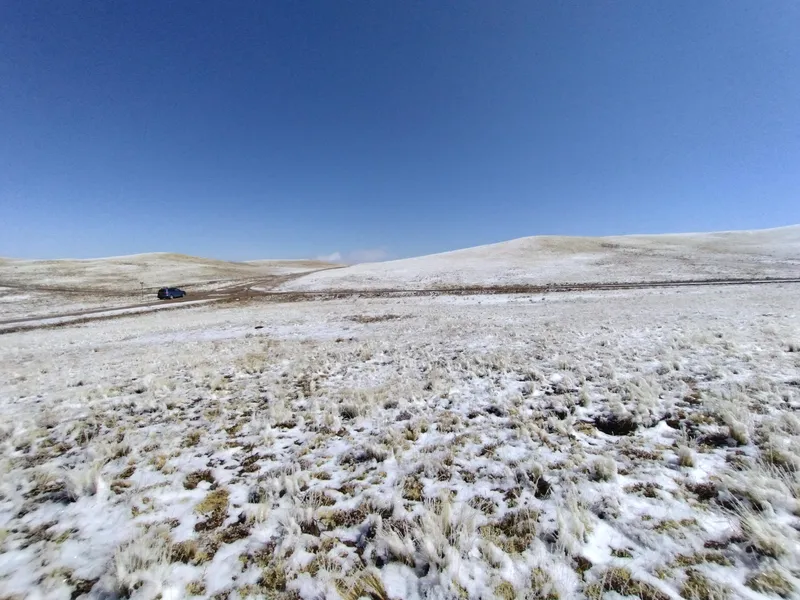
Size: 5.31 Acres
Terrain: Sloped, Desert, Plain
Access: Dirt Road
Conveyance: Warranty Deed
HOA: NO HOA
Taxes: $216 per year
Utilities: Power would likely be by solar or propane
Water: Would be by well or container. You can get a well permit from the State of CO.
Septic: Would be needed.
Camping: Allowed in the summer (May 1st- Oct 31st)
Types of Homes Allowed: Tiny Homes on a foundation, cabins
Nearby Attractions: Browns Canyon National Monument, Royal Gorge Bridge & Park, Blue 3 River Plaza, Cave of the Winds Mountain Park, Ghost Town Museum, Midland Tunnels
AFTER $249 DOCUMENT PROCESSING FEE
Discounted Cash Price: $14,900
Owner Financing: $1,500 down and $303 a month for 60 months
Approximate 4-corner GPS coordinates: (from DD report)
GPS NW - 3849'52.37"N, 10545'54.44"W
GPS NE - 3849'50.74"N, 10545'50.58"W
GPS SE - 3849'45.41"N,10545'55.25"W
GPS SW - 3849'46.63"N, 10545'59.74"W
From elevation to risk assessment
Search for detailed parcel information including; Elevation & Vegetation Maps, Ownership Information, Detailed Parcel Information, Crop History Map, Soil Survey Productivity Data, and more.
Research Parcel InformationDirections
https://goo.gl/maps/XYoT6P5efLcuJ61a8
Environmental Factors
Resources
Park County Properties By Type
- Undeveloped Land for Sale in Park County, Colorado
- Ranches for Sale in Park County, Colorado
- Residential Property for Sale in Park County, Colorado
- Riverfront Property for Sale in Park County, Colorado
- Lakefront Property for Sale in Park County, Colorado
- Horse Property for Sale in Park County, Colorado
- Timberland for Sale in Park County, Colorado
- Beachfront Property for Sale in Park County, Colorado
- Farms for Sale in Park County, Colorado
- Hunting Land for Sale in Park County, Colorado
- Recreational Property for Sale in Park County, Colorado
- Commercial Property for Sale in Park County, Colorado
Properties for Sale Nearby Counties
Park County Properties By City
- Alma, Colorado Land for Sale
- Bailey, Colorado Land for Sale
- Como, Colorado Land for Sale
- Fairplay, Colorado Land for Sale
- Grant, Colorado Land for Sale
- Guffey, Colorado Land for Sale
- Hartsel, Colorado Land for Sale
- Jefferson, Colorado Land for Sale
- Lake George, Colorado Land for Sale
- Shawnee, Colorado Land for Sale
- Tarryall, Colorado Land for Sale
- Alma Junction, Colorado Land for Sale
- More
- Antero Junction, Colorado Land for Sale
- Balfour, Colorado Land for Sale
- Bordenville, Colorado Land for Sale
- Estabrook, Colorado Land for Sale
- Garo, Colorado Land for Sale
- Glenisle, Colorado Land for Sale
- Glentivar, Colorado Land for Sale
- Haver, Colorado Land for Sale
- Insmont, Colorado Land for Sale
- Peabodys, Colorado Land for Sale
- Pike-San Isabel Village, Colorado Land for Sale
- Platte Springs, Colorado Land for Sale
- Santa Maria, Colorado Land for Sale
- Singleton, Colorado Land for Sale
- Trump, Colorado Land for Sale
- Webster, Colorado Land for Sale
- Weller, Colorado Land for Sale
- Will-O-The-Wisp, Colorado Land for Sale