Red Cloud Mine Rd, Desert Center, CA 92239 - Riverside County
93.06 acres in Riverside County, California
Description
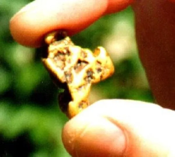
The scenic Red Cloud patent gold mine is for sale! The mine consists of 93+ acres. The seller says it has 4 lode claims and 2 mill sites. Located in the pristine Chuckwalla Mountains, a desert area east of Indio and southwest of Desert Center. Seller says the high-grade gold vein is approximately 2-5 feet wide and pays to oz in gold per ton. Seller says the vein on the surface is over 4000 ft. Seller says that also included is porphyry 200 ft wide by 1000 yards that pays 0.1 oz per ton. Seller says the land is free of environmental restrictions and includes a grandfather clause. The Red Cloud Mine is located approximately 40 miles northwest of the Mesquite Mine which seller says is the richest gold mine operating in California. This large stunningly beautiful acreage includes 5 parcel numbers, APNs 811-110-003, 004, 005, 006, 007 with BLM land between the parcels. There are buildable flat areas that would be great for a resort or retreat. For example, the Dottie Welborn claim at the entrance to the beautiful Red Cloud Canyon area is 22 acres and mostly flat land. The sellers are retired miners and their family has been involved in gold mining since 1862. Various reports and newspaper articles are available on brokers website. Gold nugget photo is a stock photo. Other photos are intended to show the general canyon area and may or may not be of actual parcels. Now its time for a new generation to own the fascinating Red Cloud Mine!
Land Use: Open Space Rural
Directions: From Indio, take I-10 east. Before Desert Center, take the Red Cloud Mine Rd exit. Go south on Red Cloud Mine Rd to the end. Take a 4WD and all maps. Coordinates of the first parcel are longitude -115.454668 and latitude +33.613419.
From elevation to risk assessment
Search for detailed parcel information including; Elevation & Vegetation Maps, Ownership Information, Detailed Parcel Information, Crop History Map, Soil Survey Productivity Data, and more.
Research Parcel InformationEnvironmental Factors
Riverside County Properties By Type
- Undeveloped Land for Sale in Riverside County, California
- Ranches for Sale in Riverside County, California
- Farms for Sale in Riverside County, California
- Residential Property for Sale in Riverside County, California
- Commercial Property for Sale in Riverside County, California
- Horse Property for Sale in Riverside County, California
- Lakefront Property for Sale in Riverside County, California
- Riverfront Property for Sale in Riverside County, California
- Recreational Property for Sale in Riverside County, California
- Beachfront Property for Sale in Riverside County, California
- Timberland for Sale in Riverside County, California
- Hunting Land for Sale in Riverside County, California
Properties for Sale Nearby Counties
Riverside County Properties By City
- Aguanga, California Land for Sale
- Anza, California Land for Sale
- Banning, California Land for Sale
- Beaumont, California Land for Sale
- Blythe, California Land for Sale
- Cabazon, California Land for Sale
- Calimesa, California Land for Sale
- Cathedral City, California Land for Sale
- Coachella, California Land for Sale
- Corona, California Land for Sale
- Desert Center, California Land for Sale
- Desert Hot Springs, California Land for Sale
- More
- Hemet, California Land for Sale
- Homeland, California Land for Sale
- Idyllwild, California Land for Sale
- Indian Wells, California Land for Sale
- Indio, California Land for Sale
- La Quinta, California Land for Sale
- Lake Elsinore, California Land for Sale
- Mecca, California Land for Sale
- Menifee, California Land for Sale
- Mira Loma, California Land for Sale
- Moreno Valley, California Land for Sale
- Mountain Center, California Land for Sale
- Murrieta, California Land for Sale
- Norco, California Land for Sale
- North Palm Springs, California Land for Sale
- Nuevo, California Land for Sale
- Palm Desert, California Land for Sale
- Palm Springs, California Land for Sale
- Perris, California Land for Sale
- Rancho Mirage, California Land for Sale
- Riverside, California Land for Sale
- San Jacinto, California Land for Sale
- Sun City, California Land for Sale
- Temecula, California Land for Sale
- Thermal, California Land for Sale
- Thousand Palms, California Land for Sale
- Wildomar, California Land for Sale
- Winchester, California Land for Sale
- Arlington, California Land for Sale
- Bermuda Dunes, California Land for Sale
- Box Springs, California Land for Sale
- Canyon Lake, California Land for Sale
- Casa Blanca, California Land for Sale
- Cherry Valley, California Land for Sale
- Chiriaco Summit, California Land for Sale
- Desert Edge, California Land for Sale
- Eagle Mountain, California Land for Sale
- Gilman Hot Springs, California Land for Sale
- La Sierra, California Land for Sale
- Lakeview, California Land for Sale
- Mesa Verde, California Land for Sale
- Murrieta Hot Springs, California Land for Sale
- One Hundred Palms, California Land for Sale
- Pinyon Pines, California Land for Sale
- Quail Valley, California Land for Sale
- Ripley, California Land for Sale
- Romoland, California Land for Sale
- Rubidoux, California Land for Sale
- Sandy Korner, California Land for Sale
- Sky Valley, California Land for Sale
- Valerie, California Land for Sale
- Woodcrest, California Land for Sale
- Alberhill, California Land for Sale
- Alessandro, California Land for Sale
- Antelope Hills, California Land for Sale
- Arcilla, California Land for Sale
- Arlanza, California Land for Sale
- Arlington Station, California Land for Sale
- Arnold Heights, California Land for Sale
- Bannockburn Village, California Land for Sale
- Belltown, California Land for Sale
- Belvedere Heights, California Land for Sale
- Biskra Palms, California Land for Sale
- Bly, California Land for Sale
- Bonnie Bell, California Land for Sale
- Cactus City, California Land for Sale
- Cahuilla, California Land for Sale
- Cahuilla Hills, California Land for Sale
- Caliente Sands, California Land for Sale
- Camelot Hills, California Land for Sale
- Canyon Crest Heights, California Land for Sale
- Casa Loma, California Land for Sale
- Colina Vista, California Land for Sale
- Cox, California Land for Sale
- De Anza Village, California Land for Sale
- Desert Beach, California Land for Sale
- Desert Camp, California Land for Sale
- Desert View, California Land for Sale
- Dos Palmas Corners, California Land for Sale
- Durmid, California Land for Sale
- Dutch Village, California Land for Sale
- East Blythe, California Land for Sale
- East Hemet, California Land for Sale
- Eden, California Land for Sale
- Eden Hot Springs, California Land for Sale
- Edgemont, California Land for Sale
- Edom, California Land for Sale
- Egan, California Land for Sale
- El Casco, California Land for Sale
- Ellis, California Land for Sale
- Ennis, California Land for Sale
- Fern Valley, California Land for Sale
- Ferrum, California Land for Sale
- Garnet, California Land for Sale
- Gavilan Hills, California Land for Sale
- Glen Avon, California Land for Sale
- Glen Valley, California Land for Sale
- Glenoak Hills, California Land for Sale
- Glenoaks Country, California Land for Sale
- Good Hope, California Land for Sale
- Good Meadow, California Land for Sale
- Green Acres, California Land for Sale
- Hayfield, California Land for Sale
- Henshaw, California Land for Sale
- Hidden Palms, California Land for Sale
- High Acres Haciendas, California Land for Sale
- Highgrove, California Land for Sale
- Highland Springs, California Land for Sale
- Hinda, California Land for Sale
- Home Gardens, California Land for Sale
- Inca, California Land for Sale
- Indian Oaks, California Land for Sale
- Indio Hills, California Land for Sale
- Juniper Springs, California Land for Sale
- La Cresta, California Land for Sale
- La Cresta Highlands, California Land for Sale
- La Sierra Heights, California Land for Sale
- Lake Tamarisk, California Land for Sale
- Lake Village, California Land for Sale
- Lakeland Village, California Land for Sale
- Lakeview Hot Springs, California Land for Sale
- Lemona, California Land for Sale
- Linda Rose, California Land for Sale
- Los Ranchitos, California Land for Sale
- Macomber Palms, California Land for Sale
- Magnolia Avenue, California Land for Sale
- March Field, California Land for Sale
- May, California Land for Sale
- Mead Valley, California Land for Sale
- Menifee Lakes, California Land for Sale
- Mesaville, California Land for Sale
- Midland, California Land for Sale
- Miller Farms, California Land for Sale
- Mons, California Land for Sale
- Moonlight Rim, California Land for Sale
- Moreno Knolls, California Land for Sale
- Mortmar, California Land for Sale
- Myoma, California Land for Sale
- Nicklin, California Land for Sale
- North Elsinore, California Land for Sale
- Oakridge Ranches, California Land for Sale
- Oasis, California Land for Sale
- Ordway, California Land for Sale
- Ormand, California Land for Sale
- Owl, California Land for Sale
- Pachappa, California Land for Sale
- Palm Desert Country, California Land for Sale
- Pedley, California Land for Sale
- Pepper Corner, California Land for Sale
- Pine Cove, California Land for Sale
- Pine Wood, California Land for Sale
- Pinto Wye, California Land for Sale
- Pinyon Crest, California Land for Sale
- Porphyry, California Land for Sale
- Prenda, California Land for Sale
- Pushawalla Palms, California Land for Sale
- Radec, California Land for Sale
- Rainbow Canyon Village, California Land for Sale
- Ramona Bowl, California Land for Sale
- Rancho Dos Palmas, California Land for Sale
- Rancho las Perris, California Land for Sale
- Ribbonwood, California Land for Sale
- Rimlon, California Land for Sale
- Riverside Junction, California Land for Sale
- Royal Palms, California Land for Sale
- Saddle Junction, California Land for Sale
- Sage, California Land for Sale
- Salton, California Land for Sale
- Salvia, California Land for Sale
- Santa Margarita Groves, California Land for Sale
- Santa Rosa South, California Land for Sale
- Santa Rosa West, California Land for Sale
- Sedco Hills, California Land for Sale
- Serrano Heights, California Land for Sale
- Shadow Ridge Creek, California Land for Sale
- Snow Creek, California Land for Sale
- Soboba Hot Springs, California Land for Sale
- Stalder, California Land for Sale
- Styx, California Land for Sale
- Sunnymead, California Land for Sale
- Sunnyslope, California Land for Sale
- Suntown, California Land for Sale
- Sycamore Hills, California Land for Sale
- Sycamore Springs, California Land for Sale
- Sylvan Meadows, California Land for Sale
- Taylor, California Land for Sale
- Temecula Ranchos, California Land for Sale
- Temescal, California Land for Sale
- Terra Cotta, California Land for Sale
- Thomas Mountain, California Land for Sale
- Twin Pines, California Land for Sale
- Valle de los Caballos, California Land for Sale
- Valle Vista, California Land for Sale
- Valley Vista, California Land for Sale
- Weisel, California Land for Sale
- West March, California Land for Sale
- White Water, California Land for Sale
- Willis Palms, California Land for Sale
- Windsor Crest, California Land for Sale
- Whitewater, California Land for Sale