26930 Highway 145, Dolores, CO 81323 - Montezuma County
93.5 acres in Montezuma County, Colorado
Description
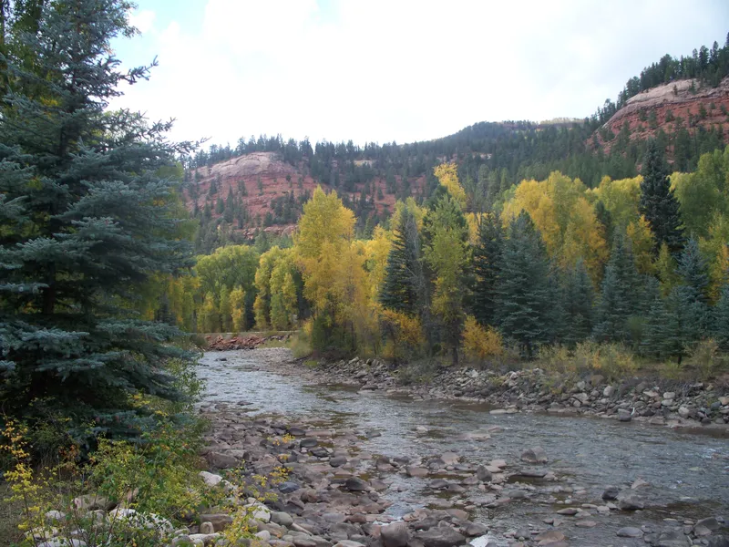
This is a very special property with approximately 1/2 mile of Dolores River frontage. Historically known as "The Potato Patch" early settlers farmed potatoes which were transported by the train up the Dolores River Valley to Telluride and down to Dolores. The 93.5 acres is comprised of 2 tracts; (1.) 85.9 acres and (2.) 7.60 acres. The property is bounded on the east by National Forest. The lay of the land is a mix of irrigated pastures and varies from flat river bottom and benches to steep Aspen covered slopes. The views from the home which occupies a higher bench expand from the Aspen and Cottonwood framed pastures across the valley floor to the pine forests and red sandstone cliffs. Truly magnificent. The improvements consist of a 2 level 4 bedroom home; 40' x 50' equipment shed/shop with loft, outbuildings, coral, RV site with hook ups and old settlers cabin (not habitable but adds color)
The property is ideal for a family wishing to escape from the rush, pressures and realities of the work-a-day world to a place where time stands still and your primary sounds consist of breezes in the surrounding "quakies" (Aspens),
rush of the river and other sounds of nature. The lifestyle opportunity here is unsurpassed. The pastures are ideal for maintaining a number of horses and/or cows. It is just a 20 minute drive to the amenities of Dolores to the south or about 45 minutes to the mountain resort town of Telluride which boasts big mountain skiing and numerous year around festivals in an old Rocky Mountain mining town atmosphere. This property is ideal for year around living or to be used as a mountain retreat. Plenty of room and beautiful sites to build additional homes if desired.
From elevation to risk assessment
Search for detailed parcel information including; Elevation & Vegetation Maps, Ownership Information, Detailed Parcel Information, Crop History Map, Soil Survey Productivity Data, and more.
Research Parcel InformationDirections
Approximately 20 miles north of Dorores and 37 miles south of Telluride, Colorado on Highway 145
Environmental Factors
Montezuma County Properties By Type
- Undeveloped Land for Sale in Montezuma County, Colorado
- Riverfront Property for Sale in Montezuma County, Colorado
- Ranches for Sale in Montezuma County, Colorado
- Farms for Sale in Montezuma County, Colorado
- Hunting Land for Sale in Montezuma County, Colorado
- Residential Property for Sale in Montezuma County, Colorado
- Recreational Property for Sale in Montezuma County, Colorado
- Lakefront Property for Sale in Montezuma County, Colorado
- Commercial Property for Sale in Montezuma County, Colorado
- Horse Property for Sale in Montezuma County, Colorado
- Timberland for Sale in Montezuma County, Colorado
- Beachfront Property for Sale in Montezuma County, Colorado
Properties for Sale Nearby Counties
Montezuma County Properties By City
- Cortez, Colorado Land for Sale
- Dolores, Colorado Land for Sale
- Lewis, Colorado Land for Sale
- Mancos, Colorado Land for Sale
- Pleasant View, Colorado Land for Sale
- Towaoc, Colorado Land for Sale
- Yellow Jacket, Colorado Land for Sale
- Arriola, Colorado Land for Sale
- Stoner, Colorado Land for Sale
- Golconda, Colorado Land for Sale
- Lebanon, Colorado Land for Sale
- Mariano, Colorado Land for Sale
- More