Auction Information

96 Acre Webster County, Nebraska LAND AUCTION
Legal Description: Lots 1 & 2 in the Northwest Quarter (NW ) & 13.61 acres lying West of RR in the Northeast Quarter, Southwest Quarter (NE , SW ) in Section Sixteen (16), Township Four North (T4N), Range Ten West (R10W) of the 6th P.M. Webster County, Nebraska 96 acres +/-.
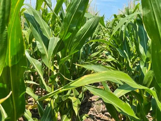
Description: This is a high quality non irrigated farm with excellent access and productive soils. This area of South-Central Nebraska is known for high yields and strong markets for the crops grown. There are livestock production facilities, an ethanol plant, soybean processing and major grain terminals less than 30 miles from this property. The production potential and competitive markets make this a great addition to your farming operation or investment portfolio.
FSA Data:
Crop Base Acres PLC Yield
Wheat 21.71 35
Corn 35.72 113
Soybeans 30.87 37
Total Base 88.3
Farmland Cropland
89.97 89.89
Taxes: $2,531.48 (2021)
From elevation to risk assessment
Search for detailed parcel information including; Elevation & Vegetation Maps, Ownership Information, Detailed Parcel Information, Crop History Map, Soil Survey Productivity Data, and more.
Research Parcel InformationDirections
Farm Location: From Blue Hill go 1 miles South on Hwy 281 to Rd X, then 1 mile west (across RR tracks) to Rd 1500, then mile North. (The farm is on the East side of the road.)
Environmental Factors
Resources
Land for Sale by Travis Augustin
Webster County Properties By Type
- Farms for Sale in Webster County, Nebraska
- Ranches for Sale in Webster County, Nebraska
- Commercial Property for Sale in Webster County, Nebraska
- Riverfront Property for Sale in Webster County, Nebraska
- Residential Property for Sale in Webster County, Nebraska
- Hunting Land for Sale in Webster County, Nebraska
- Horse Property for Sale in Webster County, Nebraska
- Recreational Property for Sale in Webster County, Nebraska
- Undeveloped Land for Sale in Webster County, Nebraska
- Timberland for Sale in Webster County, Nebraska
- Lakefront Property for Sale in Webster County, Nebraska
- Beachfront Property for Sale in Webster County, Nebraska
Properties for Sale Nearby Counties
Webster County Properties By City
- Bladen, Nebraska Land for Sale
- Blue Hill, Nebraska Land for Sale
- Guide Rock, Nebraska Land for Sale
- Inavale, Nebraska Land for Sale
- Red Cloud, Nebraska Land for Sale
- Cowles, Nebraska Land for Sale
- Rosemont, Nebraska Land for Sale
- Amboy, Nebraska Land for Sale
- Lester Junction, Nebraska Land for Sale
- Pawnee Village, Nebraska Land for Sale