1.665 Acres, San Juan County NM, Parcel 2086172500232
Description
-Owner Financing
-Monthly Payment $407.51
-Down Payment $3,500
*** GUARANTEED FINANCING- No Credit Check***
MONEY BACK SATISFACTION GUARANTEE
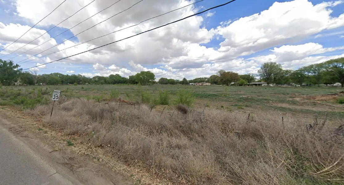
Learn more about the possibilities in the developing Fruitland, New Mexico community to buy 1.665 acres of level land. Among other things, this area can be utilized to build homes, park RVs, and establish private campgrounds. Beyond the rustic appeal, there are other necessities, such close access to natural gas and electric utilities. This is an inexpensive and secure investment because it has a money back satisfaction guarantee, guaranteed financing, and no credit check.
Contact us today to secure your slice of Fruitland, NM, and take the first step towards realizing your vision in a community thats growing and thriving!
Property Details:
Lot Size: 1.665
County: San Juan
Address: US 64, Fruitland, NM 87416
Terrain: Level
Power: There are electric pole lines available on Road 6675
Water: No utility - contact Lower Valley Water 505-598-5585
Septic/Sewer: Sewer by septic
Gas: Natural Gas - New Mexico Gas Company (888) 664-2726
Access: Road 6675
HOA/ POA: no HOA
APN: 2086172500232
Other information or restrictions:
RVs Allowed: RVs shall not be used for storage purposes of any item not utilized for direct operation of the RV
Camp on Property: Yes camping allowed in your own private property
Mobile Homes Allowed: Mobile homes shall be installed consistent with the Manufactured Housing Act (Chapter 60, Article 14, NMSA 1978) and State of New Mexico Manufacture Housing Division Rules and Regulations
*** Buyer to verify all information***
Closest Town/City: Fruitland, Kirtland, NM 87416 - 4 mins (2.8 miles)
Average annual precipitation: 8.35 inches of rain/ 14.61 inches of snow
Average Temperature(winter/summer): 20/90
Approx. Coordinates: 36.74079, -108.39483
From elevation to risk assessment
Search for detailed parcel information including; Elevation & Vegetation Maps, Ownership Information, Detailed Parcel Information, Crop History Map, Soil Survey Productivity Data, and more.
Research Parcel InformationEnvironmental Factors
Resources
San Juan County Properties By Type
- Commercial Property for Sale in San Juan County, New Mexico
- Undeveloped Land for Sale in San Juan County, New Mexico
- Farms for Sale in San Juan County, New Mexico
- Hunting Land for Sale in San Juan County, New Mexico
- Riverfront Property for Sale in San Juan County, New Mexico
- Ranches for Sale in San Juan County, New Mexico
- Residential Property for Sale in San Juan County, New Mexico
- Horse Property for Sale in San Juan County, New Mexico
- Lakefront Property for Sale in San Juan County, New Mexico
- Recreational Property for Sale in San Juan County, New Mexico
- Timberland for Sale in San Juan County, New Mexico
- Beachfront Property for Sale in San Juan County, New Mexico
Properties for Sale Nearby Counties
- Apache County, New Mexico Land for Sale
- Archuleta County, New Mexico Land for Sale
- La Plata County, New Mexico Land for Sale
- McKinley County, New Mexico Land for Sale
- Montezuma County, New Mexico Land for Sale
- Rio Arriba County, New Mexico Land for Sale
- San Juan County, New Mexico Land for Sale
- Sandoval County, New Mexico Land for Sale
San Juan County Properties By City
- Aztec, New Mexico Land for Sale
- Blanco, New Mexico Land for Sale
- Bloomfield, New Mexico Land for Sale
- Farmington, New Mexico Land for Sale
- Flora Vista, New Mexico Land for Sale
- Fruitland, New Mexico Land for Sale
- Kirtland, New Mexico Land for Sale
- La Plata, New Mexico Land for Sale
- Nageezi, New Mexico Land for Sale
- Navajo Dam, New Mexico Land for Sale
- Newcomb, New Mexico Land for Sale
- Sanostee, New Mexico Land for Sale
- More
- Sheep Springs, New Mexico Land for Sale
- Shiprock, New Mexico Land for Sale
- Cedar Hill, New Mexico Land for Sale
- Little Water, New Mexico Land for Sale
- Tocito, New Mexico Land for Sale
- Turley, New Mexico Land for Sale
- Alcatraz, New Mexico Land for Sale
- Archuleta, New Mexico Land for Sale
- Beclabito, New Mexico Land for Sale
- Christopher Place, New Mexico Land for Sale
- Cottonwood, New Mexico Land for Sale
- Crystal, New Mexico Land for Sale
- Cudei, New Mexico Land for Sale
- Fivemile Crossing, New Mexico Land for Sale
- Huerfano, New Mexico Land for Sale
- Inca, New Mexico Land for Sale
- Kimbeto, New Mexico Land for Sale
- Lake Valley, New Mexico Land for Sale
- Lee Acres, New Mexico Land for Sale
- Lucero Place, New Mexico Land for Sale
- Mackey Place, New Mexico Land for Sale
- Mullen Place, New Mexico Land for Sale
- Nenahnezad, New Mexico Land for Sale
- Ojo Amarillo, New Mexico Land for Sale
- Rattlesnake, New Mexico Land for Sale
- Self Place, New Mexico Land for Sale
- Spencerville, New Mexico Land for Sale
- Toadlena, New Mexico Land for Sale
- Tsaya, New Mexico Land for Sale
- Two Grey Hills, New Mexico Land for Sale
- Ulibarri Place, New Mexico Land for Sale
- Upper Fruitland, New Mexico Land for Sale
- Middle Mesa, New Mexico Land for Sale