Larranaga Property
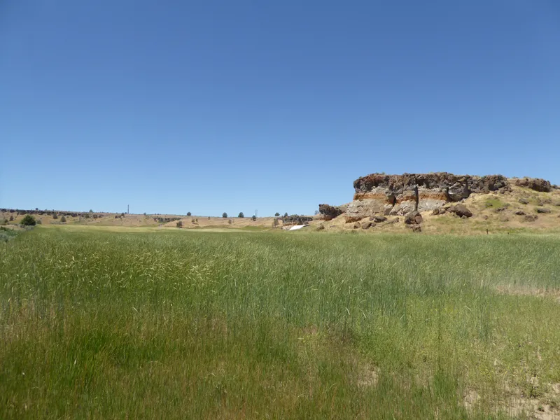
The Larranaga Property is an irregular shaped parcel located west of Alturas. The property is a historically irrigated farm with rangeland. The property was used for sheep production and is currently grazed by livestock seasonally. The topography varies. There are flat areas that are currently dryland farmed to rye. There are large rock formations overlooking the fields. The native grassland land surrounds the dryland fields on the north and the south. The native grassland is generally rolling hills with limited juniper trees. There is a pond located in the northeastern portion of the property that is used as a water source for livestock. The elevation of the property ranges from approximately 4,400 feet in elevation to approximately 4,500 feet in elevation. There is a Quonset building 100 x 50 (5,000 sq. ft.) with a concrete perimeter foundation, dirt floor, metal frame and metal roof. The surrounding land uses include rural residential to the west, agricultural to the north, a shooting range immediately to the south and agricultural to the east. The subject property contains an older irrigation well that is not currently in use. The property contains wheel lines that havent been used for many years.
From elevation to risk assessment
Search for detailed parcel information including; Elevation & Vegetation Maps, Ownership Information, Detailed Parcel Information, Crop History Map, Soil Survey Productivity Data, and more.
Research Parcel InformationDirections
N. West st south of Alturas. Property is located behind the gun range.
Resources
Land for Sale by Kasey Stewart
Modoc County Properties By Type
- Undeveloped Land for Sale in Modoc County, California
- Residential Property for Sale in Modoc County, California
- Ranches for Sale in Modoc County, California
- Recreational Property for Sale in Modoc County, California
- Lakefront Property for Sale in Modoc County, California
- Riverfront Property for Sale in Modoc County, California
- Timberland for Sale in Modoc County, California
- Farms for Sale in Modoc County, California
- Hunting Land for Sale in Modoc County, California
- Horse Property for Sale in Modoc County, California
- Commercial Property for Sale in Modoc County, California
- Beachfront Property for Sale in Modoc County, California
Properties for Sale Nearby Counties
Modoc County Properties By City
- Adin, California Land for Sale
- Alturas, California Land for Sale
- Canby, California Land for Sale
- Cedarville, California Land for Sale
- Davis Creek, California Land for Sale
- Eagleville, California Land for Sale
- Fort Bidwell, California Land for Sale
- Lake City, California Land for Sale
- Likely, California Land for Sale
- Lookout, California Land for Sale
- California Pines, California Land for Sale
- Willow Ranch, California Land for Sale
- More
- Ambrose, California Land for Sale
- Boles, California Land for Sale
- Bormister, California Land for Sale
- Brooks Mill, California Land for Sale
- Cantrall Mill, California Land for Sale
- Christensen, California Land for Sale
- Copic, California Land for Sale
- D Flourney, California Land for Sale
- Dalton, California Land for Sale
- Daphnedale Park, California Land for Sale
- Day, California Land for Sale
- Demuth, California Land for Sale
- Derner, California Land for Sale
- Dibble Place, California Land for Sale
- Fairport, California Land for Sale
- Fletcher Place, California Land for Sale
- Flourney, California Land for Sale
- Grizzlie Place, California Land for Sale
- Hackamore, California Land for Sale
- Hannchen, California Land for Sale
- Harper, California Land for Sale
- Homestead, California Land for Sale
- Juniper, California Land for Sale
- K Flourney, California Land for Sale
- Kalina, California Land for Sale
- Kandra, California Land for Sale
- Kauffman, California Land for Sale
- Kephart, California Land for Sale
- Lakeview Junction, California Land for Sale
- Liskey, California Land for Sale
- Lookout Junction, California Land for Sale
- Mammoth, California Land for Sale
- McGarva, California Land for Sale
- Meares, California Land for Sale
- Menlo Baths, California Land for Sale
- Mulkey Place, California Land for Sale
- New Pine Creek, California Land for Sale
- Old Hulbert Place, California Land for Sale
- Perez, California Land for Sale
- R Flourney, California Land for Sale
- Ramsey, California Land for Sale
- Scarface, California Land for Sale
- Staley, California Land for Sale
- Stronghold, California Land for Sale
- Surprise Station, California Land for Sale
- Tuber, California Land for Sale
- Vestil, California Land for Sale
- White Horse, California Land for Sale