1.71 Acres, Adams County WI, Parcel 018-01063-0116
-Just Reduced Cash Price 40,935.00
-Owner Financing available with Down payment.
*** GUARANTEED FINANCING- No Credit Check***
MONEY BACK SATISFACTION GUARANTEE
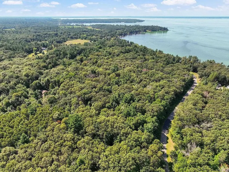
Envision becoming the proud owner of a roomy 1.71 acre lot tucked away in the serene neighborhood of Arkdale, WI. This property, which is perfectly situated inside the Petenwell Landing Association, provides the convenience of big town Big Flats area amenities with the tranquility of rural living. Your path to land ownership is simple and secure, with guaranteed financing and no credit check needed. This is further supported by our money back satisfaction guarantee.
Property Details:
Lot Size: 1.71
County: Adams
Address: Arkdale, WI, 54613
Terrain: Level
Power: Electric service is located along all town roads throughout the subdivision. Lot Owners are responsible for constructing this utility from the road to their homesite. All service must be installed underground
Water: Fosters Well Drilling can provide information pertaining to water wells / Phone: (608) 339-3717
Septic/Sewer: Sewer by septic
Gas: Fuel and Propane
Access: S Badger Lane
HOA/ POA: xxxx
APN: HOA: Petenwell Landing Association, Inc. / $75
Other information or restrictions:
RVs Allowed: No more than 1 RV including, but not limited to boats, trailers, campers, ATVs, jet skis and snowmobiles, shall be stored on any lot (unless garaged)
Camp on Property: Camping is permitted on a Lot (specifically not to include the Outlots) for not more than 14 consecutive days nor more than 50 days in any calendar year.
Mobile Homes Allowed: Mobile Homes are not permitted.
*** Buyer to verify all information***
Closest Town/City: Big Flats, Wisconsin 54613 - 12 mins (8.2 miles)
Average annual precipitation: 33 inches of rain/ 43 inches of snow
Average Temperature(winter/summer): 5.7/82.7
Approx. Coordinates: 44.14231, -89.92729
From elevation to risk assessment
Search for detailed parcel information including; Elevation & Vegetation Maps, Ownership Information, Detailed Parcel Information, Crop History Map, Soil Survey Productivity Data, and more.
Research Parcel InformationResources
Land for Sale by APXN
Adams County Properties By Type
- Lakefront Property for Sale in Adams County, Wisconsin
- Riverfront Property for Sale in Adams County, Wisconsin
- Beachfront Property for Sale in Adams County, Wisconsin
- Hunting Land for Sale in Adams County, Wisconsin
- Undeveloped Land for Sale in Adams County, Wisconsin
- Farms for Sale in Adams County, Wisconsin
- Residential Property for Sale in Adams County, Wisconsin
- Ranches for Sale in Adams County, Wisconsin
- Recreational Property for Sale in Adams County, Wisconsin
- Timberland for Sale in Adams County, Wisconsin
- Commercial Property for Sale in Adams County, Wisconsin
- Horse Property for Sale in Adams County, Wisconsin
Properties for Sale Nearby Counties
Adams County Properties By City
- Adams, Wisconsin Land for Sale
- Arkdale, Wisconsin Land for Sale
- Dellwood, Wisconsin Land for Sale
- Friendship, Wisconsin Land for Sale
- Grand Marsh, Wisconsin Land for Sale
- Big Flats, Wisconsin Land for Sale
- Monroe Center, Wisconsin Land for Sale
- Big Spring, Wisconsin Land for Sale
- Cottonville, Wisconsin Land for Sale
- Easton, Wisconsin Land for Sale
- New Rome, Wisconsin Land for Sale
- Plainville, Wisconsin Land for Sale
- More