13 PRIVATE ACRES * GORGEOUS VIEWS * STATE LAND ACCESS
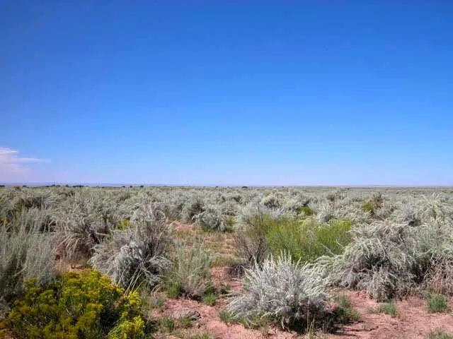
This unique 13.33 acre property wont last long! With state land on two sides, you will always find yourself with panoramic views of this incredible area of Apache County. In addition to the lush vegetation, there are no neighbors in sight. You will have plenty of privacy yet adequate access from the platted Spurlock Side Road. Just jump on I-40 (part of old Route 66), head west, and you will quickly be on your way to hiking in the Petrified Forest National Park or immersing yourself in the Painted Desert! If youre looking for some small town charm, take a short drive to the Painted Desert Grill in Chambers for a hearty meal. With abounding landscapes and state land on both sides, this property is the perfect spot to build your getaway cabin!
The photos included here are satellite photos and photos of a nearby property we recently owned. I havent had the chance to visit yet so I am including everything I know about this property in the details below.
NEARBY CITIES & ATTRACTIONS (APPROX.)
16 miles to Navajo Travel Center
24 miles to gas, groceries, post office & pharmacy in Chambers
31 miles to Petrified Forest National Park
1.5 hours to Painted Desert
95 miles to Casa Malpais Ruins
3 hours to Sedona, AZ
PAYMENT OPTIONS
Easy checkout, click the Buy Now button, complete the quick checkout and we will receive notification your payment has been made. When the funds have cleared, our team will process the documentation and send you title to your property. We take most major credit and debit cards. If you need to pay by wire transfer or cashiers check, give us a call.
Discounted Cash Price $3,699 plus $199 for closing.
PROPERTY DETAILS
Size (Acres): 13.33
Best Attribute: Gorgeous Views
General Location: Chambers, AZ 86502
APN or Other ID: 20676017C
Subdivision: NA
Legal Description: The Northerly 1/3 of NE4 of NE4 of sec 27, T18N, R26E (13 AC +/-).
Approx. GPS:
34.937066, -109.559848
34.935862, -109.559856
34.935901, -109.564346
34.937105, -109.564330
Property Type: Rural Land
Zoning: General Agricultural.
HOA/POA: No
Terrain: Varied
General Elevation: Approx. 6,000
Power: Would be by generator, solar or wind.
Phone: Mobile/Satellite/Alternative
Water: Would need well or alternative system
Sewer: Would need septic or alternative system
Roads: Dirt Road
Time to Build: No Limit
Title Info: Free & Clear Title, Conveyed from LG Solutions LLC
Annual Property Taxes: Approx. $37
Doc Fee: $199
Terms: Cash
From elevation to risk assessment
Search for detailed parcel information including; Elevation & Vegetation Maps, Ownership Information, Detailed Parcel Information, Crop History Map, Soil Survey Productivity Data, and more.
Research Parcel InformationEnvironmental Factors
Land for Sale by Dave Ayres
Apache County Properties By Type
- Undeveloped Land for Sale in Apache County, Arizona
- Residential Property for Sale in Apache County, Arizona
- Farms for Sale in Apache County, Arizona
- Ranches for Sale in Apache County, Arizona
- Recreational Property for Sale in Apache County, Arizona
- Lakefront Property for Sale in Apache County, Arizona
- Hunting Land for Sale in Apache County, Arizona
- Riverfront Property for Sale in Apache County, Arizona
- Beachfront Property for Sale in Apache County, Arizona
- Commercial Property for Sale in Apache County, Arizona
- Timberland for Sale in Apache County, Arizona
- Horse Property for Sale in Apache County, Arizona
Properties for Sale Nearby Counties
- Catron County, Arizona Land for Sale
- Cibola County, Arizona Land for Sale
- Graham County, Arizona Land for Sale
- Greenlee County, Arizona Land for Sale
- McKinley County, Arizona Land for Sale
- Montezuma County, Arizona Land for Sale
- Navajo County, Arizona Land for Sale
- San Juan County, Arizona Land for Sale
- San Juan County, Arizona Land for Sale
Apache County Properties By City
- Alpine, Arizona Land for Sale
- Chambers, Arizona Land for Sale
- Chinle, Arizona Land for Sale
- Concho, Arizona Land for Sale
- Dennehotso, Arizona Land for Sale
- Eagar, Arizona Land for Sale
- Fort Defiance, Arizona Land for Sale
- Ganado, Arizona Land for Sale
- Greer, Arizona Land for Sale
- Houck, Arizona Land for Sale
- Lukachukai, Arizona Land for Sale
- Lupton, Arizona Land for Sale
- More
- Many Farms, Arizona Land for Sale
- Mcnary, Arizona Land for Sale
- Nazlini, Arizona Land for Sale
- Nutrioso, Arizona Land for Sale
- Rock Point, Arizona Land for Sale
- Round Rock, Arizona Land for Sale
- Saint Johns, Arizona Land for Sale
- Saint Michaels, Arizona Land for Sale
- Sanders, Arizona Land for Sale
- Springerville, Arizona Land for Sale
- Teec Nos Pos, Arizona Land for Sale
- Vernon, Arizona Land for Sale
- Window Rock, Arizona Land for Sale
- Concho Valley, Arizona Land for Sale
- Cornfields, Arizona Land for Sale
- Greasewood, Arizona Land for Sale
- Klagetoh, Arizona Land for Sale
- Mexican Water, Arizona Land for Sale
- Red Mesa, Arizona Land for Sale
- Richville, Arizona Land for Sale
- Rough Rock, Arizona Land for Sale
- Salado, Arizona Land for Sale
- Salina, Arizona Land for Sale
- Steamboat Canyon, Arizona Land for Sale
- Sunrise Springs, Arizona Land for Sale
- Tahchee, Arizona Land for Sale
- Toyei, Arizona Land for Sale
- Adamana, Arizona Land for Sale
- Allentown, Arizona Land for Sale
- Boneyard, Arizona Land for Sale
- Bonita Trading Post, Arizona Land for Sale
- Burnside, Arizona Land for Sale
- Chetco, Arizona Land for Sale
- Correjo Crossing, Arizona Land for Sale
- Cove, Arizona Land for Sale
- Coyote Springs, Arizona Land for Sale
- Crosby Crossing, Arizona Land for Sale
- Del Muerto, Arizona Land for Sale
- Diamond Fields, Arizona Land for Sale
- El Tule, Arizona Land for Sale
- Emmanuel Mission, Arizona Land for Sale
- Feaster, Arizona Land for Sale
- Flat Rock, Arizona Land for Sale
- Green Spot, Arizona Land for Sale
- Greer Place, Arizona Land for Sale
- Hawley Lake, Arizona Land for Sale
- Heap Place, Arizona Land for Sale
- Hunt, Arizona Land for Sale
- Hunters Point, Arizona Land for Sale
- Junction Overlook, Arizona Land for Sale
- Kinlichee, Arizona Land for Sale
- Kinney Junction, Arizona Land for Sale
- Los Burros, Arizona Land for Sale
- Lower Wheatfields, Arizona Land for Sale
- Maverick, Arizona Land for Sale
- Mexican Water Trading Post, Arizona Land for Sale
- Milkwater, Arizona Land for Sale
- Navajo, Arizona Land for Sale
- Northwoods, Arizona Land for Sale
- Oak Springs, Arizona Land for Sale
- Paulcell Place, Arizona Land for Sale
- Pine Springs, Arizona Land for Sale
- Pinta, Arizona Land for Sale
- Potter Place, Arizona Land for Sale
- Rosebud, Arizona Land for Sale
- Sand Springs, Arizona Land for Sale
- Sehili, Arizona Land for Sale
- Steamboat, Arizona Land for Sale
- Tanner Springs, Arizona Land for Sale
- Tes Nez Iah, Arizona Land for Sale
- Three Forks, Arizona Land for Sale
- Totacon, Arizona Land for Sale
- Troweek, Arizona Land for Sale
- Tsintaa Yiti Ii, Arizona Land for Sale
- Twin Falls, Arizona Land for Sale
- Upper Wheatfields, Arizona Land for Sale
- Wheatfields, Arizona Land for Sale
- White Clay, Arizona Land for Sale
- Wide Ruins, Arizona Land for Sale
- Wood Springs, Arizona Land for Sale
- Woodspring Trading Post, Arizona Land for Sale
- Yazzi, Arizona Land for Sale