SPECIAL PRICING ASK ME 19 Acres Farm-Ranch Corning, Ca. Tehama COUNTY
19 Acres Farm-Ranch
Corning, Ca.
Tehama COUNTY
This property is in Tehama County (/them/ t-HAY-m) is a county located in northern Ca. As of the 2010 census, the population was 63,463. The county seat and largest city is Red Bluff. Tehama County comprises the Red Bluff, CA Micropolitan Statistical Area, which is also included in the Redding-Red Bluff, CA Combined Statistical Area. The county is bisected by the Sacramento River. Tehama County was formed from parts of Butte, Colusa, and Shasta Counties in 1856.
This specific land is south of Corning, CA. The City of Corning, California, was incorporated in 1907 and provides a full range of municipal services including Police, Fire, Parks and Recreation, Library, Public Works and Municipal Airport. Located just 25 miles northwest of Chico and 17 miles south of Red Bluff, Corning is perhaps best known for its award-winning olive products.
Agriculture plays an important role in this rural community. Other important crops include almonds, walnuts and peaches, as well as cattle and sheep ranching. Situated directly on Interstate 5, two hours north of the State Capitol Sacramento, Corning is an ideal jumping-off point for "Upstate California" travelers. The South Avenue Freeway Interchange admits drivers to an enormous truck stop complex, able to service travelers and truckers 24 hours a day. The Corning Road/Solano Avenue Interchange flows directly into downtown Corning, offering a variety of goods and services, including gift shops, antiques, novelty stores and fine dining.
DONT MISS OUT ON THIS GREAT OPPORTUNITY!!
Property Profile:
APN: 089-150-006-000
Property Address: Corning, CA 96021
Legal Description: PTN NW1/4 SEC 19 TWP 23N R3W
Use: Vacant Land / Agricultural
Lot Size: 18.96 Acres / 825,897 sq. ft.
HOA: NO HOA fees
State/Province: California
Doc Type: Grant Deed
Taxes: Only $70 per year.
County: Tehama
City/ Location: Corning, CA 96021 See Map.
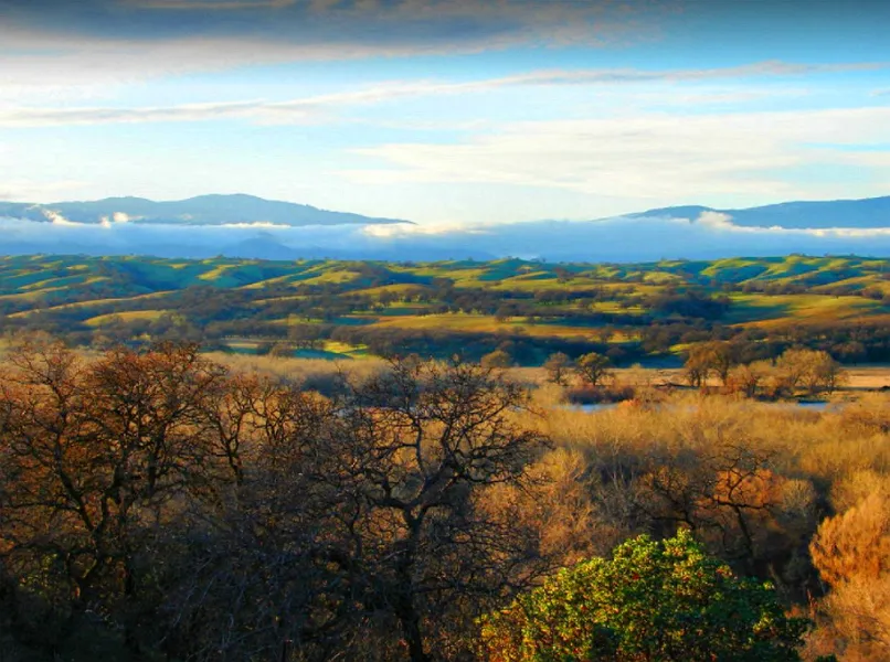
The photos 2, 4, 6, 8, 10, and 12 show the actual property and the surrounding lots. Photos 1, 3, 5, 7, 9, and 11 shows general area.
We have also included a County Parcel Map and an aerial Map to help you. The assessor's parcel number to the property in Tehama County is APN# 089-150-006-000
Here is a link (including the GPS coordinates) to view the location of the property on Google Maps:
39.837409,-122.248043
(You may have to copy and paste this to use it.) Once the map pops up, simply use the zoom tool on the left side of that screen to view the map in more detail. You can even view an aerial photo by clicking on the Satellite tab in the upper right portion of that screen.
All information we have on this property is disclosed within the content of the listing page. Any and all other information on this property should be directed toward the city or county of which the property is located in. Your due diligence should be performed, to ensure the property meets your needs and criteria.
From elevation to risk assessment
Search for detailed parcel information including; Elevation & Vegetation Maps, Ownership Information, Detailed Parcel Information, Crop History Map, Soil Survey Productivity Data, and more.
Research Parcel InformationLand for Sale by Javier Prodiz
Tehama County Properties By Type
- Farms for Sale in Tehama County, California
- Ranches for Sale in Tehama County, California
- Undeveloped Land for Sale in Tehama County, California
- Residential Property for Sale in Tehama County, California
- Hunting Land for Sale in Tehama County, California
- Horse Property for Sale in Tehama County, California
- Riverfront Property for Sale in Tehama County, California
- Commercial Property for Sale in Tehama County, California
- Lakefront Property for Sale in Tehama County, California
- Recreational Property for Sale in Tehama County, California
- Timberland for Sale in Tehama County, California
- Beachfront Property for Sale in Tehama County, California
Properties for Sale Nearby Counties
Tehama County Properties By City
- Corning, California Land for Sale
- Cottonwood, California Land for Sale
- Flournoy, California Land for Sale
- Gerber, California Land for Sale
- Los Molinos, California Land for Sale
- Manton, California Land for Sale
- Mill Creek, California Land for Sale
- Mineral, California Land for Sale
- Paskenta, California Land for Sale
- Paynes Creek, California Land for Sale
- Proberta, California Land for Sale
- Red Bluff, California Land for Sale
- More
- Tehama, California Land for Sale
- Vina, California Land for Sale
- Dairyville, California Land for Sale
- Alford Place, California Land for Sale
- Avery Place, California Land for Sale
- Banfield Place, California Land for Sale
- Bayles Place, California Land for Sale
- Beegum, California Land for Sale
- Bend, California Land for Sale
- Black Forest, California Land for Sale
- Blunt, California Land for Sale
- Bollinger Place, California Land for Sale
- Brown Place, California Land for Sale
- Campbellville, California Land for Sale
- Childs Meadows, California Land for Sale
- Cold Fork, California Land for Sale
- Copeland, California Land for Sale
- Copple Place, California Land for Sale
- Dales, California Land for Sale
- Dantuma Place, California Land for Sale
- Dawson Place, California Land for Sale
- Deer Creek, California Land for Sale
- El Camino, California Land for Sale
- Facht Place, California Land for Sale
- Favinger Place, California Land for Sale
- Finley Place, California Land for Sale
- Fowler Place, California Land for Sale
- Gilliam Place, California Land for Sale
- Griffin Place, California Land for Sale
- Hammer Place, California Land for Sale
- Haven Place, California Land for Sale
- Henleyville, California Land for Sale
- Hercraff Place, California Land for Sale
- Hooker, California Land for Sale
- Houghton Place, California Land for Sale
- Kiska, California Land for Sale
- Lowrey, California Land for Sale
- Lyman Springs, California Land for Sale
- Lyonsville, California Land for Sale
- Marian Place, California Land for Sale
- Mary Ellen Place, California Land for Sale
- McCartney Place, California Land for Sale
- McKenzie Place, California Land for Sale
- Merrills Landing, California Land for Sale
- Meyers Place, California Land for Sale
- Mitchell Place, California Land for Sale
- Montgomery Place, California Land for Sale
- Morgan Springs, California Land for Sale
- Pape Place, California Land for Sale
- Payne Place, California Land for Sale
- Peligreen Place, California Land for Sale
- Pellow Place, California Land for Sale
- Pete Hoff Place, California Land for Sale
- Peterson Place, California Land for Sale
- Pettyjohn Place, California Land for Sale
- Polk Springs, California Land for Sale
- Rancho Tehama Reserve, California Land for Sale
- Rawson, California Land for Sale
- Red Bank, California Land for Sale
- Richfield, California Land for Sale
- Roberts Place, California Land for Sale
- Saint Bernard, California Land for Sale
- Saunders Place, California Land for Sale
- Savercool Place, California Land for Sale
- Shackleford Place, California Land for Sale
- Skinner Mill Place, California Land for Sale
- Squaw Hill, California Land for Sale
- Steuben Place, California Land for Sale
- Swain Place, California Land for Sale
- Thompson Place, California Land for Sale
- Wade Place, California Land for Sale
- Watson, California Land for Sale
- Wells Place, California Land for Sale
- Whitlock Place, California Land for Sale
- Wilder Place, California Land for Sale
- Yellowjacket, California Land for Sale