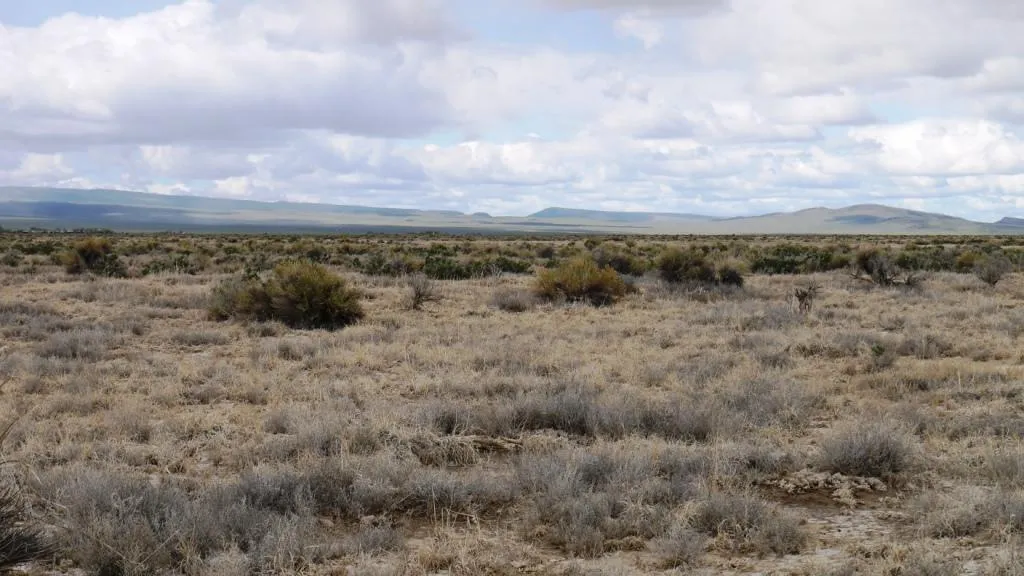
10 Acres outside Crescent Valley
Peaceful 10 acre parcel less than five miles east of Crescent Valley right at the base of the mountains. Accessible by several good dirt roads and a 2 track road. Great spot for your hunting base camp.
Crescent Valley
Crescent Valley is an unincorporated community located along the western border of Eureka County, less than 20 miles south of Interstate 80. The community was developed to provide housing for workers in the area mines and has continued to go throughout the years. With affordable housing, Crescent Valley is the preferred place to live vs busing in from the northern towns. For recreation near town, the dirt hills and ditches on the outskirts of Crescent Valley are the perfect terrain to enjoy dirt biking and ATV riding.
Eureka County
Located in north central Nevada, Eureka County is one of the least populated counties in the state. The entire county is composed of just three towns, Eureka, Beowawe, and Crescent Valley. With elevations ranging from 4000-10631 feet the air is clean and the views are spectacular. Mild temperatures, along with the surrounding mountains and the Humboldt River, make Eureka County an outdoor playground. The outdoor enthusiast will never lack for activity. Hunting, fishing, hiking, swimming and much more are all readily available.
Land Information:
Size: 10 Acres
Dimensions: 660 X 660
APN: 005-500-08
Legal: T29N R49E S7 NW1/4 SE1/4 NE1/4
GPS: Approximate GPS Coordinates
40.400409, -116.486063 (NW Corner)
40.400404, -116.483703 (NE Corner)
40.398597, -116.483673 (SE Corner)
40.398591, -116.486063 (SW Corner)
Plat map, and larger high resolution pictures available - please inquire.
Owner financing available, please inquire. No Credit Checks, Everyone Qualifies. We accept all major credit cards.
Closing and document preparation fee: $199
C-2015005-AAT
Center of lot: 40.399495, -116.484867
From elevation to risk assessment
Search for detailed parcel information including; Elevation & Vegetation Maps, Ownership Information, Detailed Parcel Information, Crop History Map, Soil Survey Productivity Data, and more.
Research Parcel InformationEnvironmental Factors
Boise, ID
Land for Sale by Government Land Sales
Eureka County Properties By Type
- Hunting Land for Sale in Eureka County, Nevada
- Residential Property for Sale in Eureka County, Nevada
- Recreational Property for Sale in Eureka County, Nevada
- Undeveloped Land for Sale in Eureka County, Nevada
- Ranches for Sale in Eureka County, Nevada
- Farms for Sale in Eureka County, Nevada
- Commercial Property for Sale in Eureka County, Nevada
- Horse Property for Sale in Eureka County, Nevada
- Lakefront Property for Sale in Eureka County, Nevada
- Beachfront Property for Sale in Eureka County, Nevada
- Riverfront Property for Sale in Eureka County, Nevada
- Timberland for Sale in Eureka County, Nevada
Properties for Sale Nearby Counties
Eureka County Properties By City
- Crescent Valley, Nevada Land for Sale
- Eureka, Nevada Land for Sale
- Beowawe, Nevada Land for Sale
- Dunphy, Nevada Land for Sale
- Alpha, Nevada Land for Sale
- Barth, Nevada Land for Sale
- Blackburn, Nevada Land for Sale
- Buckhorn, Nevada Land for Sale
- Cluro, Nevada Land for Sale
- Corwin, Nevada Land for Sale
- Eunice Place, Nevada Land for Sale
- Harney, Nevada Land for Sale
- More