Salmon River Estates - Elk Bend
Salmon River Estates Unit 2 property south of Salmon in Elk Bend. Has power, water, and sewer available. Great lot to build a cabin or just vacation. Steps to the Salmon River where you will enjoy world class fishing. You will find this location is central to most anything you decide to do in the area.
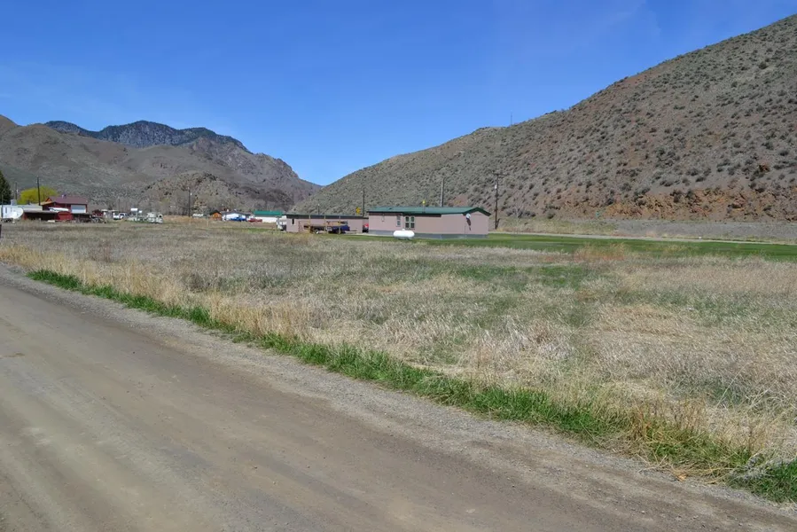
Elk Bend
A small rural residential community located on the Salmon River about 20 miles south of Salmon, Idaho. Originally established in the late 1960's as a retirement and recreation community, development didn't begin in earnest until the early 2000's. Elk Bend has a local RV park/store, and the Sportsman Lodge and Bar. Additional services can be found in nearby Salmon.
Salmon
Salmon, Idaho is located on the Salmon River in central Idaho at the foot of the Beaverhead mountain range. The birthplace of Sacagawea, this small central Idaho mountain town of around 3,200 residents is a sportsman's paradise. This all season destination is one the most scenic areas in all of Idaho. Known worldwide as the White Water Capital of the World additional summer activities include golfing, fishing, hunting, hiking, and horseback riding. There is no break when the weather changes, just a transition to skiing (downhill and cross country), snowmobiling and even ice skating.
Salmon is home to one of the largest mountain festivals in Idaho: Salmon River Days. Held over 4th of July weekend, this festival draws visitors from around the region for parades, fireworks, boat races, and much more. Perfectly situated for day trips to the mountains, lakes, hot springs, ghost towns and more, Salmon has it all.
Land Information:
Size: .135 Acres
Dimensions: 52' X 113'
APN: RP000750020300
Legal: Salmon River Estates Unit 2 Block 2 Lot 30
GPS: Approximate GPS Coordinates
44.910759, -113.964601 (NW Corner)
44.910921, -113.964233 (NE Corner)
44.910811, -113.964128 (SE Corner)
44.910642, -113.964493 (SW Corner)
Plat map, and larger high resolution pictures available.
Owner financing available, please inquire. No credit checks, everyone qualifies. We accept all major credit cards. All cash offers considered.
Document preparation fee: $199
C-2019018-ETFH
From elevation to risk assessment
Search for detailed parcel information including; Elevation & Vegetation Maps, Ownership Information, Detailed Parcel Information, Crop History Map, Soil Survey Productivity Data, and more.
Research Parcel InformationEnvironmental Factors
Boise, ID
Land for Sale by Government Land Sales
Lemhi County Properties By Type
- Residential Property for Sale in Lemhi County, Idaho
- Riverfront Property for Sale in Lemhi County, Idaho
- Ranches for Sale in Lemhi County, Idaho
- Undeveloped Land for Sale in Lemhi County, Idaho
- Lakefront Property for Sale in Lemhi County, Idaho
- Hunting Land for Sale in Lemhi County, Idaho
- Commercial Property for Sale in Lemhi County, Idaho
- Farms for Sale in Lemhi County, Idaho
- Recreational Property for Sale in Lemhi County, Idaho
- Horse Property for Sale in Lemhi County, Idaho
- Timberland for Sale in Lemhi County, Idaho
- Beachfront Property for Sale in Lemhi County, Idaho
Properties for Sale Nearby Counties
Lemhi County Properties By City
- Carmen, Idaho Land for Sale
- Cobalt, Idaho Land for Sale
- Gibbonsville, Idaho Land for Sale
- Leadore, Idaho Land for Sale
- Lemhi, Idaho Land for Sale
- May, Idaho Land for Sale
- North Fork, Idaho Land for Sale
- Salmon, Idaho Land for Sale
- Shoup, Idaho Land for Sale
- Tendoy, Idaho Land for Sale
- Baker, Idaho Land for Sale
- Elk Bend, Idaho Land for Sale
- More