153.83 acres in Phelps County, Nebraska
153.83 Acres - Pivot Irrigated Cropland - Phelps County, Nebraska
- High quality pivot irrigated cropland
- Productive soils in excellent area
- Price: $2,077,000
Location: Next to the Phelps/Kearney County line at the corner of 736 Rd. and 20 Rd. From Funk, 3 miles east on Highway 6 & 34 and 1 3/4 miles north on 20 Rd. From west edge of Axtell, 1 mile north on 22 Rd. and 2 miles west on L Rd.
Legal Description: Part Southeast Quarter of Section 12, Township 6 North, Range 17 West of the 6th P.M., Phelps County, Nebraska
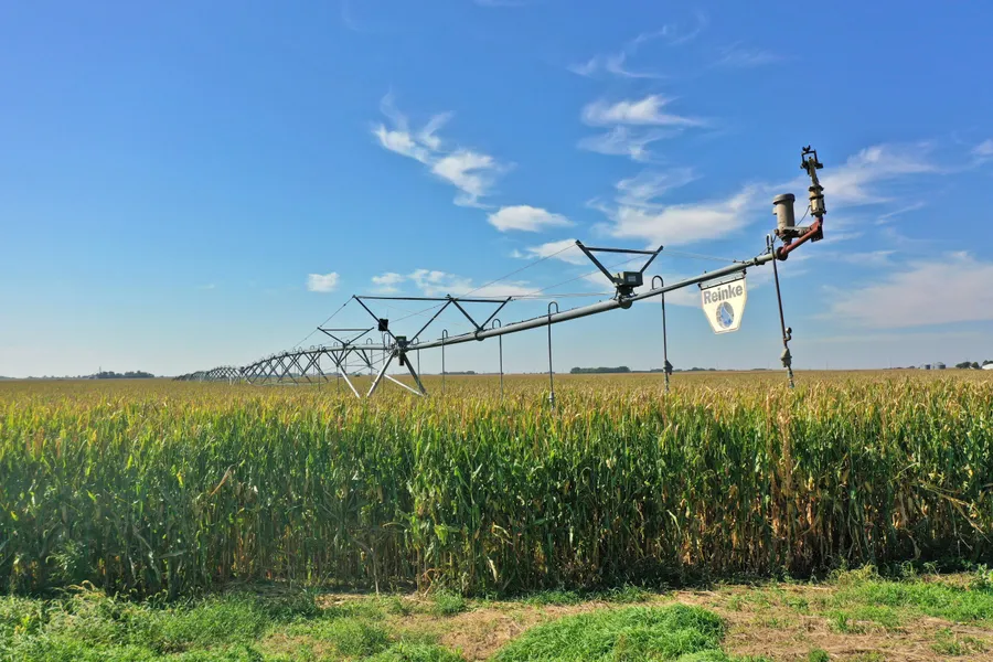
About the Land: 153.83 Acres, more or less, according to Phelps County Assessors records. Consisting of highly productive irrigated cropland with Class 1 rated Holdrege silt loam soils and a home/building site. Pivot irrigated cropland with all 4 corners gravity irrigated. Includes a Reinke 7 tower pivot system new in 2007, irrigation well with electric submersible pump, 2 canal pumps (one w/elec. motor) and irrigation pipe for the corners. In addition the farm has 144 acres of CNPPID canal water. The farm is setup to facilitate water from the well and/or CNPPID water to the pivot. The building site includes a 2 bedroom home with central air & heat and partial basement, a 60ft. X 30ft. Quonset type building with concrete floor and two older grain bins with some damage.
Farm Service Agency: Corn base 71.66 acres, Soybeans base 71.04 acres
Natural Resources District: The land is located in the Tri-Basin NRD and has certified irrigation rights for 145.2 acres.
Well Data: (per Holdrege Irrigation) G-035027, June 1971, 2015 electric submersible pump was installed, 156ft. deep, 22ft. static water level, 40ft. pumping level, 100ft. of PVC 8 pipe, 40HP, setup to pump 850GPM at 39 PSI
Soil Types: 100% Holdrege silt loam
2024 Taxes: $ 8,064.88
Price: $ 2,077,000
10% Earnest money payment on signing of purchase contract, remainder at closing. Full possession for 2026 crop season.
From elevation to risk assessment
Search for detailed parcel information including; Elevation & Vegetation Maps, Ownership Information, Detailed Parcel Information, Crop History Map, Soil Survey Productivity Data, and more.
Research Parcel InformationDirections
Location: Next to the Phelps/Kearney County line at the corner of 736 Rd. and 20 Rd. From Funk, 3 miles east on Highway 6 & 34 and 1 3/4 miles north on 20 Rd. From west edge of Axtell, 1 mile north on 22 Rd. and 2 miles west on L Rd.
Resources
Land for Sale by Luke Huddleston
Phelps County Properties By Type
- Farms for Sale in Phelps County, Nebraska
- Ranches for Sale in Phelps County, Nebraska
- Recreational Property for Sale in Phelps County, Nebraska
- Hunting Land for Sale in Phelps County, Nebraska
- Undeveloped Land for Sale in Phelps County, Nebraska
- Commercial Property for Sale in Phelps County, Nebraska
- Residential Property for Sale in Phelps County, Nebraska
- Horse Property for Sale in Phelps County, Nebraska
- Lakefront Property for Sale in Phelps County, Nebraska
- Beachfront Property for Sale in Phelps County, Nebraska
- Riverfront Property for Sale in Phelps County, Nebraska
- Timberland for Sale in Phelps County, Nebraska