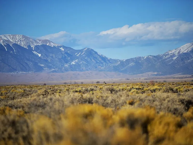
Mt Blanca & Sand Dunes Views!- 5 acres Alamosa, CO
Description
Adventure awaits! 5 acres near the Great Sand Dunes National Park! Good Access to build your Vacation cabin or just a place to escape the city! Only 22 minutes to Alamosa and the new Drive thru Starbucks and Walmart.....!!
The Great Sand Dunes National Park is just a short drive away and offers a seasonal Medano Creek/beach created at the base of the dunes.
- Trails from the Sand Dunes lead to forests, wetlands and alpine lakes like Medano Lake, which is home to trout and tundra wildlife.
- Take a hike to Zapata Falls or spend the day sand boarding the dunes! The dunes are constantly changing, which gives you endless opportunities for photos!
- If you have down payment of $199, we will owner finance. Pre Approved. Spend your time on this rare Gem in Southern Colorado!
- NO Covenants or HOA Fees.
- Unlimited Hiking, fishing and outdoor sports
- 13.7 miles to ALAMOSA (Walmart, Hospital, Starbucks, College)
- 22.3 miles to Great Sand Dunes National Park
$199 DOWN/$135 PER MONTH-FINANCE TERMS-INSTANT APPROVAL/NO CREDIT CHECKS-
Interest Rate 0%
Loan Term: 50 months
Monthly Payment $135 (plus a $15 note servicing fee and yearly taxes)
Document Fee: $249
OR
PAY IN FULL CASH DISCOUNT-$3,950
Purchase Price $3,950
Document Fee: $249
LAND DETAILS
- Parcel APN: 528118305024
- INT#20-004
- Address: TBD 4th St/Grant Ave, Alamosa, CO 81101
- Terrain- Flat with various shrubbery.
- Road Access: Dirt Road
- Size: 4.94 acres
- Zoning: Vacant/Estate Residential
- UTILITIES: Off Grid- most houses in area are on solar Solar, need well or water haul, need septic or tank
- Zoning Definition: Build or Camping allowed limited part of the year. Please contact county to confirm use or restrictions.
- YEARLY TAXES: $65 Approx
From elevation to risk assessment
Search for detailed parcel information including; Elevation & Vegetation Maps, Ownership Information, Detailed Parcel Information, Crop History Map, Soil Survey Productivity Data, and more.
Research Parcel InformationDirections
WANT TO VISIT? Approximate Corner Coordinates:
NW 37.530621, -105.69533
NW 37.530204, -105.695866
NE 37.530642, -105.694729
SE 37.529068, -105.694654
SW 37.52906, -105.695807
Environmental Factors
Resources
Alamosa County Properties By Type
- Undeveloped Land for Sale in Alamosa County, Colorado
- Riverfront Property for Sale in Alamosa County, Colorado
- Lakefront Property for Sale in Alamosa County, Colorado
- Ranches for Sale in Alamosa County, Colorado
- Farms for Sale in Alamosa County, Colorado
- Recreational Property for Sale in Alamosa County, Colorado
- Residential Property for Sale in Alamosa County, Colorado
- Hunting Land for Sale in Alamosa County, Colorado
- Commercial Property for Sale in Alamosa County, Colorado
- Horse Property for Sale in Alamosa County, Colorado
- Timberland for Sale in Alamosa County, Colorado
- Beachfront Property for Sale in Alamosa County, Colorado