0.35 Acre in Mount Vernon, Texas
Owner Financing Available - This 0.35 acre lot is located in Mount Vernon, Texas and the address is Hunters Hollow Drive, Mount Vernon, TX 75457.
Mount Vernon is a small town located in the northeastern part of the state of Texas, in the United States. It is situated in Franklin County, about 100 miles northeast of Dallas, and has a population of approximately 2,700 people.
Mount Vernon offers outdoor recreational opportunities for visitors and residents. The town is situated near several lakes, including Lake Cypress Springs, Lake Bob Sandlin, and Lake Monticello, which offer fishing, boating, and other water sports. The area also has several parks and nature trails for hiking and picnicking. Amenities in Tall Tree are, clubhouse, tennis courts, basketball court, swimming pool, and boat ramp.
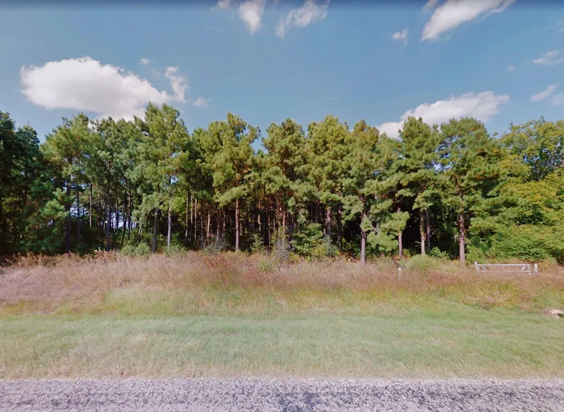
Features: Mostly cleared out, Close to Lake Cypress Springs
Only $300 Down and $250/month for 56 months = $14300 or Discounted Cash Price: $11500
PROPERTY DETAILS
APN: 4192
Address: Hunters Hollow Drive, Mount Vernon, TX 75457
County: Franklin
State: Texas
Size: 0.35 Acre
Dimensions: 138' x 110' x 138' x 113'
Legal: AB 60 J BLAIRLT 16 BLK 13 SEC 3 TALL TREE
Terrain: Flat
Access: Dirt Road
Power: Power in the Area (Power Company: Ambit Energy: 972-522-8226 )
Water: Water in the Area (West Harrison Water Supply Corporation: 903-668-2450) (Well: KWS Keithville Water Service: 318-900-9355) (Water Haul: Cypress Springs Special Utility District: 903-588-2081)
Sewer: Sewer or Septic in the Area (Septic: Quality Contracting: 903-537-4702)
Taxes per Year: $42
HOA Fees per Year: $325 Annual / $ Transfer
GPS Coordinates (center) at the road: 33.073683, -95.174768
--- Northwest Corner: 33.073835, -95.174981
--- Northeast Corner: 33.073844, -95.174532
--- Southwest Corner: 33.073537, -95.174996
--- Southeast Corner: 33.073536, -95.174546
Elevation: 422
BUILDING INFORMATION
Zoning: TX-Franklin-Mount-Vernon-Tall-Tree-Residential-North-2
Time Limit to Build: No time limit to build
Site Built Homes Allowed: Allowed 450 sq ft min
Modular Homes Allowed: Allowed
Manufactured Homes Allowed: Allowed
Mobile Homes Allowed: Allowed
Tiny Homes Friendly: Allowed
ALLOWABLE USES
Full-Time RV Living Allowed: Not Allowed
RV on the Property While I build: Allowed with a permit
Camping in a RV Allowed: Allowed with a permit
From elevation to risk assessment
Search for detailed parcel information including; Elevation & Vegetation Maps, Ownership Information, Detailed Parcel Information, Crop History Map, Soil Survey Productivity Data, and more.
Research Parcel InformationDirections
From 590 TX-37
Mt Vernon, TX 75457, USA
1.Head north on TX-37 N
2.Turn right onto FM 21 S
3.Turn right onto FM 2723
4.Turn right to stay on FM 2723
5.Turn right onto Red Oak Dr
6.Turn right onto Winding Ln
7.Turn right onto Hunters Hollow Dr
8.Lot is on the right
Resources
Land for Sale by Benjamin Davis
Franklin County Properties By Type
- Ranches for Sale in Franklin County, Texas
- Farms for Sale in Franklin County, Texas
- Hunting Land for Sale in Franklin County, Texas
- Residential Property for Sale in Franklin County, Texas
- Lakefront Property for Sale in Franklin County, Texas
- Undeveloped Land for Sale in Franklin County, Texas
- Recreational Property for Sale in Franklin County, Texas
- Riverfront Property for Sale in Franklin County, Texas
- Beachfront Property for Sale in Franklin County, Texas
- Timberland for Sale in Franklin County, Texas
- Horse Property for Sale in Franklin County, Texas
- Commercial Property for Sale in Franklin County, Texas