Land & Liberty on 10 Acres in Navajo County, AZ! $279.00/Mo
Description
Congratulations! You're officially approved for seller financing on this prime lot in Navajo County, Arizona. Yes, you can own a whopping 10-acre spread of lush land for as little as $279.00 a month - no credit checks needed!
Its a winning investment opportunity right here in Navajo County, AZ! A magnificent 10-acre lot available for you to grow your portfolio, or develop for some other lucrative endeavor. Do you want a location suitable for ATV riding, Dirt biking, and RV parking? Then this is the perfect lot for you. Just 19 minutes from Cholla Lake where you can fish and frolic the time away. Hone in on the spaciousness and seclusion with no HOA or neighbors to get in your way. Are you a classic or contemporary person? It doesnt matter because you can build whatever you envision.
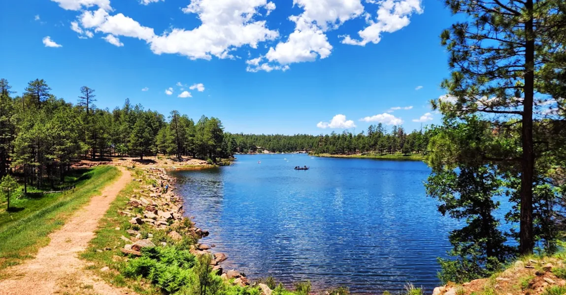
Then, plan a trip to any of the numerous wonders that surround you! Like the Sitgreaves National Forest (as pictured in gallery) for camping and chanced encounters with wildlife. Whenever you need some extra hiking fun and adventures, visit the Petrified Forest National Park (also in gallery) and many more fabulous sites. Handle shopping and anything else you need at the proximate commercial hub, Joseph City. Dont miss out on what could be your best decision yet!
Whats a better venture than owning your piece of paradise? If you're ready to grow, then come check this out! Message now and lets seal this deal today!
Property Details
Property Address: Joseph City Unified District, AZ, USA 86032 (approximate)
Property APN: 104-39-001E
Property Size: 10.00 Acres
Terrain: Slightly Sloped, Desert
Access: Dirt
Conveyance: WARRANTY DEED
HOA Fees: None in the area.
Taxes: Approximately $27.80 per year
Terms:
Cash Price: $14,999.00 plus $249 doc fee.
Owner Financing: $150 down plus $249 document fee and $279 for 60 months
GPS Coordinates (approximate):
Center 351'46.24"N,11022'20.06"W
SE 351'42.97"N,11022'16.03"W
SW 351'42.93"N,11022'23.96"W
NW 351'49.47"N,11022'23.99"W
NE 351'49.5"N,11022'16.06"W
From elevation to risk assessment
Search for detailed parcel information including; Elevation & Vegetation Maps, Ownership Information, Detailed Parcel Information, Crop History Map, Soil Survey Productivity Data, and more.
Research Parcel InformationDirections
Holbrook
Arizona 86025, USA
Continue to E Hopi Dr
31 sec (427 ft)
Head east toward 1st St
230 ft
Turn right at the 1st cross street onto 1st St
197 ft
Take I-40 W/US-180 W to I-40BUS in Joseph City. Take exit 277 from I-40 W/US-180 W
11 min (9.8 mi)
Turn right at the 1st cross street onto E Hopi Dr
1.7 mi
Turn left to merge onto I-40 W/US-180 W toward Flagstaff
7.8 mi
Take exit 277 toward I-40/Joseph City
0.3 mi
Follow I-40BUS to N Porter Rd
13 min (7.2 mi)
Turn right onto I-40BUS
1.7 mi
Continue straight onto I-40BUS/Main St
0.2 mi
Turn right toward N Porter Rd
220 ft
Continue onto N Porter Rd
5.3 mi
Joseph City Unified District
Arizona, USA
Environmental Factors
Navajo County Properties By Type
- Undeveloped Land for Sale in Navajo County, Arizona
- Residential Property for Sale in Navajo County, Arizona
- Farms for Sale in Navajo County, Arizona
- Ranches for Sale in Navajo County, Arizona
- Lakefront Property for Sale in Navajo County, Arizona
- Recreational Property for Sale in Navajo County, Arizona
- Riverfront Property for Sale in Navajo County, Arizona
- Timberland for Sale in Navajo County, Arizona
- Hunting Land for Sale in Navajo County, Arizona
- Horse Property for Sale in Navajo County, Arizona
- Commercial Property for Sale in Navajo County, Arizona
- Beachfront Property for Sale in Navajo County, Arizona
Properties for Sale Nearby Counties
Navajo County Properties By City
- Blue Gap, Arizona Land for Sale
- Cibecue, Arizona Land for Sale
- Clay Springs, Arizona Land for Sale
- Fort Apache, Arizona Land for Sale
- Heber, Arizona Land for Sale
- Holbrook, Arizona Land for Sale
- Hotevilla, Arizona Land for Sale
- Indian Wells, Arizona Land for Sale
- Joseph City, Arizona Land for Sale
- Kayenta, Arizona Land for Sale
- Keams Canyon, Arizona Land for Sale
- Kykotsmovi Village, Arizona Land for Sale
- More
- Lakeside, Arizona Land for Sale
- Overgaard, Arizona Land for Sale
- Pinedale, Arizona Land for Sale
- Pinetop, Arizona Land for Sale
- Pinon, Arizona Land for Sale
- Polacca, Arizona Land for Sale
- Second Mesa, Arizona Land for Sale
- Shonto, Arizona Land for Sale
- Show Low, Arizona Land for Sale
- Snowflake, Arizona Land for Sale
- Sun Valley, Arizona Land for Sale
- Taylor, Arizona Land for Sale
- Whiteriver, Arizona Land for Sale
- Winslow, Arizona Land for Sale
- Woodruff, Arizona Land for Sale
- Dilkon, Arizona Land for Sale
- Kykotsmovi, Arizona Land for Sale
- Low Mountain, Arizona Land for Sale
- Shumway, Arizona Land for Sale
- Smoke Signal, Arizona Land for Sale
- Aponi-vi, Arizona Land for Sale
- Aripine, Arizona Land for Sale
- Arntz, Arizona Land for Sale
- Baby Rocks, Arizona Land for Sale
- Bacavi, Arizona Land for Sale
- Bell, Arizona Land for Sale
- Betatakin Overlook, Arizona Land for Sale
- Bidahochi, Arizona Land for Sale
- Burton, Arizona Land for Sale
- Bushman Acres, Arizona Land for Sale
- Carrizo, Arizona Land for Sale
- Castle Butte, Arizona Land for Sale
- Cedar Springs, Arizona Land for Sale
- Chakpahu, Arizona Land for Sale
- Chilchinbito, Arizona Land for Sale
- Cibecue Creek, Arizona Land for Sale
- Clearview Heights, Arizona Land for Sale
- East Fork, Arizona Land for Sale
- First Mesa, Arizona Land for Sale
- Goodwater, Arizona Land for Sale
- Grasshopper, Arizona Land for Sale
- Hano, Arizona Land for Sale
- Hard Rocks, Arizona Land for Sale
- Headquarters, Arizona Land for Sale
- Hibbard, Arizona Land for Sale
- Hotevilla-Bacavi, Arizona Land for Sale
- Huk Ovi, Arizona Land for Sale
- Indian Pine, Arizona Land for Sale
- Jeddito, Arizona Land for Sale
- Kawaika-A, Arizona Land for Sale
- Kokopnyama, Arizona Land for Sale
- Lake of the Woods, Arizona Land for Sale
- Linden, Arizona Land for Sale
- Mahtson-pi, Arizona Land for Sale
- Manila, Arizona Land for Sale
- Mishongnovi, Arizona Land for Sale
- Mumurva, Arizona Land for Sale
- Na Ah Tee, Arizona Land for Sale
- Navajo Gospel Mission, Arizona Land for Sale
- Nesuftanga, Arizona Land for Sale
- Oraibi, Arizona Land for Sale
- Penzance, Arizona Land for Sale
- Pinetop-Lakeside, Arizona Land for Sale
- Pink Arrow, Arizona Land for Sale
- Pivahn-hon-kya-pi, Arizona Land for Sale
- Robinson Trail Crossing, Arizona Land for Sale
- Rosedale Heights, Arizona Land for Sale
- Roundy Crossing, Arizona Land for Sale
- Schoens Crossing, Arizona Land for Sale
- Seba Dalkai, Arizona Land for Sale
- Sevenmile, Arizona Land for Sale
- Shongopovi, Arizona Land for Sale
- Shungopavi, Arizona Land for Sale
- Sichomovi, Arizona Land for Sale
- Silver Creek, Arizona Land for Sale
- Sipaulovi, Arizona Land for Sale
- Sponseller, Arizona Land for Sale
- Tees Toh, Arizona Land for Sale
- Tewa, Arizona Land for Sale
- Toreva, Arizona Land for Sale
- Tsegi, Arizona Land for Sale
- Twin Buttes, Arizona Land for Sale
- Ubank Place, Arizona Land for Sale
- Walpi, Arizona Land for Sale
- Wepo Village, Arizona Land for Sale
- West Winslow, Arizona Land for Sale
- White Cone, Arizona Land for Sale
- Zeniff, Arizona Land for Sale