1.25 Ac Mohave AZ $100/Mo July 4 Deal
Tired of nosy neighbors, traffic jams, and overpriced coffee? Escape the chaos and claim your 1.25-acre slice of peace in Mohave County, Arizona where the only thing honking is maybe a passing jackrabbit.
Nestled between 3,269 and 3,295 feet in elevation, this gem of desert land gives you panoramic views so wide you might just spot tomorrow. Whether you're dreaming of a quirky off-grid cabin, a weekend RV escape, or just want to brag that you own land in the desert, this spots got you covered. With its sloped terrain and iconic views, its like your personal Arizona postcard, except its real, and its yours.
Getting there? Easy! A county-maintained dirt easement leads the way, and with nearby access to US HWY-93 and Route 66, you're just a scenic drive from Las Vegas, Phoenix, Tucson, or even a spontaneous road trip to L.A. (because why not?).
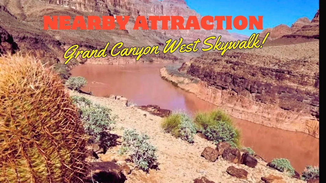
Spend your days chasing desert sunrises, hiking the Grand Canyon West Skywalk, or getting your kicks on Route 66 in historic Kingman. And when night fall? Its you, the stars, and the sky so clear it'll make your Wi-Fi feel irrelevant.
Oh, and did we mention its only $100/month with owner financing? That's cheaper than your monthly coffee habit. So, if you're ready to go from "meh" to Mohave magic, don't wait, this desert is ready for its next wild-hearted owner (that's you).
PAYMENT INFO:
Cash Price: $3,500
Owner Financing Terms: $100 Monthly For 40 Months
Down Payment: $100
Doc Fee: $250
PROPERTY INFO:
County: Mohave
State: Arizona
Size: 1.25
APN: 338-11-245
COORDINATE
Center: 3557'42.7"N,1141'24.15"W
NW: 3557'43.51"N,1141'26.17"W
NE: 3557'43.51"N,1141'22.16"W
SE: 3557'41.88"N,1141'22.16"W
SW: 3557'41.88"N,1141'26.17"W
COUNTY INFO:
Zoning: Recreational Residential
Camping: Tent camping is not allowed but RV camping is allowed for up to two weeks at a time, but no more than 30 calendar days in a year.
RVs: RVs are allowed. One could camp with an RV for up to two weeks at a time, but no more than 30 calendar days in a year. If one wanted to live in their RV or stay longer than the previously identified time they will need to obtain a Temporary Residence Permit.
Mobile Home: Mobile homes are allowed. It will need to be manufactured after June 15, 1976, be installed by a licensed installer, have a verifiable HUD date plate, and have state-approved skirting within 90 days of installation.
Water: Need to build a well or haul water
Sewer/Septic: Septic
Electric: Solar, wind, or generator
Gas: No natural gas. LP, diesel, or tank.
From elevation to risk assessment
Search for detailed parcel information including; Elevation & Vegetation Maps, Ownership Information, Detailed Parcel Information, Crop History Map, Soil Survey Productivity Data, and more.
Research Parcel InformationDirections
1. From Salt Lake City, Utah
Take I-15 S out of Salt Lake City
Continue on I-15 S for approximately 330 miles
Take exit 64 for US-93 S toward Pioche/Ely
Follow US-93 S for about 100 miles
Merge onto I-11 S/US-93 S toward Boulder City
Take US-93 S to AZ-68 E
Turn left onto E McConnico Rd
Follow the road until you reach the area of
3557'42.7"N, 1141'24.15"W
2. From Denver, Colorado
Take I-70 W from Denver
Merge onto US-191 S via exit 182 toward Moab
Take US-160 W toward Kayenta
Merge onto AZ-95 S
Continue on AZ-68 W toward Kingman
Head southwest on E McConnico Rd
Arrive at
3557'42.7"N, 1141'24.15"W
3. From San Diego, California
Take I-15 N from San Diego
Merge onto I-215 N
Continue on I-15 N through Las Vegas
Merge onto I-11 S/US-93 S toward Boulder City
Cross the Hoover Dam into Arizona
Take the exit for AZ-68 E
Head toward McConnico
Turn onto E McConnico Rd and continue to
3557'42.7"N, 1141'24.15"W
4. From Albuquerque, New Mexico
Take I-40 W out of Albuquerque
Drive for approximately 430 miles
Take exit 71 toward Stockton Hill Rd
Head north on Stockton Hill Rd
Turn left onto E McConnico Rd
Continue straight to
3557'42.7"N, 1141'24.15"W
5. From Portland, Oregon
Take I-5 S toward Sacramento
Merge onto US-395 S toward Reno
Take I-80 E briefly, then US-95 S through Tonopah
Continue on US-95 S into Las Vegas
Merge onto I-11 S/US-93 S
Exit onto AZ-68 E
Drive east and turn onto E McConnico Rd until you reach
3557'42.7"N, 1141'24.15"W
Hudson, WI
Land for Sale by Kevin Cameron
Mohave County Properties By Type
- Undeveloped Land for Sale in Mohave County, Arizona
- Residential Property for Sale in Mohave County, Arizona
- Farms for Sale in Mohave County, Arizona
- Ranches for Sale in Mohave County, Arizona
- Commercial Property for Sale in Mohave County, Arizona
- Recreational Property for Sale in Mohave County, Arizona
- Lakefront Property for Sale in Mohave County, Arizona
- Riverfront Property for Sale in Mohave County, Arizona
- Horse Property for Sale in Mohave County, Arizona
- Hunting Land for Sale in Mohave County, Arizona
- Beachfront Property for Sale in Mohave County, Arizona
- Timberland for Sale in Mohave County, Arizona
Properties for Sale Nearby Counties
- Clark County, Arizona Land for Sale
- Coconino County, Arizona Land for Sale
- Kane County, Arizona Land for Sale
- La Paz County, Arizona Land for Sale
- Lincoln County, Arizona Land for Sale
- San Bernardino County, Arizona Land for Sale
- Washington County, Arizona Land for Sale
- Yavapai County, Arizona Land for Sale
Mohave County Properties By City
- Bullhead City, Arizona Land for Sale
- Chloride, Arizona Land for Sale
- Colorado City, Arizona Land for Sale
- Dolan Springs, Arizona Land for Sale
- Golden Valley, Arizona Land for Sale
- Hackberry, Arizona Land for Sale
- Kingman, Arizona Land for Sale
- Lake Havasu City, Arizona Land for Sale
- Littlefield, Arizona Land for Sale
- Meadview, Arizona Land for Sale
- Mohave Valley, Arizona Land for Sale
- Oatman, Arizona Land for Sale
- More
- Peach Springs, Arizona Land for Sale
- Topock, Arizona Land for Sale
- Valentine, Arizona Land for Sale
- Wikieup, Arizona Land for Sale
- Yucca, Arizona Land for Sale
- Black Meadow Landing, Arizona Land for Sale
- Cane Beds, Arizona Land for Sale
- Grasshopper Junction, Arizona Land for Sale
- Moccasin, Arizona Land for Sale
- Truxton, Arizona Land for Sale
- White Hills, Arizona Land for Sale
- Antares, Arizona Land for Sale
- Arizona Village, Arizona Land for Sale
- Athos, Arizona Land for Sale
- Berry, Arizona Land for Sale
- Bonelli Landing, Arizona Land for Sale
- Booze Crossing, Arizona Land for Sale
- Butler, Arizona Land for Sale
- Catfish Paradise, Arizona Land for Sale
- Cedar, Arizona Land for Sale
- Cerbat, Arizona Land for Sale
- Crozier, Arizona Land for Sale
- Cyclopic, Arizona Land for Sale
- Davis Dam, Arizona Land for Sale
- Fivemile Landing, Arizona Land for Sale
- Franconia, Arizona Land for Sale
- Getz, Arizona Land for Sale
- Greenwood, Arizona Land for Sale
- Griffith, Arizona Land for Sale
- Harris, Arizona Land for Sale
- Haviland, Arizona Land for Sale
- Indian Moccasin, Arizona Land for Sale
- Jops Landing, Arizona Land for Sale
- Katherine, Arizona Land for Sale
- Larneds Landing, Arizona Land for Sale
- McConnico, Arizona Land for Sale
- Mesquite Creek, Arizona Land for Sale
- Mohave Crossing, Arizona Land for Sale
- Mount Trumbull, Arizona Land for Sale
- New Kingman, Arizona Land for Sale
- Oak Grove, Arizona Land for Sale
- Powell, Arizona Land for Sale
- Ray Place, Arizona Land for Sale
- Rock Crossing, Arizona Land for Sale
- Santa Claus, Arizona Land for Sale
- Signal, Arizona Land for Sale
- Six Mile Crossing, Arizona Land for Sale
- Sixmile Village, Arizona Land for Sale
- South Cove, Arizona Land for Sale
- Stockton, Arizona Land for Sale
- Tuweep, Arizona Land for Sale
- Walapai, Arizona Land for Sale
- Willow Valley, Arizona Land for Sale
- Willow Beach, Arizona Land for Sale
- Temple Bar Marina, Arizona Land for Sale
- Fort Mohave, Arizona Land for Sale
- Valle Vista, Arizona Land for Sale
- Valle Vista, Arizona Land for Sale