5.04-Acre Grand Escape in Costilla, CO OWNER FINANCED $169/Mo
Description
YOU'RE APPROVED FOR OWNER FINANCING - with no CREDIT CHECKS or PREPAYMENTS necessary! Just $150 down (+$249 doc fee) and $169 a month to claim!
Desperate to break away from the clustered city? This 5.04-acre escape in Costilla, Colorado is ideal in both its location and price claim it now for just $169 monthly. What's in store for you: outstanding sunrises and sunsets against the backdrop of the captivating mountains. Prime for your mainstay dwelling or cool-down cabin, wherever your imagination takes you! Build with peace of mind with requisite zoning stipulations and zero HOA overheads or fees in the area. Get away from the stress and strain with a restorative visit to any of the various local attractions just a short distance from the premises.
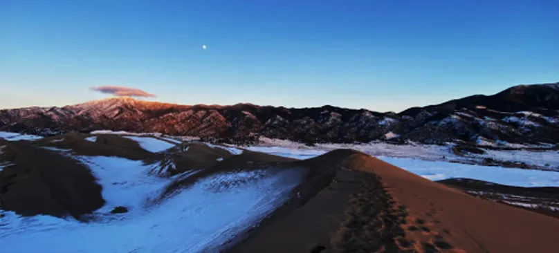
For a quick shopping run, the well-equipped and proximate town of Fort Garland is your friend. Mere minutes away from the comfort of your private space! With easy access via Ray Rd, you can head out on the nearest highways like CO-159 for ease of travel to the popular sights. The Great Sand Dunes (as pictured in gallery) are your ticket to thrilling ATV rides and seasonal creek/beach access at the base of the dunes. Don't miss this once-in-a-lifetime chance. Message or call now for more information.
Property Details:
Property Address: Centennial School District R-1, CO, USA, Mesita, Colorado 81152 (approximate)
Property APN: 71546230
Property Size: 5.04 Acres
Terrain: Flat, Plain, Desert
Access: Ray Rd
Conveyance: SPECIAL WARRANTY DEED
HOA Fees: None in the area.
Taxes: Approximately $72.28 per year
GPS Coordinates (approximate):
NW 379'13.68"N,10540'0.4"W
NE 379'13.68"N,10539'56.37"W
SW 379'7.04"N,10540'0.46"W
SE 379'7.02"N,10539'56.43"W
Terms:
Cash Price: $7,499.00 plus $249 doc fee.
Owner Financing: $150.00 down plus $249 document fee and $169 for 60 months
From elevation to risk assessment
Search for detailed parcel information including; Elevation & Vegetation Maps, Ownership Information, Detailed Parcel Information, Crop History Map, Soil Survey Productivity Data, and more.
Research Parcel InformationDirections
Fort Garland
Colorado, USA
Take Pfeiffer Ave to 4th Ave
40 sec (0.1 mi)
Head south toward 5th Ave
112 ft
Turn right at the 1st cross street onto 5th Ave
187 ft
Turn left at the 1st cross street onto Pfeiffer Ave
384 ft
Follow CO-159 S to County Rd P
21 min (20.5 mi)
Turn left at the 1st cross street onto 4th Ave
0.2 mi
Turn right onto CO-159 S/Miranda Ave
Continue to follow CO-159 S
20.2 mi
Turn right onto County Rd P
5 min (4.2 mi)
Continue onto CO-142 W
1 min (1.0 mi)
Continue on Rd 10. Take Nance Blvd to Ray Rd in San Acacio
10 min (6.2 mi)
Turn left onto Rd 10
2.0 mi
Turn right onto Rd M
1.5 mi
Continue onto Nance Blvd
2.3 mi
Turn left onto Ray Rd
0.4 mi
Centennial School District R-1
Colorado, USA
Environmental Factors
Costilla County Properties By Type
- Undeveloped Land for Sale in Costilla County, Colorado
- Residential Property for Sale in Costilla County, Colorado
- Riverfront Property for Sale in Costilla County, Colorado
- Lakefront Property for Sale in Costilla County, Colorado
- Ranches for Sale in Costilla County, Colorado
- Recreational Property for Sale in Costilla County, Colorado
- Farms for Sale in Costilla County, Colorado
- Hunting Land for Sale in Costilla County, Colorado
- Timberland for Sale in Costilla County, Colorado
- Horse Property for Sale in Costilla County, Colorado
- Commercial Property for Sale in Costilla County, Colorado
- Beachfront Property for Sale in Costilla County, Colorado
Properties for Sale Nearby Counties
Costilla County Properties By City
- Blanca, Colorado Land for Sale
- Chama, Colorado Land for Sale
- Fort Garland, Colorado Land for Sale
- Jaroso, Colorado Land for Sale
- San Luis, Colorado Land for Sale
- Garcia, Colorado Land for Sale
- Los Fuertes, Colorado Land for Sale
- Mesita, Colorado Land for Sale
- San Pablo, Colorado Land for Sale
- San Pedro, Colorado Land for Sale
- Eastdale, Colorado Land for Sale
- Fir, Colorado Land for Sale
- More