12.5 Acres on HWY 400 - Pershing County Nevada
Description
***See all of our listings by visiting us at governmentlandsales.us***
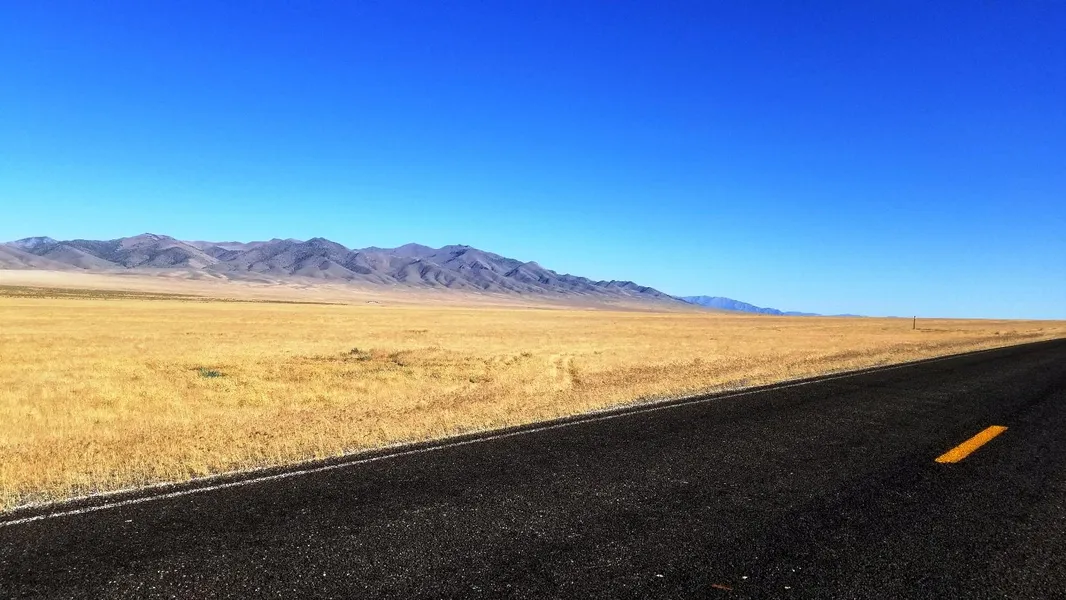
Great highway acreage in Nevada! This property lies 3.5 miles south of I-80 at Mill City directly on HWY 400. It is accessed by the paved highway and has great views in all directions. Use this property to create your homestead or just as a base camp for your outdoor recreational activities.
Mill City
Mill City is an unincorporated community in Pershing County, Nevada. The community got its start as a mining community. Due to its convenient access, the area also processed ores from outside mines. After the area mines closed up it transformed to a bedroom community. It still has gas, groceries and a restaurant to serve the locals.
Pershing County
As the last county to be established in Nevada, Pershing County has a population of nearly 7,000 residents and its county seat lies in Lovelock. It is home to the Black Rock Desert location of the annual Burning Man Festival (partially in Pershing county). Lying 20 miles SW of Mill City is one of Pershing Counties largest attractions, Rye Patch Reservoir. With 72 miles of shoreline this outdoor playground is home to trophy fishing, camping, boating, and great water skiing and swimming.
Land Information:
Size: 12.43 Acres
Dimensions: 805' X 660' X 793' X 660'
Legal: Township 32N Range 35E Section 21 S1/2 SE1/4 NW1/4 (Lying easterly of HWY 400)
APN: 008-500-17
GPS: Approximate GPS Coordinates
40.633687, -118.054731 (NW Corner)
40.633665, -118.051826 (NE Corner)
40.631851, -118.051799 (SE Corner)
40.631871, -118.054658 (SW Corner)
Owner financing available, please inquire. No credit checks, everyone qualifies. We accept all major credit cards. All cash offers are considered.
Document preparation fee: $249
C-2019041-CNNN
From elevation to risk assessment
Search for detailed parcel information including; Elevation & Vegetation Maps, Ownership Information, Detailed Parcel Information, Crop History Map, Soil Survey Productivity Data, and more.
Research Parcel InformationEnvironmental Factors
Pershing County Properties By Type
- Undeveloped Land for Sale in Pershing County, Nevada
- Residential Property for Sale in Pershing County, Nevada
- Recreational Property for Sale in Pershing County, Nevada
- Hunting Land for Sale in Pershing County, Nevada
- Ranches for Sale in Pershing County, Nevada
- Lakefront Property for Sale in Pershing County, Nevada
- Farms for Sale in Pershing County, Nevada
- Commercial Property for Sale in Pershing County, Nevada
- Riverfront Property for Sale in Pershing County, Nevada
- Horse Property for Sale in Pershing County, Nevada
- Timberland for Sale in Pershing County, Nevada
- Beachfront Property for Sale in Pershing County, Nevada
Properties for Sale Nearby Counties
Pershing County Properties By City
- Imlay, Nevada Land for Sale
- Lovelock, Nevada Land for Sale
- Cosgrave, Nevada Land for Sale
- Humboldt, Nevada Land for Sale
- Mill City, Nevada Land for Sale
- Oreana, Nevada Land for Sale
- Rye Patch, Nevada Land for Sale
- Toulon, Nevada Land for Sale
- Tungsten, Nevada Land for Sale
- Unionville, Nevada Land for Sale
- Arabia, Nevada Land for Sale
- Colado, Nevada Land for Sale
- More
- Fitting, Nevada Land for Sale
- Granite Point, Nevada Land for Sale
- Humboldt City, Nevada Land for Sale
- Humboldt House, Nevada Land for Sale
- Kodak, Nevada Land for Sale
- Kyle Hot Springs, Nevada Land for Sale
- Lower Rochester, Nevada Land for Sale
- Nightingale, Nevada Land for Sale
- Panama, Nevada Land for Sale
- Perth, Nevada Land for Sale
- Placerites, Nevada Land for Sale
- Poker Brown, Nevada Land for Sale
- Rochester, Nevada Land for Sale
- Scossa, Nevada Land for Sale
- Trego, Nevada Land for Sale
- Twain, Nevada Land for Sale
- Woolsey, Nevada Land for Sale