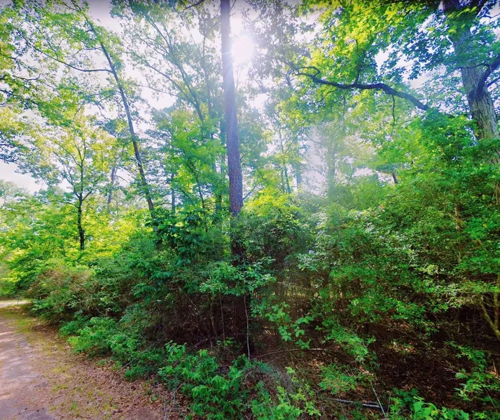
0.15 Acre in Livingston, Texas
This 0.15 acre lot is located in Livingston, Texas and the address is Mound, Livingston, TX 77351.
Indian Hill Estates is a gorgeous little community in Livingston, Texas in Polk County. This Lake Livingston subdivision boasts beautiful properties that are merely ten miles away from shopping, dining, and city recreation and are just twelve miles from medical facilities.
Those who are interested in buying a house for sale in Indian Hill Estates can join the Indian Hill Peninsula Civic Club and Community Center where a multitude of activities and events are held. Along with the other perks, Indian Hill Estates real estate offers homebuyers unobstructed views of Lake Livingston.
Features: Close to Lake Livingston, No POA, Has water and sewer
Only $300 Down and $200/month for 51 months = $10500 or Discounted Cash Price: $8400
PROPERTY DETAILS
APN: I0400004400
Address: Mound, Livingston, TX 77351
County: Polk
State: Texas
Size: 0.15 Acre
Dimensions: 60' x 110'
Legal: INDIAN HILL #1 BLK 3 LOT 10
Terrain: Flat
Access: Paved Road
Power: Power at the lot
Water: Water at the lot
Sewer: Sewer available
Taxes per Year: $18
HOA Fees per Year: No HOA/POA
GPS Coordinates (center) at the road: 30.778028, -95.047201
--- Northwest Corner: 30.778074, -95.047406
--- Northeast Corner: 30.778200, -95.047288
--- Southwest Corner: 30.777882, -95.047139
--- Southeast Corner: 30.778006, -95.047018
Elevation: 222
BUILDING INFORMATION
Zoning: TX-Polk-Livingston-Indian-Hill-Residential
Time Limit to Build: No time limit to build
Site Built Homes Allowed: Allowed 1000 min sqft
Modular Homes Allowed: Not Allowed
Manufactured Homes Allowed: Not Allowed
Mobile Homes Allowed: Not Allowed
Tiny Homes Friendly: Not Allowed
ALLOWABLE USES
Full-Time RV Living Allowed: Not Allowed
RV on the Property While I build: Allowed
Camping in a RV Allowed: Not Allowed
From elevation to risk assessment
Search for detailed parcel information including; Elevation & Vegetation Maps, Ownership Information, Detailed Parcel Information, Crop History Map, Soil Survey Productivity Data, and more.
Research Parcel InformationDirections
From Onalaska Independent School District Texas, USA
1.Head southeast on U.S. Hwy 190 E toward Blanchard Loop
2.Turn right onto FM3126 S
3.Turn right onto Alabama Point
4.Turn right onto Lakeshore Point
5.Turn left onto Mound
6.Lot is on the left
Resources
Land for Sale by Benjamin Davis
Polk County Properties By Type
- Hunting Land for Sale in Polk County, Texas
- Undeveloped Land for Sale in Polk County, Texas
- Lakefront Property for Sale in Polk County, Texas
- Ranches for Sale in Polk County, Texas
- Residential Property for Sale in Polk County, Texas
- Timberland for Sale in Polk County, Texas
- Riverfront Property for Sale in Polk County, Texas
- Farms for Sale in Polk County, Texas
- Recreational Property for Sale in Polk County, Texas
- Commercial Property for Sale in Polk County, Texas
- Horse Property for Sale in Polk County, Texas
- Beachfront Property for Sale in Polk County, Texas
Properties for Sale Nearby Counties
Polk County Properties By City
- Ace, Texas Land for Sale
- Camden, Texas Land for Sale
- Corrigan, Texas Land for Sale
- Dallardsville, Texas Land for Sale
- Goodrich, Texas Land for Sale
- Leggett, Texas Land for Sale
- Livingston, Texas Land for Sale
- Moscow, Texas Land for Sale
- Onalaska, Texas Land for Sale
- Asia, Texas Land for Sale
- Barnes, Texas Land for Sale
- Barnum, Texas Land for Sale
- More
- Carmona, Texas Land for Sale
- Pluck, Texas Land for Sale
- Segno, Texas Land for Sale
- Wakefield, Texas Land for Sale
- Bering, Texas Land for Sale
- Blanchard, Texas Land for Sale
- Bold Springs, Texas Land for Sale
- Camp Ruby, Texas Land for Sale
- Camp Seale, Texas Land for Sale
- Colita, Texas Land for Sale
- East Tempe, Texas Land for Sale
- Holly Grove, Texas Land for Sale
- Hortense, Texas Land for Sale
- Israel, Texas Land for Sale
- Kiam, Texas Land for Sale
- Lamont, Texas Land for Sale
- Lily Island, Texas Land for Sale
- Marston, Texas Land for Sale
- Moore Hill, Texas Land for Sale
- New Camp Ruby, Texas Land for Sale
- New Hope, Texas Land for Sale
- New Willard, Texas Land for Sale
- Oak Shade, Texas Land for Sale
- Ollie, Texas Land for Sale
- Patonia, Texas Land for Sale
- Schwab City, Texas Land for Sale
- Seven Oaks, Texas Land for Sale
- Skinner Town, Texas Land for Sale
- Swartout, Texas Land for Sale
- Tigerville, Texas Land for Sale
- Tobacco Patch, Texas Land for Sale
- Walda, Texas Land for Sale
- West Livingston, Texas Land for Sale
- West Tempe, Texas Land for Sale