25,750 sq. ft. Parcel Thermalito, Ca / Oroville, Ca. Butte COUNTY
25,750 sq. ft.
Parcel
Thermalito, Ca / Oroville, Ca.
Butte COUNTY
This Land is north-west in the vicinity of Thermalito in Butte County, California, United States. The population was 6,646 at the 2010 census, up from 6,045 at the 2000 census. The area is generally considered an integral part of Oroville, and borders the town on two sides, in addition to the near enclave of the city of Oroville surrounded by Thermalito on all sides, with the exception of the extremely narrow spit of land connecting Afterbay to Oroville proper.
Butte County is watered by the Feather River and the Sacramento River. Butte Creek and Big Chico Creek are additional perennial streams, both tributary to the Sacramento. The county is the home of California State University, Chico and of Butte College.
There are four major hospitals and the State of California defines Butte County as being inside Health Service Area 1. A special district, the Butte County Air Quality Management District, regulates airborne pollutant emissions in the county. It does this following regional regulations, state, and federal laws. For example, in recent years, the agency changed rules that once allowed residents to burn household trash outdoors.
Values are on the rise!
Dont miss out on this one!
Property Profile:
APN: 030-110-012-000
Property Address: Oroville, CA 95965
Legal Description: OFF 14TH ST
Use: RV
Lot Size: 25,750 sq. ft.
Zoning: AR
State/Province: California
Doc Type: Grant Deed
Taxes: Only $45 per year.
County: Butte
City/ Location: Oroville, CA 95965 See Map.
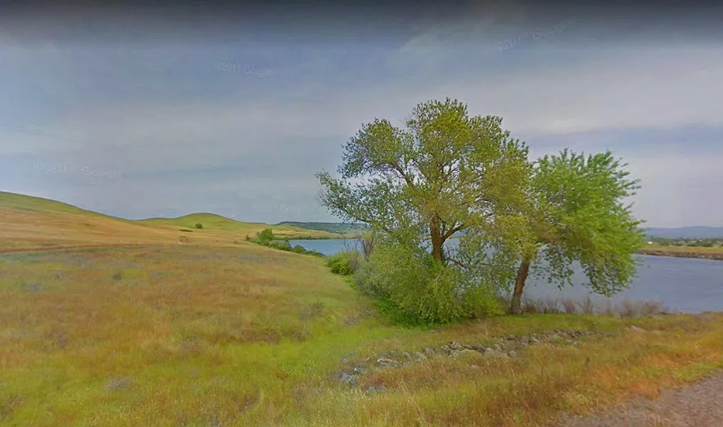
The photos 2, 4, 6, 8, 10, and 12 show the actual property and the surrounding lots. Photos 1, 3, 5, 7, 9, and 11 shows general area.
We have also included a County Parcel Map and an aerial Map to help you. The assessor's parcel number to the property in Butte County is APN# 030-110-012-000
Here is a link (including the GPS coordinates) to view the location of the property on Google Maps:
39.509910,-121.597486
(You may have to copy and paste this to use it.) Once the map pops up, simply use the zoom tool on the left side of that screen to view the map in more detail. You can even view an aerial photo by clicking on the Satellite tab in the upper right portion of that screen.
All information we have on this property is disclosed within the content of the listing page. Any and all other information on this property should be directed toward the city or county of which the property is located in. Your due diligence should be performed, to ensure the property meets your needs and criteria.
From elevation to risk assessment
Search for detailed parcel information including; Elevation & Vegetation Maps, Ownership Information, Detailed Parcel Information, Crop History Map, Soil Survey Productivity Data, and more.
Research Parcel InformationEnvironmental Factors
Land for Sale by Javier Prodiz
Butte County Properties By Type
- Farms for Sale in Butte County, California
- Ranches for Sale in Butte County, California
- Undeveloped Land for Sale in Butte County, California
- Residential Property for Sale in Butte County, California
- Lakefront Property for Sale in Butte County, California
- Riverfront Property for Sale in Butte County, California
- Commercial Property for Sale in Butte County, California
- Hunting Land for Sale in Butte County, California
- Timberland for Sale in Butte County, California
- Horse Property for Sale in Butte County, California
- Recreational Property for Sale in Butte County, California
- Beachfront Property for Sale in Butte County, California
Properties for Sale Nearby Counties
Butte County Properties By City
- Bangor, California Land for Sale
- Berry Creek, California Land for Sale
- Biggs, California Land for Sale
- Chico, California Land for Sale
- Clipper Mills, California Land for Sale
- Durham, California Land for Sale
- Feather Falls, California Land for Sale
- Forbestown, California Land for Sale
- Forest Ranch, California Land for Sale
- Gridley, California Land for Sale
- Magalia, California Land for Sale
- Nelson, California Land for Sale
- More
- Oroville, California Land for Sale
- Palermo, California Land for Sale
- Paradise, California Land for Sale
- Richvale, California Land for Sale
- Stirling City, California Land for Sale
- Brush Creek, California Land for Sale
- Butte Meadows, California Land for Sale
- Butte Valley, California Land for Sale
- Chapmantown, California Land for Sale
- Cohasset, California Land for Sale
- Dayton, California Land for Sale
- East Gridley, California Land for Sale
- Honcut, California Land for Sale
- Hurleton, California Land for Sale
- La Porte, California Land for Sale
- Nimshew, California Land for Sale
- Nord, California Land for Sale
- Oregon City, California Land for Sale
- Paradise Pines, California Land for Sale
- Pentz, California Land for Sale
- Pulga, California Land for Sale
- Richardson Springs, California Land for Sale
- Robinsons Corner, California Land for Sale
- South Oroville, California Land for Sale
- Thermalito, California Land for Sale
- Wyandotte, California Land for Sale
- Yankee Hill, California Land for Sale
- Anita, California Land for Sale
- Barber, California Land for Sale
- Blavo, California Land for Sale
- Camp Eighteen, California Land for Sale
- Cana, California Land for Sale
- Concow, California Land for Sale
- Craig, California Land for Sale
- Cresta, California Land for Sale
- De Sabla, California Land for Sale
- DeSabla, California Land for Sale
- Dodge Place, California Land for Sale
- Dodgeland, California Land for Sale
- East Biggs, California Land for Sale
- Elsey, California Land for Sale
- Esquon, California Land for Sale
- Fagan, California Land for Sale
- Glenburn, California Land for Sale
- Helltown, California Land for Sale
- Hughes Place, California Land for Sale
- Inskip, California Land for Sale
- Irish Town, California Land for Sale
- James, California Land for Sale
- Jonesville, California Land for Sale
- Junction House, California Land for Sale
- Kister, California Land for Sale
- Kramm, California Land for Sale
- Lovelock, California Land for Sale
- Lumpkin, California Land for Sale
- Mayaro, California Land for Sale
- Merrimac, California Land for Sale
- Mineral Slide, California Land for Sale
- Nelsons Crossing, California Land for Sale
- Old Forbestown, California Land for Sale
- Oroleve, California Land for Sale
- Oroville Junction, California Land for Sale
- Parkhill, California Land for Sale
- Peachton, California Land for Sale
- Poe, California Land for Sale
- Powellton, California Land for Sale
- Ramada, California Land for Sale
- Rancho Llano Seco, California Land for Sale
- Riceton, California Land for Sale
- Robinson Mills, California Land for Sale
- Roble, California Land for Sale
- Rogerville, California Land for Sale
- Shippee, California Land for Sale
- Stirling Junction, California Land for Sale
- Toadtown, California Land for Sale
- Vista Robles, California Land for Sale
- Wicks Corner, California Land for Sale