RANCH FARM 22.9 ACRES Inyokern, CA KERN COUNTY
RANCH FARM
22.9 ACRES
Inyokern, CA
KERN COUNTY
This property is located in the vicinity of Inyokern (formerly, siding 16 and Magnolia) is a census-designated place in Kern County, Ca. Its name derives from its location near the border between Inyo and Kern Counties. Inyokern is located 8 miles west of Ridgecrest, at an elevation of 2434 feet. It is on the western side of the Indian Wells Valley
Inyokern lies in Indian Wells Valley, with the eastern slopes of the Sierra Nevada rising to the west. It is on U.S. Route 395, the main north-south artery, connecting the Inland Empire to Reno, Nevada. US 395 also connects Inyokern to Los Angeles via State Route 14 through Palmdale. State Route 178, the main east-west artery, connects Inyokern to Bakersfield, the county seat, via Lake Isabella in the west, and to Death Valley via Ridgecrest in the east.
On the eastern edge of the Mojave Desert and the eastern foothills of the Tehachapi Mountains, Mojave is uniquely located at the cross-roads of two major highways and is central to many aviation, historical, and natural treasures and activities.
Inyokern has the highest insolation of any locale on the North American continent, having over 355 days of sunshine each year. The town is home to the past and current world champion musical saw players.
The Inyokern Airport is a popular location for car commercials, the grand Sierra Nevada Mountains for the backdrop. Indigenous animals that can be found in the valley floor are kit foxes, coyotes, bobcats, and roadrunners. Bears and Mountain Lions occasionally come down from the adjacent Sierra Nevada Mountains looking for food.
DONT MISS OUT ON THIS GREAT OPPORTUNITY!
Property Profile:
APN: 341-010-28
Property Address: Corner of Bowman Rd & Valley St. Inyokern, CA 93527
Legal Description: S 12 T 27 R 38 *N1/2 OF W1/2 OF E1/3 OF N1/2 EXC RD
Zoning: A - 1 MH
Use: Vacant Land
Lot Size: 22.9 Acres / 998,830 sq. ft.
State/Province: California
Doc Type: Grant Deed
Taxes: Only $168 per year.
County: Kern
City/ Location: Inyokern, CA 93527 See Map.
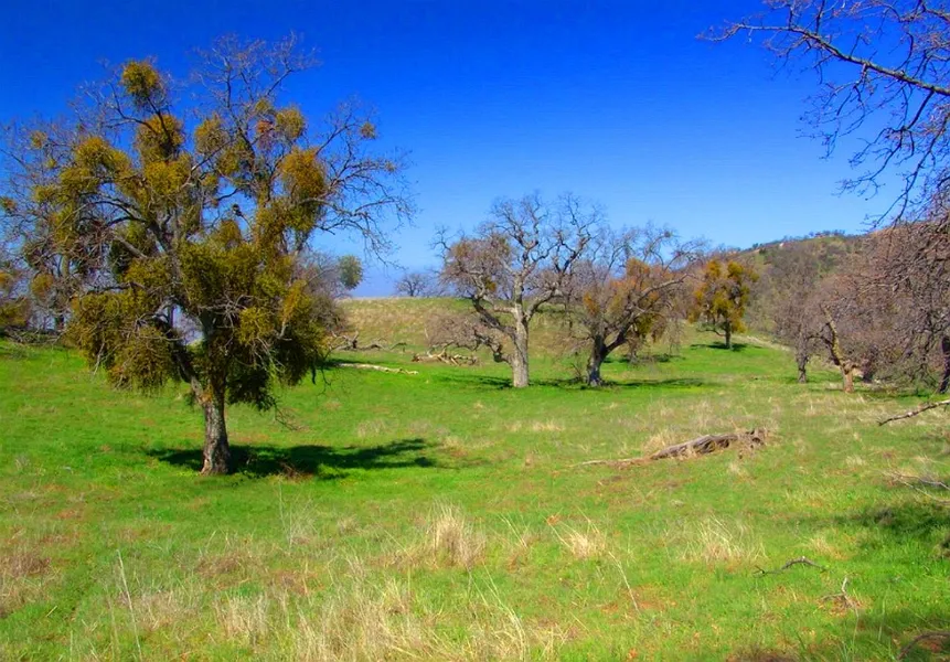
The photos 2, 4, 6, 8, 10, and 12 show the actual property and the surrounding lots. Photos 1, 3, 5, 7, 9, and 11 shows general area.
We have also included a County Parcel Map and an aerial Map to help you. The assessor's parcel number to the property in Kern is APN# 341-010-28-00
Here is a link (including the GPS coordinates) to view the location of the property on Google Maps:
35.607819,-117.836341
(You may have to copy and paste this to use it.) Once the map pops up, simply use the zoom tool on the left side of that screen to view the map in more detail. You can even view an aerial photo by clicking on the Satellite tab in the upper right portion of that screen.
All information we have on this property is disclosed within the content of the listing page. Any and all other information on this property should be directed toward the city or county of which the property is located in. Your due diligence should be performed, to ensure the property meets your needs and criteria.
From elevation to risk assessment
Search for detailed parcel information including; Elevation & Vegetation Maps, Ownership Information, Detailed Parcel Information, Crop History Map, Soil Survey Productivity Data, and more.
Research Parcel InformationLand for Sale by Javier Prodiz
Kern County Properties By Type
- Farms for Sale in Kern County, California
- Undeveloped Land for Sale in Kern County, California
- Ranches for Sale in Kern County, California
- Residential Property for Sale in Kern County, California
- Riverfront Property for Sale in Kern County, California
- Commercial Property for Sale in Kern County, California
- Lakefront Property for Sale in Kern County, California
- Recreational Property for Sale in Kern County, California
- Horse Property for Sale in Kern County, California
- Beachfront Property for Sale in Kern County, California
- Hunting Land for Sale in Kern County, California
- Timberland for Sale in Kern County, California
Properties for Sale Nearby Counties
- Inyo County, California Land for Sale
- Kings County, California Land for Sale
- Los Angeles County, California Land for Sale
- San Bernardino County, California Land for Sale
- San Luis Obispo County, California Land for Sale
- Santa Barbara County, California Land for Sale
- Tulare County, California Land for Sale
- Ventura County, California Land for Sale
Kern County Properties By City
- Arvin, California Land for Sale
- Bakersfield, California Land for Sale
- Bodfish, California Land for Sale
- Boron, California Land for Sale
- Buttonwillow, California Land for Sale
- Caliente, California Land for Sale
- California City, California Land for Sale
- Cantil, California Land for Sale
- Delano, California Land for Sale
- Edison, California Land for Sale
- Edwards, California Land for Sale
- Fellows, California Land for Sale
- More
- Frazier Park, California Land for Sale
- Glennville, California Land for Sale
- Inyokern, California Land for Sale
- Johannesburg, California Land for Sale
- Keene, California Land for Sale
- Kernville, California Land for Sale
- Lake Isabella, California Land for Sale
- Lamont, California Land for Sale
- Lebec, California Land for Sale
- Lost Hills, California Land for Sale
- Maricopa, California Land for Sale
- Mojave, California Land for Sale
- Onyx, California Land for Sale
- Randsburg, California Land for Sale
- Red Mountain, California Land for Sale
- Ridgecrest, California Land for Sale
- Rosamond, California Land for Sale
- Shafter, California Land for Sale
- Taft, California Land for Sale
- Tehachapi, California Land for Sale
- Tupman, California Land for Sale
- Wasco, California Land for Sale
- Weldon, California Land for Sale
- Wofford Heights, California Land for Sale
- Woody, California Land for Sale
- Aerial Acres, California Land for Sale
- Bear Valley Springs, California Land for Sale
- China Lake, California Land for Sale
- Desert Lake, California Land for Sale
- Di Giorgio, California Land for Sale
- Golden Hills, California Land for Sale
- Gorman, California Land for Sale
- Havilah, California Land for Sale
- Loraine, California Land for Sale
- Mettler, California Land for Sale
- Monolith, California Land for Sale
- Mountain Mesa, California Land for Sale
- North Edwards, California Land for Sale
- Pearsonville, California Land for Sale
- Pine Mountain Club, California Land for Sale
- Pumpkin Center, California Land for Sale
- Sand Canyon, California Land for Sale
- Stallion Springs, California Land for Sale
- Willow Springs, California Land for Sale
- Actis, California Land for Sale
- Algoso, California Land for Sale
- Annette, California Land for Sale
- Ansel, California Land for Sale
- Armistead, California Land for Sale
- Bannister, California Land for Sale
- Bealville, California Land for Sale
- Bena, California Land for Sale
- Bissell, California Land for Sale
- Blackwells Corner, California Land for Sale
- Bowerbank, California Land for Sale
- Bradys, California Land for Sale
- Brown, California Land for Sale
- Burton Mill, California Land for Sale
- Cable, California Land for Sale
- Calders Corner, California Land for Sale
- Camp Owens, California Land for Sale
- Cawelo, California Land for Sale
- Ceneda, California Land for Sale
- Chaffee, California Land for Sale
- Cherokee Strip, California Land for Sale
- China Lake Acres, California Land for Sale
- Cinco, California Land for Sale
- Claraville, California Land for Sale
- Conner, California Land for Sale
- Crome, California Land for Sale
- Derby Acres, California Land for Sale
- Dow, California Land for Sale
- Dustin Acres, California Land for Sale
- East Bakersfield, California Land for Sale
- Edmundson Acres, California Land for Sale
- El Rita, California Land for Sale
- Elmo, California Land for Sale
- Famoso, California Land for Sale
- Fig Orchard, California Land for Sale
- Fleta, California Land for Sale
- Ford City, California Land for Sale
- Fruitvale, California Land for Sale
- Fuller Acres, California Land for Sale
- Garlock, California Land for Sale
- Gloster, California Land for Sale
- Goler Heights, California Land for Sale
- Gosford, California Land for Sale
- Grapevine, California Land for Sale
- Greenacres, California Land for Sale
- Gulf, California Land for Sale
- Gypsite, California Land for Sale
- Halfway House, California Land for Sale
- Harpertown, California Land for Sale
- Harts Place, California Land for Sale
- Hazelton, California Land for Sale
- Hights Corner, California Land for Sale
- Hollis, California Land for Sale
- Ilmon, California Land for Sale
- Jasmin, California Land for Sale
- Jastro, California Land for Sale
- Kayandee, California Land for Sale
- Kecks Corner, California Land for Sale
- Kern, California Land for Sale
- Kern City, California Land for Sale
- Kern Lake, California Land for Sale
- Kernell, California Land for Sale
- Keyesville, California Land for Sale
- Kilowatt, California Land for Sale
- Lackey Place, California Land for Sale
- Lake of the Woods, California Land for Sale
- Landco, California Land for Sale
- Lerdo, California Land for Sale
- Lokern, California Land for Sale
- Lonsmith, California Land for Sale
- Magunden, California Land for Sale
- Maltha, California Land for Sale
- Manolith, California Land for Sale
- Marcel, California Land for Sale
- McFarland, California Land for Sale
- McKittrick, California Land for Sale
- Mexican Colony, California Land for Sale
- Midoil, California Land for Sale
- Millersville, California Land for Sale
- Millux, California Land for Sale
- Minter Village, California Land for Sale
- Miracle Hot Springs, California Land for Sale
- Missouri Triangle, California Land for Sale
- Mitchells Corner, California Land for Sale
- Moreland Mill, California Land for Sale
- Myricks Corner, California Land for Sale
- Neufeld, California Land for Sale
- North Belridge, California Land for Sale
- North Shafter, California Land for Sale
- Oil City, California Land for Sale
- Oil Junction, California Land for Sale
- Oildale, California Land for Sale
- Old Fort Tejon, California Land for Sale
- Old Garlock, California Land for Sale
- Old River, California Land for Sale
- Palmo, California Land for Sale
- Panama, California Land for Sale
- Patch, California Land for Sale
- Pentland, California Land for Sale
- Pettit Place, California Land for Sale
- Pond, California Land for Sale
- Prospero, California Land for Sale
- Quailwood, California Land for Sale
- Quality, California Land for Sale
- Rancho Seco, California Land for Sale
- Rand, California Land for Sale
- Reward, California Land for Sale
- Ribier, California Land for Sale
- Ricardo, California Land for Sale
- Rich, California Land for Sale
- Rio Bravo, California Land for Sale
- Riverkern, California Land for Sale
- Rosedale, California Land for Sale
- Rowen, California Land for Sale
- Saco, California Land for Sale
- Sageland, California Land for Sale
- Saltdale, California Land for Sale
- San Emidio, California Land for Sale
- Sanborn, California Land for Sale
- Searles, California Land for Sale
- Seguro, California Land for Sale
- Semitropic, California Land for Sale
- Shirley Meadows, California Land for Sale
- Silt, California Land for Sale
- Slater, California Land for Sale
- Smith Corner, California Land for Sale
- South Lake, California Land for Sale
- South Taft, California Land for Sale
- Spellacy, California Land for Sale
- Spicer City, California Land for Sale
- Squirrel Mountain Valley, California Land for Sale
- Stevens, California Land for Sale
- Summit, California Land for Sale
- Taft Heights, California Land for Sale
- Thomas Lane, California Land for Sale
- Una, California Land for Sale
- Valley Acres, California Land for Sale
- Venola, California Land for Sale
- Vinland, California Land for Sale
- Wallace Center, California Land for Sale
- Walong, California Land for Sale
- Weedpatch, California Land for Sale
- Wheeler Ridge, California Land for Sale
- Wherry Housing, California Land for Sale
- Wible Orchard, California Land for Sale
- Woodford, California Land for Sale
- Zentner, California Land for Sale