40 Acres, Sweetwater County WY, Parcel 04-1996-01-4-00-021.00
Description
-Owner Financing
-Monthly Payment of $299.64
-Down Payment of $8,000
Secure 40 Acres with Guaranteed Financing and a Money Back Satisfaction Guarantee
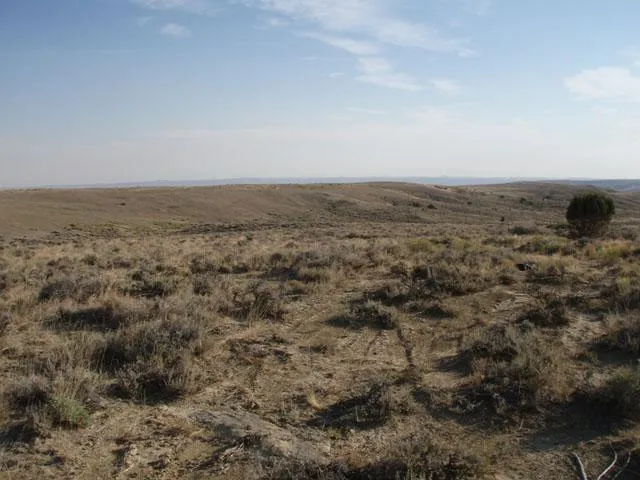
Imagine yourself in Sweetwater County, Wyoming, on 40 spacious acres where the options are endless and the sky is the limit. Safe and transparent financing options, no credit check prerequisites, and a money back satisfaction guarantee pave the way for your ownership.
Contact us today to secure your piece of Sweetwater, WY, and take the first step towards realizing your dream of owning a significant piece of the American West!
Property Details:
Lot Size: 40
County: Sweetwater
Address: Red Desert Nw 02100, Wamsutter, WY, 82336
Terrain: Level
Power: A power pole line runs along Pipeline Road
Water: Well permits can be obtained by contacting the Wyoming State Engineers Office, Ground Water Division, at 307-777-6163
Septic/Sewer: Septic permits are issued by the Sweetwater County Environmental Health Department. at 307-872-3930 with any questions.
Gas: Natural Gas contact: MountainWest Overthrust Pipeline (801-584-6034)
Access: Pipeline Road
HOA/ POA: no HOA
APN: 1996-01-4-00-021-00
Other information or restrictions:
RVs Allowed: A Recreational Vehicle is not considered a manufactured or mobile home and shall not be placed on a permanent foundation
Camp on Property: Regulations for camping on private property was not mentioned. Contact Sweetwater County Land Use Office 307-872-3914
Mobile Homes Allowed: Titles are required when purchasing a new mobile home or transferring ownership
*** Buyer to verify all information***
Closest Town/City: Point of Rocks, Wyoming - 37 mins (37.5 miles)
Average annual precipitation: 8.17 inches of rain/ 28 inches of snow
Average Temperature(winter/summer): 8/85
Approx. Coordinates: 41.64961, -108.1687
From elevation to risk assessment
Search for detailed parcel information including; Elevation & Vegetation Maps, Ownership Information, Detailed Parcel Information, Crop History Map, Soil Survey Productivity Data, and more.
Research Parcel InformationEnvironmental Factors
Resources
Sweetwater County Properties By Type
- Ranches for Sale in Sweetwater County, Wyoming
- Undeveloped Land for Sale in Sweetwater County, Wyoming
- Farms for Sale in Sweetwater County, Wyoming
- Residential Property for Sale in Sweetwater County, Wyoming
- Horse Property for Sale in Sweetwater County, Wyoming
- Riverfront Property for Sale in Sweetwater County, Wyoming
- Recreational Property for Sale in Sweetwater County, Wyoming
- Lakefront Property for Sale in Sweetwater County, Wyoming
- Commercial Property for Sale in Sweetwater County, Wyoming
- Hunting Land for Sale in Sweetwater County, Wyoming
- Beachfront Property for Sale in Sweetwater County, Wyoming
- Timberland for Sale in Sweetwater County, Wyoming
Properties for Sale Nearby Counties
Sweetwater County Properties By City
- Bairoil, Wyoming Land for Sale
- Farson, Wyoming Land for Sale
- Granger, Wyoming Land for Sale
- Green River, Wyoming Land for Sale
- Little America, Wyoming Land for Sale
- Point Of Rocks, Wyoming Land for Sale
- Reliance, Wyoming Land for Sale
- Rock Springs, Wyoming Land for Sale
- Superior, Wyoming Land for Sale
- Wamsutter, Wyoming Land for Sale
- Bitter Creek, Wyoming Land for Sale
- Eden, Wyoming Land for Sale
- More
- Quealy, Wyoming Land for Sale
- Red Desert, Wyoming Land for Sale
- Tipton, Wyoming Land for Sale
- Arrowhead Springs, Wyoming Land for Sale
- Blairtown, Wyoming Land for Sale
- Bryan, Wyoming Land for Sale
- Burntfork, Wyoming Land for Sale
- Clearview Acres, Wyoming Land for Sale
- Creston Junction, Wyoming Land for Sale
- Granger Junction, Wyoming Land for Sale
- Greenhough Place, Wyoming Land for Sale
- J O Junction, Wyoming Land for Sale
- James Town, Wyoming Land for Sale
- Kanda, Wyoming Land for Sale
- McKinnon, Wyoming Land for Sale
- Monell, Wyoming Land for Sale
- North Rock Springs, Wyoming Land for Sale
- Petes Place, Wyoming Land for Sale
- Purple Sage, Wyoming Land for Sale
- Rendezvous, Wyoming Land for Sale
- Riovista, Wyoming Land for Sale
- Robinson, Wyoming Land for Sale
- Rocky Crossing, Wyoming Land for Sale
- Salt Wells, Wyoming Land for Sale
- South Baxter, Wyoming Land for Sale
- South Superior, Wyoming Land for Sale
- Stansbury, Wyoming Land for Sale
- Sweeney Ranch, Wyoming Land for Sale
- Table Rock, Wyoming Land for Sale
- Thayer Junction, Wyoming Land for Sale
- Washam, Wyoming Land for Sale