For as low as $250 down and $250 a month!
APN: 8290-00-00A-219-0-000-00
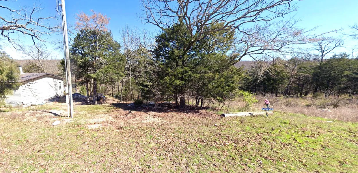
This 0.12-acre parcel is situated on W Carlie Drive in Park Hill, Oklahoma, within the Lake Ten Killer Harbor subdivision. It offers an ideal opportunity for building a home or vacation retreat.
Lake Ten Killer is renowned for its peaceful community and scenic beauty. The property is conveniently close to Lake Tenkiller, perfect for enjoying boating, fishing, and other water activities. The area also boasts excellent hiking trails and abundant opportunities to immerse yourself in nature.
Whether youre seeking a tranquil place to reside or a serene getaway, this property in Park Hill is an excellent option. With owner financing available, Discover endless possibilities todaydont miss out on this opportunity!
Cash Price: $12,000.00
Term Option 1: $250 down, $250 for 60 months, for a total price of $15,250
Term Option 2: $350 down, $350 for 39 months, for a total price of $14,000
Term Option 3: $450 down, $450 for 29 months, for a total price of $13,500
GPS Coordinates (center) at the road: 35.6512, -95.0323
Northwest Corner: 35.6514, -95.0322
Northeast Corner: 35.6514, -95.0320
Southwest Corner: 35.6512, -95.0323
Southeast Corner: 35.6511, -95.0322
Legal Description: Lot No. 219, Block A, Lake Tenkiller Harbor
Elevation: 680'
Terrain: Uneven
Access: Gravel Road
Power: Provided by Lake Region Electric Cooperative (918) 772-2526
Water: Provided by USW Water/Sewer (832) 756-2143
Sewer: Provided by USW Water/Sewer (832) 756-2143
Zoning: Vacant - Single Family Residential
RV Living: Allowed
Mobile Home Living: Allowed
Manufactured Homes: Allowed
POA: Lake Tenkiller Harbor Property Owners Association
POA Fees Per Year: $101.92
Taxes Per Year: $8.00
Road Fee: $10.00
County Contact Information: For more information, call Cherokee County Clerk at: (918) 456-0691
Conveyance: Warranty Deed
From elevation to risk assessment
Search for detailed parcel information including; Elevation & Vegetation Maps, Ownership Information, Detailed Parcel Information, Crop History Map, Soil Survey Productivity Data, and more.
Research Parcel InformationResources
Land for Sale by AGT Properties, LLC
Cherokee County Properties By Type
- Undeveloped Land for Sale in Cherokee County, Oklahoma
- Farms for Sale in Cherokee County, Oklahoma
- Riverfront Property for Sale in Cherokee County, Oklahoma
- Hunting Land for Sale in Cherokee County, Oklahoma
- Lakefront Property for Sale in Cherokee County, Oklahoma
- Ranches for Sale in Cherokee County, Oklahoma
- Residential Property for Sale in Cherokee County, Oklahoma
- Commercial Property for Sale in Cherokee County, Oklahoma
- Horse Property for Sale in Cherokee County, Oklahoma
- Recreational Property for Sale in Cherokee County, Oklahoma
- Timberland for Sale in Cherokee County, Oklahoma
- Beachfront Property for Sale in Cherokee County, Oklahoma
Properties for Sale Nearby Counties
Cherokee County Properties By City
- Cookson, Oklahoma Land for Sale
- Hulbert, Oklahoma Land for Sale
- Moodys, Oklahoma Land for Sale
- Park Hill, Oklahoma Land for Sale
- Peggs, Oklahoma Land for Sale
- Tahlequah, Oklahoma Land for Sale
- Welling, Oklahoma Land for Sale
- Pettit, Oklahoma Land for Sale
- Qualls, Oklahoma Land for Sale
- Barber, Oklahoma Land for Sale
- Briggs, Oklahoma Land for Sale
- Caney Ridge, Oklahoma Land for Sale
- More
- Carters Landing, Oklahoma Land for Sale
- Dry Creek, Oklahoma Land for Sale
- Eldon, Oklahoma Land for Sale
- Eli, Oklahoma Land for Sale
- Ellerville, Oklahoma Land for Sale
- Gabriel, Oklahoma Land for Sale
- Gideon, Oklahoma Land for Sale
- Indian Meadows, Oklahoma Land for Sale
- Keys, Oklahoma Land for Sale
- Lost City, Oklahoma Land for Sale
- Lowrey, Oklahoma Land for Sale
- Manard, Oklahoma Land for Sale
- Metory, Oklahoma Land for Sale
- Pettit Bay, Oklahoma Land for Sale
- Pumpkin Center, Oklahoma Land for Sale
- Scraper, Oklahoma Land for Sale
- Tailholt, Oklahoma Land for Sale
- Tenkiller, Oklahoma Land for Sale
- Teresita, Oklahoma Land for Sale
- Thompson Corner, Oklahoma Land for Sale
- Tsa La Gi Indian Village, Oklahoma Land for Sale
- Wildcat Point, Oklahoma Land for Sale
- Woodall, Oklahoma Land for Sale
- Zeb, Oklahoma Land for Sale