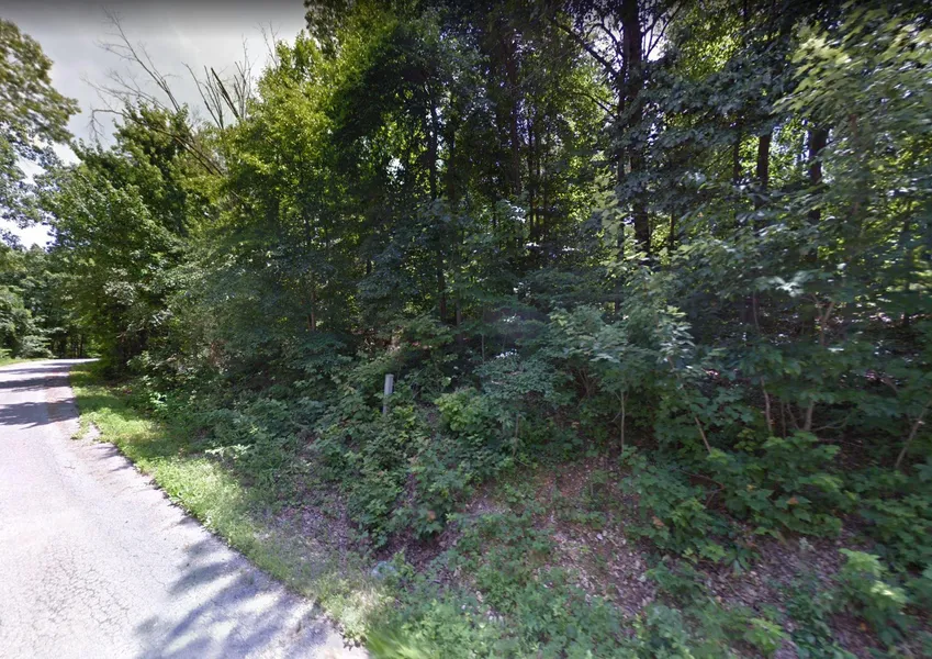
1.47 Acres in Bella Vista, Arkansas
This 1.47 acre lot is located in Bella Vista, Arkansas and the address is Selkirk Drive, Bella Vista, AR 72715.
Bella Vista is located in Benton County, Arkansas along the border of Missouri and Oklahoma.
The city of Bella Vista is located on the Springfield Plateau of the Ozark Mountains. Amenities include numerous parks, clubhouses with workout areas, swimming pools, six 18 hole golf courses, one 9 hole golf course, seven lakes with fishing and boat docks (3 ski lakes), a marina, swimming beach, putt putt golf courses and tennis courts, dog park, softball field, and extensive hiking and biking trails throughout its beautiful Ozark hills.
Features: Oversized Lot touches Missouri border
Only $400 Down and $300/month for 63 months = $19300 or Discounted Cash Price: $15500
PROPERTY DETAILS
APN: 16-18501-000
Address: Selkirk Drive, Bella Vista, AR 72715
County: Benton
State: Arkansas
Size: 1.47 Acres
Dimensions: 99' x 314'
Legal: Lot 3, Block 2 Lanark Subdivision
Terrain: Flat
Access: Paved Road
Power: Power at the lot
Water: Water at the lot
Sewer: Would be by Septic
Taxes per Year: $38
HOA Fees per Year: $192
GPS Coordinates (center) at the road: 36.499073, -94.334982
--- Northwest Corner: 36.499444, -94.335400
--- Northeast Corner: 36.499344, -94.334340
--- Southwest Corner: 36.498765, -94.335391
--- Southeast Corner: 36.498631, -94.335106
Elevation: 1200
BUILDING INFORMATION
Zoning: AR-Benton-R-1 Single Family Residential
Time Limit to Build: No time limit to build
Site Built Homes Allowed: Allowed. 1000 min sqft
Modular Homes Allowed: Allowed
Manufactured Homes Allowed: Not Allowed
Mobile Homes Allowed: Not Allowed
Tiny Homes Friendly: Not Allowed
ALLOWABLE USES
Full-Time RV Living Allowed: Not Allowed
RV on the Property While I build: Not Allowed
Camping in a RV Allowed: Not Allowed
From elevation to risk assessment
Search for detailed parcel information including; Elevation & Vegetation Maps, Ownership Information, Detailed Parcel Information, Crop History Map, Soil Survey Productivity Data, and more.
Research Parcel InformationDirections
From 2012 State Hwy 90:
1. Head west on State Hwy 90 W toward Brush Creek Rd
2. Turn left at the 1st cross street onto Brush Creek Rd/County Rd SW9024
3. Continue to follow County RdSW9024
4. Slight right onto Leith Ln
5. Turn left at the 1st cross streetonto Lothian Dr
6. Turn right onto Glasgow Dr
7. Turn right onto Glasgow Rd
8. Turn right onto Selkirk Dr
9.Lot is on the left
Resources
Land for Sale by Benjamin Davis
Benton County Properties By Type
- Undeveloped Land for Sale in Benton County, Arkansas
- Farms for Sale in Benton County, Arkansas
- Hunting Land for Sale in Benton County, Arkansas
- Riverfront Property for Sale in Benton County, Arkansas
- Lakefront Property for Sale in Benton County, Arkansas
- Ranches for Sale in Benton County, Arkansas
- Residential Property for Sale in Benton County, Arkansas
- Commercial Property for Sale in Benton County, Arkansas
- Timberland for Sale in Benton County, Arkansas
- Recreational Property for Sale in Benton County, Arkansas
- Horse Property for Sale in Benton County, Arkansas
- Beachfront Property for Sale in Benton County, Arkansas
Properties for Sale Nearby Counties
Benton County Properties By City
- Avoca, Arkansas Land for Sale
- Bella Vista, Arkansas Land for Sale
- Bentonville, Arkansas Land for Sale
- Cave Springs, Arkansas Land for Sale
- Centerton, Arkansas Land for Sale
- Decatur, Arkansas Land for Sale
- Garfield, Arkansas Land for Sale
- Gateway, Arkansas Land for Sale
- Gentry, Arkansas Land for Sale
- Gravette, Arkansas Land for Sale
- Hiwasse, Arkansas Land for Sale
- Lowell, Arkansas Land for Sale
- More
- Maysville, Arkansas Land for Sale
- Pea Ridge, Arkansas Land for Sale
- Rogers, Arkansas Land for Sale
- Siloam Springs, Arkansas Land for Sale
- Sulphur Springs, Arkansas Land for Sale
- Nebo, Arkansas Land for Sale
- Springtown, Arkansas Land for Sale
- Accident, Arkansas Land for Sale
- Apple Spur, Arkansas Land for Sale
- Beaty, Arkansas Land for Sale
- Beaver Shores, Arkansas Land for Sale
- Blackjack Corner, Arkansas Land for Sale
- Bland, Arkansas Land for Sale
- Bloomfield, Arkansas Land for Sale
- Brightwater, Arkansas Land for Sale
- Cherokee City, Arkansas Land for Sale
- Clantonville, Arkansas Land for Sale
- Clear Point, Arkansas Land for Sale
- Creech, Arkansas Land for Sale
- Cross Hollow, Arkansas Land for Sale
- Dawn Hill, Arkansas Land for Sale
- Dug Hill, Arkansas Land for Sale
- Eagle Corner, Arkansas Land for Sale
- Elkhorn Tavern, Arkansas Land for Sale
- Falling Springs, Arkansas Land for Sale
- Frisco, Arkansas Land for Sale
- Gallatin, Arkansas Land for Sale
- Glade, Arkansas Land for Sale
- Green Acres, Arkansas Land for Sale
- Healing Springs, Arkansas Land for Sale
- Hickory Creek, Arkansas Land for Sale
- Hico, Arkansas Land for Sale
- Highfill, Arkansas Land for Sale
- Hill Top, Arkansas Land for Sale
- Ionia, Arkansas Land for Sale
- Lake Frances, Arkansas Land for Sale
- Lakeland Hills, Arkansas Land for Sale
- Larue, Arkansas Land for Sale
- Leetown, Arkansas Land for Sale
- Little Flock, Arkansas Land for Sale
- Logan, Arkansas Land for Sale
- Lost Bridge Village, Arkansas Land for Sale
- Martin, Arkansas Land for Sale
- Mason Valley, Arkansas Land for Sale
- Miller, Arkansas Land for Sale
- Monte Ne, Arkansas Land for Sale
- Monte Ne Shores, Arkansas Land for Sale
- Norwood, Arkansas Land for Sale
- Osage Mills, Arkansas Land for Sale
- Pedro, Arkansas Land for Sale
- Pine Top, Arkansas Land for Sale
- Pleasure Heights, Arkansas Land for Sale
- Rago, Arkansas Land for Sale
- Rambo Riviera, Arkansas Land for Sale
- Robinson, Arkansas Land for Sale
- Rocky Comfort, Arkansas Land for Sale
- Seba, Arkansas Land for Sale
- Silent Grove, Arkansas Land for Sale
- Tanglewood, Arkansas Land for Sale
- Twin Springs, Arkansas Land for Sale
- Vaughn, Arkansas Land for Sale
- Vista Shores, Arkansas Land for Sale
- War Eagle, Arkansas Land for Sale
- War Eagle Cove, Arkansas Land for Sale