Five Plus Acre Lot - Swenson Road- Soda Springs, ID
Description
***See all of our listings by visiting us at governmentlandsales.us***
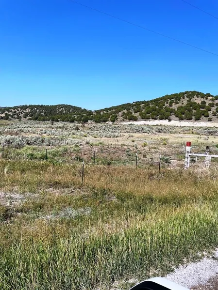
Wonderful 5+ acre parcel located about 10 miles NW of Soda Springs, ID. This secluded lot provides gorgeous views in every direction. It is located just far enough out of town to make you feel secluded yet close enough to quickly visit town for supplies or for dining and entertainment. The lot has slope and character including mature trees. Make this your off-grid paradise or use it as a base camp for all of your recreational activities.
Soda Springs
As the county seat of Caribou County, Soda Springs is home to the worlds only captive geyser, it was discovered when drilling for a swimming pool nearly 80 years ago. It is now capped and controlled by a timer and it erupts every hour on the hour. The geyser reaches heights of 100 feet, 365 days a year. Soda Springs is also base camp for the famous 55 mile Highline Recreation Trail, groomed snowmobile trails in and outside of town, and groomed cross country ski area. The Soda Springs Nordic Ski Association has trail maps and grooming schedules. In addition, there are also two beautiful Golf Courses to provide summer recreation. The Oregon Trail Golf Club has the original wagon ruts still intact from the Oregon trail.
Land Information:
Size: 5.1 Acres
Dimensions: 720.7' X 512.72' X 835.03'
APN: 005512000450
Legal: Great Columbia Subdivision Phase I Lot 45
Address: Swenson Road, Soda Springs, ID 83217
GPS: Approximate GPS Coordinates
42.705677, -111.749787 (NW Corner)
42.704982, -111.748058 (NE Corner)
42.704306, -111.747960 (SE Corner)
42.703760, -111.749758 (SW Corner)
Owner financing available, please inquire. No credit checks, everyone qualifies. We accept all major credit cards. All Cash offers considered.
Document preparation fee: $249
C-2021058 NHTT -*
From elevation to risk assessment
Search for detailed parcel information including; Elevation & Vegetation Maps, Ownership Information, Detailed Parcel Information, Crop History Map, Soil Survey Productivity Data, and more.
Research Parcel InformationEnvironmental Factors
Caribou County Properties By Type
- Farms for Sale in Caribou County, Idaho
- Undeveloped Land for Sale in Caribou County, Idaho
- Recreational Property for Sale in Caribou County, Idaho
- Ranches for Sale in Caribou County, Idaho
- Lakefront Property for Sale in Caribou County, Idaho
- Riverfront Property for Sale in Caribou County, Idaho
- Commercial Property for Sale in Caribou County, Idaho
- Hunting Land for Sale in Caribou County, Idaho
- Horse Property for Sale in Caribou County, Idaho
- Timberland for Sale in Caribou County, Idaho
- Residential Property for Sale in Caribou County, Idaho
- Beachfront Property for Sale in Caribou County, Idaho
Properties for Sale Nearby Counties
Caribou County Properties By City
- Bancroft, Idaho Land for Sale
- Conda, Idaho Land for Sale
- Grace, Idaho Land for Sale
- Soda Springs, Idaho Land for Sale
- Wayan, Idaho Land for Sale
- Bench, Idaho Land for Sale
- Central, Idaho Land for Sale
- Chesterfield, Idaho Land for Sale
- Henry, Idaho Land for Sale
- Lago, Idaho Land for Sale
- Lund, Idaho Land for Sale
- Niter, Idaho Land for Sale
- More