Oversized 2.4 Acre Lot in Timberon - Magnificent Views
***See all of our listings by visiting us at governmentlandsales.us***
Affordable acreage in the Timberon subdivision. This lot measure nearly 2.5 acres and is located in the quiet southernmost area of Timberon, New Mexico, in the Sacramento Mountains in the southern part of the Lincoln National Forest. This is a wonderful view lot. Great for a permanent home or a vacation getaway.
Timberon
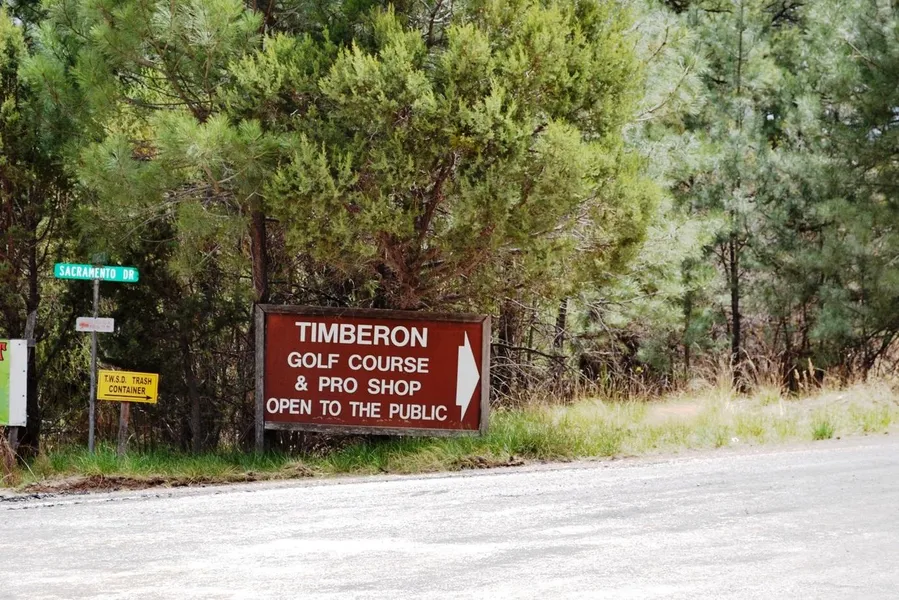
Located in Otero County in south central New Mexico, Timberon is south of Cloudcroft and southeast of Alamogordo. The elevation ranges from 6,900 to 7,200 feet within the community. This mountain paradise includes an airport for the aviation enthusiasts. For the golf fans there is a 9 hole regulation golf course with a clubhouse and restaurant. The community pool is maintained by the local water district and is normally open from Memorial day to Labor day.
For the outdoor enthusiast Timberon has a fishing lake and miles of trails and primitive roads for your off-road vehicle adventures. When you are done stop by one of the three community restaurants for a bite to eat. Other services in the area include a hardware and general store for supplies and groceries, and a volunteer fire department with EMS and ambulance service.
Land Info:
Legal: Timberon Unit 4 Block 49 Lot 29
APN: R044958
UPC: 11O4071115437086
Size: 2.405 Acres
Dimensions: 463.67' X 157.55' X 363.80' X 368.79'
GPS: Approximate GPS Coordinates
32.6025, -105.6818 (NW Corner)
32.6027, -105.6813 (NE Corner)
32.6018, -105.6808 (SE Corner)
32.6013, -105.6818 (SW Corner)
32.6020, -105.6814 (Center)
Owner financing available, please inquire. No credit checks, everyone qualifies. We accept all major credit cards. All cash offers are considered.
Document preparation fee: $299
C-2024085 EATT
Disclaimer: All of the information in this listing is accurate to the best of our knowledge at the time of posting. Potential buyer(s) should do their own research and due diligence to verify all information provided and make a decision to purchase based on their own research.
From elevation to risk assessment
Search for detailed parcel information including; Elevation & Vegetation Maps, Ownership Information, Detailed Parcel Information, Crop History Map, Soil Survey Productivity Data, and more.
Research Parcel InformationDirections
Environmental Factors
Boise, ID
Land for Sale by Government Land Sales
Otero County Properties By Type
- Undeveloped Land for Sale in Otero County, New Mexico
- Ranches for Sale in Otero County, New Mexico
- Residential Property for Sale in Otero County, New Mexico
- Hunting Land for Sale in Otero County, New Mexico
- Recreational Property for Sale in Otero County, New Mexico
- Farms for Sale in Otero County, New Mexico
- Commercial Property for Sale in Otero County, New Mexico
- Riverfront Property for Sale in Otero County, New Mexico
- Horse Property for Sale in Otero County, New Mexico
- Timberland for Sale in Otero County, New Mexico
- Lakefront Property for Sale in Otero County, New Mexico
- Beachfront Property for Sale in Otero County, New Mexico
Properties for Sale Nearby Counties
- Chaves County, New Mexico Land for Sale
- Culberson County, New Mexico Land for Sale
- Dona Ana County, New Mexico Land for Sale
- Eddy County, New Mexico Land for Sale
- El Paso County, New Mexico Land for Sale
- Hudspeth County, New Mexico Land for Sale
- Lincoln County, New Mexico Land for Sale
- Sierra County, New Mexico Land for Sale
Otero County Properties By City
- Alamogordo, New Mexico Land for Sale
- Bent, New Mexico Land for Sale
- Cloudcroft, New Mexico Land for Sale
- La Luz, New Mexico Land for Sale
- Mayhill, New Mexico Land for Sale
- Mescalero, New Mexico Land for Sale
- Orogrande, New Mexico Land for Sale
- Sacramento, New Mexico Land for Sale
- Timberon, New Mexico Land for Sale
- Tularosa, New Mexico Land for Sale
- Weed, New Mexico Land for Sale
- Three Rivers, New Mexico Land for Sale
- More
- Alamorosa, New Mexico Land for Sale
- Alvarado, New Mexico Land for Sale
- Apache, New Mexico Land for Sale
- Avis, New Mexico Land for Sale
- Blazers Mill, New Mexico Land for Sale
- Boles Acres, New Mexico Land for Sale
- Carrizo, New Mexico Land for Sale
- Chippeway Park, New Mexico Land for Sale
- Corner Well, New Mexico Land for Sale
- Crisp, New Mexico Land for Sale
- Dunes, New Mexico Land for Sale
- Elwood, New Mexico Land for Sale
- High Rolls, New Mexico Land for Sale
- Hortonville, New Mexico Land for Sale
- Kearney, New Mexico Land for Sale
- Marcia, New Mexico Land for Sale
- Maxon, New Mexico Land for Sale
- Mountain Park, New Mexico Land for Sale
- Newman, New Mexico Land for Sale
- Old Wright Place, New Mexico Land for Sale
- Omlee, New Mexico Land for Sale
- Piñon, New Mexico Land for Sale
- Point of Sands, New Mexico Land for Sale
- Salinas, New Mexico Land for Sale
- Silver Springs, New Mexico Land for Sale
- Turquoise, New Mexico Land for Sale
- Valmont, New Mexico Land for Sale
- Whitetail, New Mexico Land for Sale
- Wimsatt, New Mexico Land for Sale
