119-08-199/ COCHISE COUNTY, AZ
Description
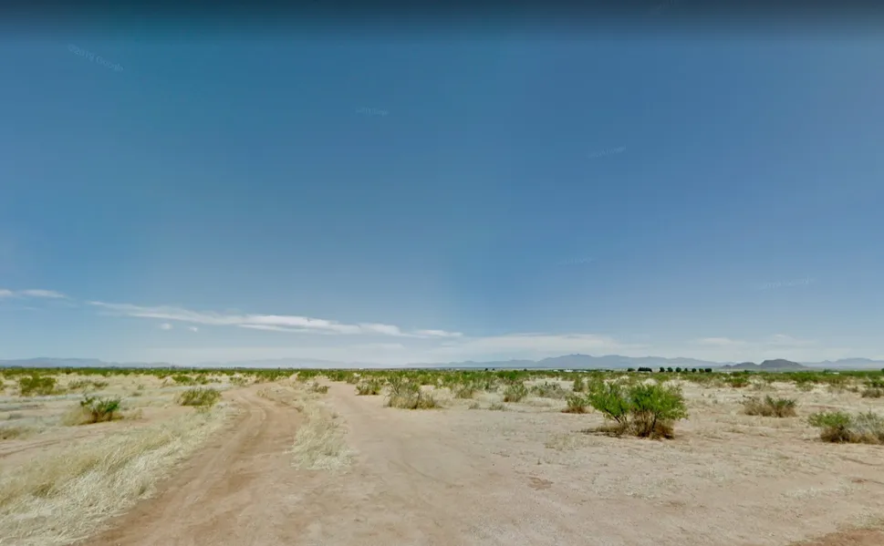
PERFECT SPOT FOR YOUR OUTDOOR RETREAT! ONE HOUR FROM TUCSON AND EASY ACCESS FROM HWY 10! This lot has terrific mountain views and over one acre for you to enjoy!
ABOUT THE LAND:
PRICE: $2,500.00
XY COORDINATES (CENTER): 31.950100, -109.907900
PARCEL NUMBER: 119-08-199
ACRES: 1.07
CITY: AZ SUNSITES (PEARCE)
COUNTY: COCHISE
LEGAL DESCRIPTION: AZ SUNSITES #1 LOT 3 BLK 190 8-07 LV MAP BOOK
LEGAL ACCESS: VIA W DOWNING ST
ROAD TYPE: DIRT
LOT DESCRIPTION: FLAT
TAXES: $49 ANNUALLY
ZONED: SR-43 (YES YOU CAN BUILD SINGLE HOUSEHOLD DWELLING (MIN 300SQFT); NO MOBILE HOMES OR MANUFACTURED HOMES- CALL COUNTY FOR SPECIFIC DETAILS).
UTIL: NEARBY POWER, WELL (OR TRUCK IN)/SEPTIC
----DISCLOSURE: This information contained herein is deemed reliable, but not guaranteed. Rec-FL (Seller) and its affiliates are not responsible for the accuracy of the information. The Buyer is responsible for verifying all information with the County. Sizes advertised are approximate. Pictures of rural land contained in this listing may or may not represent pictures of the actual parcel being sold. Seller has not seen this property in person. Other than our express Guarantees contained herein, all land is being sold as-is with no other warranties either expressed or implied as to the location, condition, accessibility, terrain, build-ability, or information contained in this listing. Buyer(s) understands that the Seller is conveying the above described property as-is and Buyer agrees to purchase property as such. No representations as to fitness for a particular purpose have been made. No verbal claims or promises have been made to Buyer which do not appear in writing. If the above described property is not situated on a public road, then Buyer hereby acknowledges such, and agrees to hold Seller harmless for maintenance and improvements to existing easement(s). Buyer also agrees that any improvement or utility bonds will be assumed by the Buyer, and Buyer agrees that if he/she/they did not physically inspect the above property, then Buyer understands that will not constitute grounds for termination of his contract.
From elevation to risk assessment
Search for detailed parcel information including; Elevation & Vegetation Maps, Ownership Information, Detailed Parcel Information, Crop History Map, Soil Survey Productivity Data, and more.
Research Parcel InformationDirections
1 HOUR FROM TUCSON, AZ
45 MIN TO WALMART
10 MIN TO HWY 10
CLOSE TO SCHOOLS, GAS STATIONS, CONVENIENCE STORES AND SHOPPING
Environmental Factors
Resources
Cochise County Properties By Type
- Undeveloped Land for Sale in Cochise County, Arizona
- Ranches for Sale in Cochise County, Arizona
- Residential Property for Sale in Cochise County, Arizona
- Farms for Sale in Cochise County, Arizona
- Recreational Property for Sale in Cochise County, Arizona
- Horse Property for Sale in Cochise County, Arizona
- Lakefront Property for Sale in Cochise County, Arizona
- Commercial Property for Sale in Cochise County, Arizona
- Riverfront Property for Sale in Cochise County, Arizona
- Hunting Land for Sale in Cochise County, Arizona
- Timberland for Sale in Cochise County, Arizona
- Beachfront Property for Sale in Cochise County, Arizona
Properties for Sale Nearby Counties
Cochise County Properties By City
- Benson, Arizona Land for Sale
- Bisbee, Arizona Land for Sale
- Bowie, Arizona Land for Sale
- Cochise, Arizona Land for Sale
- Douglas, Arizona Land for Sale
- Dragoon, Arizona Land for Sale
- Elfrida, Arizona Land for Sale
- Hereford, Arizona Land for Sale
- Huachuca City, Arizona Land for Sale
- Naco, Arizona Land for Sale
- Pearce, Arizona Land for Sale
- Pirtleville, Arizona Land for Sale
- More
- Pomerene, Arizona Land for Sale
- Saint David, Arizona Land for Sale
- San Simon, Arizona Land for Sale
- Sierra Vista, Arizona Land for Sale
- Tombstone, Arizona Land for Sale
- Willcox, Arizona Land for Sale
- Bonita, Arizona Land for Sale
- Cascabel, Arizona Land for Sale
- Dos Cabezas, Arizona Land for Sale
- Double Adobe, Arizona Land for Sale
- Gleeson, Arizona Land for Sale
- Hilltop, Arizona Land for Sale
- Huachuca Terrace, Arizona Land for Sale
- Kansas Settlement, Arizona Land for Sale
- Lowell, Arizona Land for Sale
- Mcneal, Arizona Land for Sale
- Mescal, Arizona Land for Sale
- Miracle Valley, Arizona Land for Sale
- Nicksville, Arizona Land for Sale
- Palominas, Arizona Land for Sale
- Paradise, Arizona Land for Sale
- Paul Spur, Arizona Land for Sale
- Portal, Arizona Land for Sale
- South Bisbee, Arizona Land for Sale
- Sunizona, Arizona Land for Sale
- Sunsites, Arizona Land for Sale
- Tintown, Arizona Land for Sale
- Warren, Arizona Land for Sale
- Whetstone, Arizona Land for Sale
- Apache, Arizona Land for Sale
- Apache Flats, Arizona Land for Sale
- Arizona Sun Sites, Arizona Land for Sale
- Bakerville, Arizona Land for Sale
- Benson Junction, Arizona Land for Sale
- Bernardino, Arizona Land for Sale
- Bisbee Junction, Arizona Land for Sale
- Black Bear Spring, Arizona Land for Sale
- Black Diamond, Arizona Land for Sale
- Bledsoe, Arizona Land for Sale
- Bonnie Blink, Arizona Land for Sale
- Boquillas, Arizona Land for Sale
- Bradberry, Arizona Land for Sale
- Buckeye Mill, Arizona Land for Sale
- Calumet, Arizona Land for Sale
- Campstone, Arizona Land for Sale
- Cavalay Park, Arizona Land for Sale
- Cazador, Arizona Land for Sale
- Chamiso, Arizona Land for Sale
- Chiricahua, Arizona Land for Sale
- Contention, Arizona Land for Sale
- Coronado Village, Arizona Land for Sale
- Corta Junction, Arizona Land for Sale
- Courtland, Arizona Land for Sale
- Curtiss, Arizona Land for Sale
- De Anza Village, Arizona Land for Sale
- Don Luis, Arizona Land for Sale
- East Pershing Plaza, Arizona Land for Sale
- Escalante Crossing, Arizona Land for Sale
- Fenner, Arizona Land for Sale
- Forrest, Arizona Land for Sale
- Fry, Arizona Land for Sale
- Galena, Arizona Land for Sale
- Galeyville, Arizona Land for Sale
- Gatewood Housing, Arizona Land for Sale
- Grizzles Orchard, Arizona Land for Sale
- Hookers Hot Springs, Arizona Land for Sale
- Johnson, Arizona Land for Sale
- Lewis Springs, Arizona Land for Sale
- Luzena, Arizona Land for Sale
- Manzoro, Arizona Land for Sale
- Miles Manor, Arizona Land for Sale
- Neff, Arizona Land for Sale
- Olga, Arizona Land for Sale
- Ramsey, Arizona Land for Sale
- Raso, Arizona Land for Sale
- Rileys El Encinar, Arizona Land for Sale
- Saginaw, Arizona Land for Sale
- Signal Village, Arizona Land for Sale
- Stark, Arizona Land for Sale
- Sunnyside, Arizona Land for Sale
- Taylor Place, Arizona Land for Sale
- Tully, Arizona Land for Sale
- Vanar, Arizona Land for Sale
- Village Meadows, Arizona Land for Sale
- West Pershing Plaza, Arizona Land for Sale
- Wheeler Place, Arizona Land for Sale
- Yellow Hammer Mill, Arizona Land for Sale