20 acres in Jackson County, Texas
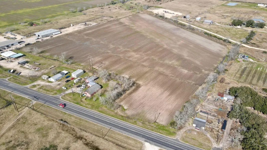
Approximately 20 acres of farm land located just outside of the Edna city limits. This property has 18.67 acres of corn base. It is currently farmed on a cash basis and is taxed at an agricultural rate. See attached satellite images and flood map. According to the attached FEMA flood map, a portion of the property lies in the floodway.
From elevation to risk assessment
Search for detailed parcel information including; Elevation & Vegetation Maps, Ownership Information, Detailed Parcel Information, Crop History Map, Soil Survey Productivity Data, and more.
Research Parcel InformationResources
Contact Seller
Listing provided by
John Petty
John Petty REALTORS(979) 543-3373
Listing last updated: February 12, 2024 at 10:20 AM
Report this listing
More Land for Sale in Jackson County
Jackson County Properties By Type
- Ranches for Sale in Jackson County, Texas
- Hunting Land for Sale in Jackson County, Texas
- Farms for Sale in Jackson County, Texas
- Undeveloped Land for Sale in Jackson County, Texas
- Recreational Property for Sale in Jackson County, Texas
- Horse Property for Sale in Jackson County, Texas
- Riverfront Property for Sale in Jackson County, Texas
- Lakefront Property for Sale in Jackson County, Texas
- Residential Property for Sale in Jackson County, Texas
- Beachfront Property for Sale in Jackson County, Texas
- Commercial Property for Sale in Jackson County, Texas
- Timberland for Sale in Jackson County, Texas
Properties for Sale Nearby Counties
Jackson County Properties By City
- Edna, Texas Land for Sale
- Francitas, Texas Land for Sale
- Ganado, Texas Land for Sale
- La Salle, Texas Land for Sale
- La Ward, Texas Land for Sale
- Lolita, Texas Land for Sale
- Vanderbilt, Texas Land for Sale
- Cordele, Texas Land for Sale
- El Toro, Texas Land for Sale
- Morales, Texas Land for Sale
- Mount Olive, Texas Land for Sale
- Weedhaven, Texas Land for Sale
- More