Bellevue, TX 76228 - Clay County
6,278 acres in Clay County, Texas
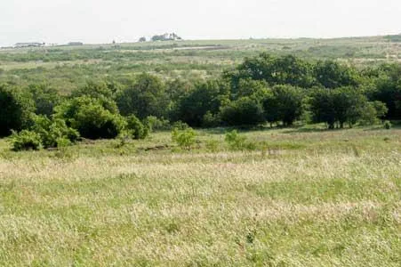
TERRAIN: Gently rolling with 90% in excellent native grasses including Side Oats
Grama, Little Bluestem, Big Bluestem, Bahia, Switch, Buffalo, Mesquite and Indian grasses. Approximately 360 acres in Giant Bermuda and Coastal Bermuda hay pasture. The tree cover consists primarily of Mesquite, Post Oak and Hackberry. Approximately 1000 acres of cultivation land.
IMPROVEMENTS: The home is a brick 3000 sq. ft. 4-3-2. Fully operating AI barn capable
of working 400 animals per day with large steel cattle pens, WW chutes
and scales. One other set of cattle pens. Equipment barn, shop, and
horse barn.
WATER: Over 40 stock ponds, the East Fork of the Little Wichita River
traverses through the property with tributaries feeding the river. There are also lake sites that could encompass many surface acres with a possible watershed of 8,000 acres. 2 good water wells in the fingers of the Trinity Sands.
CARRYING CAPACITY: The ranch on normal years will support 630 cows.
HUNTING: The deer hunting is wonderful. Part of the property was leased two years ago
and the largest harvested has been a 190 typical 10 point per the owner.
The deer herd is excellent. Excellent quail and duck population, thick with
doves. 3-400 sand hill cranes have been observed, turkey and hogs.
MINERALS: Owner owns some minerals and several wells are being pumped.
PRICE: $2,250.00 per acre, will divide.
ALL INFORMATION CONTAINED HEREON HAS BEEN OBTAINED FROM SOURCES DEEMED RELIABLE. NO REPRESENTATION OR WARRANTIES, EITHER EXPRESSED OR IMPLIED ARE MADE AS TO ITS ACCURACY BY SAID AGENT. THIS INFORMATION IS SUBJECT TO CHANGES, WITHDRAWAL, ERROR, OMISSION, CORRECTION, OR PRIOR SALE WITHOUT NOTICE. SELLER CAN RECEIVE AND ACCEPT BACKUP CONTRACTS.
From elevation to risk assessment
Search for detailed parcel information including; Elevation & Vegetation Maps, Ownership Information, Detailed Parcel Information, Crop History Map, Soil Survey Productivity Data, and more.
Research Parcel InformationDirections
Approximately 86 miles northwest of Fort Worth via US Hwy 287. Approximately 36 miles southeast of Wichita Falls.
Environmental Factors
Resources
Land for Sale by Mac A. Coalson
Clay County Properties By Type
- Ranches for Sale in Clay County, Texas
- Hunting Land for Sale in Clay County, Texas
- Farms for Sale in Clay County, Texas
- Recreational Property for Sale in Clay County, Texas
- Undeveloped Land for Sale in Clay County, Texas
- Residential Property for Sale in Clay County, Texas
- Lakefront Property for Sale in Clay County, Texas
- Riverfront Property for Sale in Clay County, Texas
- Commercial Property for Sale in Clay County, Texas
- Horse Property for Sale in Clay County, Texas
- Timberland for Sale in Clay County, Texas
- Beachfront Property for Sale in Clay County, Texas
Properties for Sale Nearby Counties
Clay County Properties By City
- Bellevue, Texas Land for Sale
- Bluegrove, Texas Land for Sale
- Byers, Texas Land for Sale
- Henrietta, Texas Land for Sale
- Petrolia, Texas Land for Sale
- Charlie, Texas Land for Sale
- Deer Creek, Texas Land for Sale
- Dickworsham, Texas Land for Sale
- Edwards, Texas Land for Sale
- Frame, Texas Land for Sale
- Halsell, Texas Land for Sale
- Huggins, Texas Land for Sale
- More