0.36 Acre Residential Lot with Full Utilities in Bly, OR
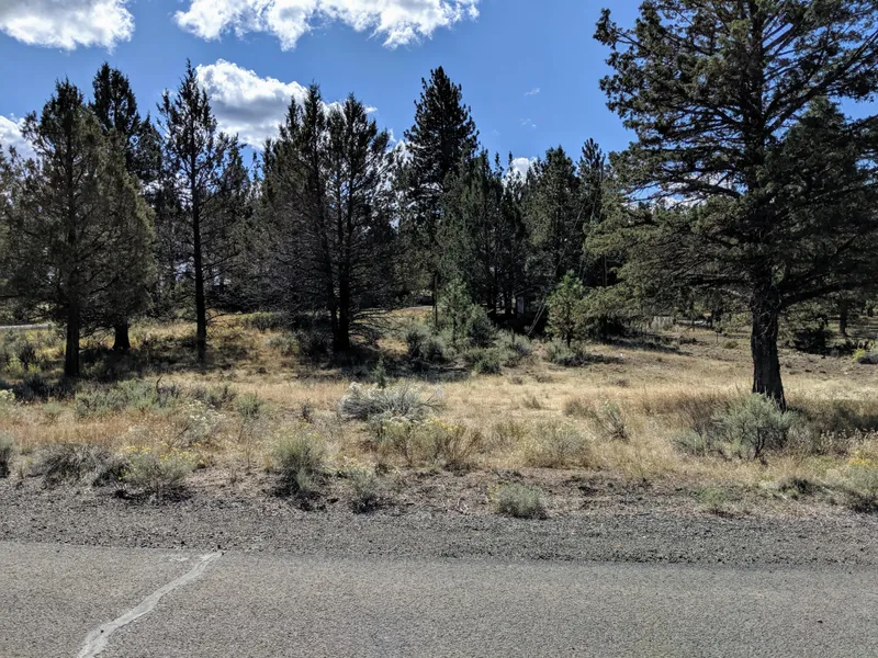
PROPERTY: (4) Residential 0.18 acre properties (2 combines to make 0.36acre) in the Bley-Was Heights subdivision on the edge of the rural town of Bly, Oregon. Zoning for these properties allows for either a site-built house or mobile home. It also has power, sewer and water available to the site.
The Bley-Was Heights subdivision is a lightly-developed neighborhood just 1 mile south of downtown Bly. A greenspace runs through the center of the subdivision. Power lines run along the rear property line, and water and sewer connections are located at the street.
AREA FEATURES:
Bly, Oregon, is a charming little town on Highway 140 approximately halfway between Klamath Falls and Lakeview, and 10 miles from the Gearhart Mountain Wilderness. It is nearly surrounded by some of Oregons amazing forests, the Fremont National Forest and Winema National Forest and the beauty those bring to the area. The nearby Sprague River is a well-known fishing destination for trout, bass and perch. Fishhole Creek and the Oc & E Woods Line State Trail (at 109-miles, this is Oregons longest linear park) are less than a half mile walk from the property. The Star Theater, built in 1948, is a Bly architectural landmark. The Gerber Reservoir and Gerber Recreation Area is less than an hour away for endless fun.
See below for Owner Financing!
PARCEL SPECIFICS:
4 Side-by-Side Parcels Available. Pick 1, 2, 3 or all 4!
Size: Parcel #1: 0.18 / Parcel #2: 0.18 / Parcel #3: 0.17 / Parcel #4: 0.19
Best Attribute: Full utilities onsite!
General Location: Bly, OR 97623
Parcel Number, #1: R407152
Legal Description, #1: BLEY-WAS HEIGHTS 1ST , BLOCK 6, LOT 3
GPS Corner Coordinates, #1:
NE: 42.3878644252889,-121.042497417618
NW: 42.3879167281608,-121.042738661267
SW: 42.3876234025757,-121.042859640118
SE: 42.3875691805712,-121.042610785325
Parcel Number, #2: R407143
Legal Description, #2: BLEY-WAS HEIGHTS 1ST , BLOCK 6, LOT 4
GPS Corner Coordinates, #2:
NE: 42.38781127835,-121.042252277433
NW: 42.3878644252889,-121.042497417618
SW: 42.3875691805712,-121.042610785325
SE: 42.3875149547688,-121.042361911779
Parcel Number, #3: R407134
Legal Description, #3: BLEY-WAS HEIGHTS 1ST , BLOCK 6, LOT 5
GPS Corner Coordinates, #3:
NE: 42.3876720073174,-121.041908984146
NC: 42.3877552952792,-121.042030781678
NW: 42.38781127835,-121.042252277433
SW: 42.3875149547688,-121.042361911779
SE: 42.3874976015077,-121.042282269443
Parcel Number, #4: R407429
Legal Description, #4: BLEY-WAS HEIGHTS 1ST , BLOCK 6, LOT 6
GPS Corner Coordinates, #4:
SE: 42.3872897059551,-121.041987670132
ES: 42.3873855501778,-121.041884489119
EN: 42.3875177858745,-121.041842549789
NW: 42.3876608502929,-121.041899114919
Property Type: Rural Land
Terrain: Flat ready to build or place your mobile home!
Utilities: Full Utilities! Power lines run along the rear property line. Water and sewer connections are located at the street.
Taxes: $70.22 for each parcel, assessed in 2018
HOA: None
Access: Henwas Loop, an asphalt street and county-maintained road
Terms: Cash Only
From elevation to risk assessment
Search for detailed parcel information including; Elevation & Vegetation Maps, Ownership Information, Detailed Parcel Information, Crop History Map, Soil Survey Productivity Data, and more.
Research Parcel InformationDirections
From Klamath Falls-Lakeview Hwy (Hwy 140), continue south on Edler St or 504 for 0.9 mile and turn left onto Henwas St. and continue to Henwas Loop. Your property(ies) are on your right60
Land for Sale by Beth Pianori
Klamath County Properties By Type
- Riverfront Property for Sale in Klamath County, Oregon
- Undeveloped Land for Sale in Klamath County, Oregon
- Farms for Sale in Klamath County, Oregon
- Lakefront Property for Sale in Klamath County, Oregon
- Beachfront Property for Sale in Klamath County, Oregon
- Residential Property for Sale in Klamath County, Oregon
- Ranches for Sale in Klamath County, Oregon
- Timberland for Sale in Klamath County, Oregon
- Recreational Property for Sale in Klamath County, Oregon
- Horse Property for Sale in Klamath County, Oregon
- Commercial Property for Sale in Klamath County, Oregon
- Hunting Land for Sale in Klamath County, Oregon
Properties for Sale Nearby Counties
Klamath County Properties By City
- Beatty, Oregon Land for Sale
- Bly, Oregon Land for Sale
- Bonanza, Oregon Land for Sale
- Chemult, Oregon Land for Sale
- Chiloquin, Oregon Land for Sale
- Crescent, Oregon Land for Sale
- Dairy, Oregon Land for Sale
- Fort Klamath, Oregon Land for Sale
- Gilchrist, Oregon Land for Sale
- Keno, Oregon Land for Sale
- Klamath Falls, Oregon Land for Sale
- Malin, Oregon Land for Sale
- More
- Merrill, Oregon Land for Sale
- Midland, Oregon Land for Sale
- Sprague River, Oregon Land for Sale
- Diamond Lake, Oregon Land for Sale
- Worden, Oregon Land for Sale
- Ainsworth Corner, Oregon Land for Sale
- Algoma, Oregon Land for Sale
- Altamont, Oregon Land for Sale
- Fairhaven, Oregon Land for Sale
- Falcon Heights, Oregon Land for Sale
- Hager, Oregon Land for Sale
- Haynesville, Oregon Land for Sale
- Henley, Oregon Land for Sale
- Hildebrand, Oregon Land for Sale
- Hot Springs, Oregon Land for Sale
- Kirk, Oregon Land for Sale
- Klamath Agency, Oregon Land for Sale
- Lake of the Woods, Oregon Land for Sale
- Langell Valley, Oregon Land for Sale
- Lorella, Oregon Land for Sale
- Malone, Oregon Land for Sale
- Modoc Point, Oregon Land for Sale
- Odell Lake, Oregon Land for Sale
- Olene, Oregon Land for Sale
- Pelican City, Oregon Land for Sale
- Rocky Point, Oregon Land for Sale
- Shady Pine, Oregon Land for Sale
- Stewart Lenox, Oregon Land for Sale
- Terminal City, Oregon Land for Sale
- Yonna, Oregon Land for Sale