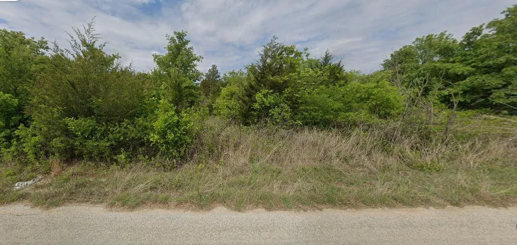
0.17 - Penn Street, Bowie, TX 76230
Description
$300 down - $300 monthly ($350 doc fees)
Property ID: 4981
Lot Size: 0.17 acres
Parcel ID: R000017407
Size: 7405.2
Dimensions: 119' x 62' x 122' x 61'
County: Montague
State: Texas
In house financing available!
$300 down & $300 monthly!
Down is non-refundable
WHY Buy Land from us?
WITH TUNDRA INVESTMENTS, WE MAKE IT EASY AND AFFORDABLE TO OWN LAND.
WE OFFER :
EASY, NO-HASSLE TRANSACTIONS
NO PRE-PAYMENT PENALTY
LOW MONTHLY PAYMENTS
BBB ACCREDITED BUSINESS
Please note: In order to ensure a smooth and legal transaction, occupancy of the lot is not permitted until full payment has been received and the deed has been officially transferred. This policy is also stated in our contract, which further emphasizes the importance of adhering to this requirement. We appreciate your understanding and cooperation in this matter. For any questions or further clarification, please dont hesitate to contact us.
Status: Available
GPS (Center) at the road: 33.481673, -97.907914
NW Corner: 33.481670, -97.907915
NE Corner: 33.481761, -97.907721
SW Corner: 33.481598, -97.908112
SE Corner: 33.481596, -97.907721
Legal Description: Lot 16 Blk 5 Unit 4 Frontier Shores
Road Access: Paved
Power: City Utility available
Water: City Utility available
Sewer: Septic Required
Zoning: TX-Montague -Bowie-NO-POA
RV Living Allowed?: Allowed
Mobile Home Living Allowed?: Allowed
Manufactured Home Living Allowed?: Allowed
Taxes Per Year?: $2.52
Conveyance: Warranty Deed
Type: Texas
From elevation to risk assessment
Search for detailed parcel information including; Elevation & Vegetation Maps, Ownership Information, Detailed Parcel Information, Crop History Map, Soil Survey Productivity Data, and more.
Research Parcel InformationDirections
GPS (Center) at the road: 33.481673, -97.907914
NW Corner: 33.481670, -97.907915
NE Corner: 33.481761, -97.907721
SW Corner: 33.481598, -97.908112
SE Corner: 33.481596, -97.907721
Environmental Factors
Resources
Montague County Properties By Type
- Ranches for Sale in Montague County, Texas
- Undeveloped Land for Sale in Montague County, Texas
- Farms for Sale in Montague County, Texas
- Lakefront Property for Sale in Montague County, Texas
- Hunting Land for Sale in Montague County, Texas
- Residential Property for Sale in Montague County, Texas
- Riverfront Property for Sale in Montague County, Texas
- Recreational Property for Sale in Montague County, Texas
- Horse Property for Sale in Montague County, Texas
- Commercial Property for Sale in Montague County, Texas
- Timberland for Sale in Montague County, Texas
- Beachfront Property for Sale in Montague County, Texas
Properties for Sale Nearby Counties
Montague County Properties By City
- Bowie, Texas Land for Sale
- Forestburg, Texas Land for Sale
- Montague, Texas Land for Sale
- Nocona, Texas Land for Sale
- Ringgold, Texas Land for Sale
- Saint Jo, Texas Land for Sale
- Sunset, Texas Land for Sale
- Fruitland, Texas Land for Sale
- Newport, Texas Land for Sale
- Stoneburg, Texas Land for Sale
- Belcherville, Texas Land for Sale
- Bonita, Texas Land for Sale
- More
- Capps Corner, Texas Land for Sale
- Dry Valley, Texas Land for Sale
- Dye, Texas Land for Sale
- Gladys, Texas Land for Sale
- Hardy, Texas Land for Sale
- Hynds City, Texas Land for Sale
- Illinois Bend, Texas Land for Sale
- Mallard, Texas Land for Sale
- McDonald, Texas Land for Sale
- New Harp, Texas Land for Sale
- Rowland, Texas Land for Sale
- Salona, Texas Land for Sale
- Spanish Fort, Texas Land for Sale