Sprague River Oregon Town Lots - 6 Adjacent Lots
***See all of our listings by visiting us at governmentlandsales.us***
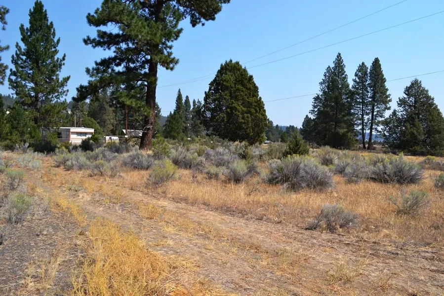
Now available, six adjacent building lots in the town of Sprague River. Nice level lots with a few shade trees. Roads are 2WD, and utilities are available at the lot. There is no HOA or CC&R's, so you can use and improve these lots as you wish.
Sprague River
This small town in Klamath County is located about 35 miles from Klamath Falls. Sprague River has basic services such groceries, gas, and a post office. There are also community services available such as a library, church, and community center. This is a wonderful town for those that are looking for a bit slower pace of life in a rural setting near services, but away from the hustle and bustle of city life. There is ample wildlife in the area with great hunting and fishing. The main attraction of the area is the Sprague River, which provides world class trout fishing. There is also great hiking in the area.
Klamath County
Klamath County is home to hundreds of lakes, rivers, and streams which offer some of the best fishing in the state. In addition to the water, there are several mountains, peaks, and hills to keep the outdoor enthusiast busy. Klamath Falls is the county seat for Klamath County, Oregon, and the majority of the county population resides here. Home to national chains and local flare, the city has all of the services one would need. It is also home to the largest freshwater lake by surface area in the state of Oregon, Upper Klamath Lake. Measuring 25 miles long and 8 miles wide, the lake is a sportsman's paradise. Also overlooking the lake, the nearby Running Y Ranch Resort & hotel features a golf course designed by Arnold Palmer and an ice skating arena.
Land Information:
Legal: First Addition to Sprague River Block 7 Lots 5-10
APN: 331732
Map and Taxlot: 3610-014BA-04400-000
Total Size: .41 Acres
Total Dimensions: 150' X 120'
GPS: Approximate GPS Coordinates
42.455899, -121.499228 (NW Corner)
42.455863, -121.498733 (NE Corner)
42.455475, -121.498757 (SE Corner)
42.455496, -121.499272 (SW Corner)
Owner financing available. No credit checks, everyone qualifies. We accept all major credit cards. All cash offers considered.
Document preparation fee: $299
Property ID: C-2020024 CTTT
From elevation to risk assessment
Search for detailed parcel information including; Elevation & Vegetation Maps, Ownership Information, Detailed Parcel Information, Crop History Map, Soil Survey Productivity Data, and more.
Research Parcel InformationBoise, ID
Land for Sale by Government Land Sales
Klamath County Properties By Type
- Riverfront Property for Sale in Klamath County, Oregon
- Undeveloped Land for Sale in Klamath County, Oregon
- Farms for Sale in Klamath County, Oregon
- Lakefront Property for Sale in Klamath County, Oregon
- Residential Property for Sale in Klamath County, Oregon
- Beachfront Property for Sale in Klamath County, Oregon
- Ranches for Sale in Klamath County, Oregon
- Timberland for Sale in Klamath County, Oregon
- Recreational Property for Sale in Klamath County, Oregon
- Horse Property for Sale in Klamath County, Oregon
- Commercial Property for Sale in Klamath County, Oregon
- Hunting Land for Sale in Klamath County, Oregon
Properties for Sale Nearby Counties
Klamath County Properties By City
- Beatty, Oregon Land for Sale
- Bly, Oregon Land for Sale
- Bonanza, Oregon Land for Sale
- Chemult, Oregon Land for Sale
- Chiloquin, Oregon Land for Sale
- Crescent, Oregon Land for Sale
- Dairy, Oregon Land for Sale
- Fort Klamath, Oregon Land for Sale
- Gilchrist, Oregon Land for Sale
- Keno, Oregon Land for Sale
- Klamath Falls, Oregon Land for Sale
- Malin, Oregon Land for Sale
- More
- Merrill, Oregon Land for Sale
- Midland, Oregon Land for Sale
- Sprague River, Oregon Land for Sale
- Diamond Lake, Oregon Land for Sale
- Worden, Oregon Land for Sale
- Ainsworth Corner, Oregon Land for Sale
- Algoma, Oregon Land for Sale
- Altamont, Oregon Land for Sale
- Fairhaven, Oregon Land for Sale
- Falcon Heights, Oregon Land for Sale
- Hager, Oregon Land for Sale
- Haynesville, Oregon Land for Sale
- Henley, Oregon Land for Sale
- Hildebrand, Oregon Land for Sale
- Hot Springs, Oregon Land for Sale
- Kirk, Oregon Land for Sale
- Klamath Agency, Oregon Land for Sale
- Lake of the Woods, Oregon Land for Sale
- Langell Valley, Oregon Land for Sale
- Lorella, Oregon Land for Sale
- Malone, Oregon Land for Sale
- Modoc Point, Oregon Land for Sale
- Odell Lake, Oregon Land for Sale
- Olene, Oregon Land for Sale
- Pelican City, Oregon Land for Sale
- Rocky Point, Oregon Land for Sale
- Shady Pine, Oregon Land for Sale
- Stewart Lenox, Oregon Land for Sale
- Terminal City, Oregon Land for Sale
- Yonna, Oregon Land for Sale